The Harmed Success Stories Concepts How To What Is Commentary
Fayette County Marcellus Shale Permits 9/23/19 - 10/6/19
Contents
Pennsylvania Bulletin Listings
INDEPENDENT REGULATORY REVIEW COMMISSION Notice of Filing of Final Rulemaking Environmental Quality Board Additional Requirements for Control of Fine Particulate Matter in the Nonattainment New Source RevieweFACTS Listings
PORTER WELL PAD B Erosion and Sediment Control General Permit 3 (New)
LEE WELL SITE Expedited E&S Stormwater General Permit 1 [Termination?] Notification (New)
FIKE UNIT 1H Drill & Operate Well Permit Inactive Status Issued 9/30/2019 (New)
GEORGE WALTERS 2 Well Plugging Notice Intent to Plug Single Well (New)
SKOVRAN UNIT 32H Residual Waste Processing Issued on 9/26/2019 (New)
NATIONAL MINES CORP 26H OG WELL Residual Waste Processing Issued on 9/26/2019 (New)
COCHRAN UNIT 22H OG WELL Residual Waste Processing Issued on 9/26/2019 (New)
CARDINE UNIT 5H OG WELL Residual Waste Processing Issued on 9/26/2019 (New)
Siegel Well Connect Pipeline Project Erosion and Sediment Control General Permit 3 Expedited (New)
UNIVAR SOLUTIONS USA INC EVERSON PLANT PAG-03 Discharge of Stormwater Assoc w Industrial Activities Transfer
WHYEL UNIT 1H Drill & Operate Well Permit Inactive Status Issued on 9/24/2019
WASIL 1 Drill & Operate Well Permit Inactive Status Issued on 9/24/2019
SNAPP TESLOVICH M03H Drill & Operate Well Permit (Unconventional) Issued 2019-09-18
SNAPP TESLOVICH M02H Drill & Operate Well Permit (Unconventional) Issued 2019-09-18
SNAPP TESLOVICH M15H Drill & Operate Well Permit (Unconventional) Issued 2019-09-18
SNAPP TESLOVICH M12H Drill & Operate Well Permit (Unconventional) Issued 2019-09-18
SNAPP TESLOVICH M04H Drill & Operate Well Permit (Unconventional) Issued 2019-09-18
SNAPP TESLOVICH M05H Drill & Operate Well Permit (Unconventional) Issued 2019-09-18
SNAPP TESLOVICH M09H Drill & Operate Well Permit (Unconventional) Issued 2019-09-18
SNAPP TESLOVICH M06H Drill & Operate Well Permit (Unconventional) Issued 2019-09-18
SNAPP TESLOVICH M08H Drill & Operate Well Permit (Unconventional) Issued 2019-09-18
SNAPP TESLOVICH M07H Drill & Operate Well Permit (Unconventional) Issued 2019-09-18
RONCO PLANT JPA 326-07-006 Water Obstruction & Encroachment Pmt
POLK UNIT 1H Pressure test notification 09/25/2019
POLK UNIT 2H Pressure test notification 09/25/2019
POLK UNIT 3H Pressure test notification 09/25/2019
POLK UNIT 4H Pressure test notification 09/25/2019
POLK UNIT 5H Pressure test notification 09/25/2019
HUMBERSTON UNIT 1H Pressure test notification 09/25/2019
JOHN HOLT 1H Pressure test notification 09/25/2019
Inspection
Anomalies (Oil & Gas Compliance Report)
Price of Natural GasSTEWART 2H valve failure caused 30-gallon spill of produced water
G HARVEY USX 4 stressed/dead vegetation near access road gate
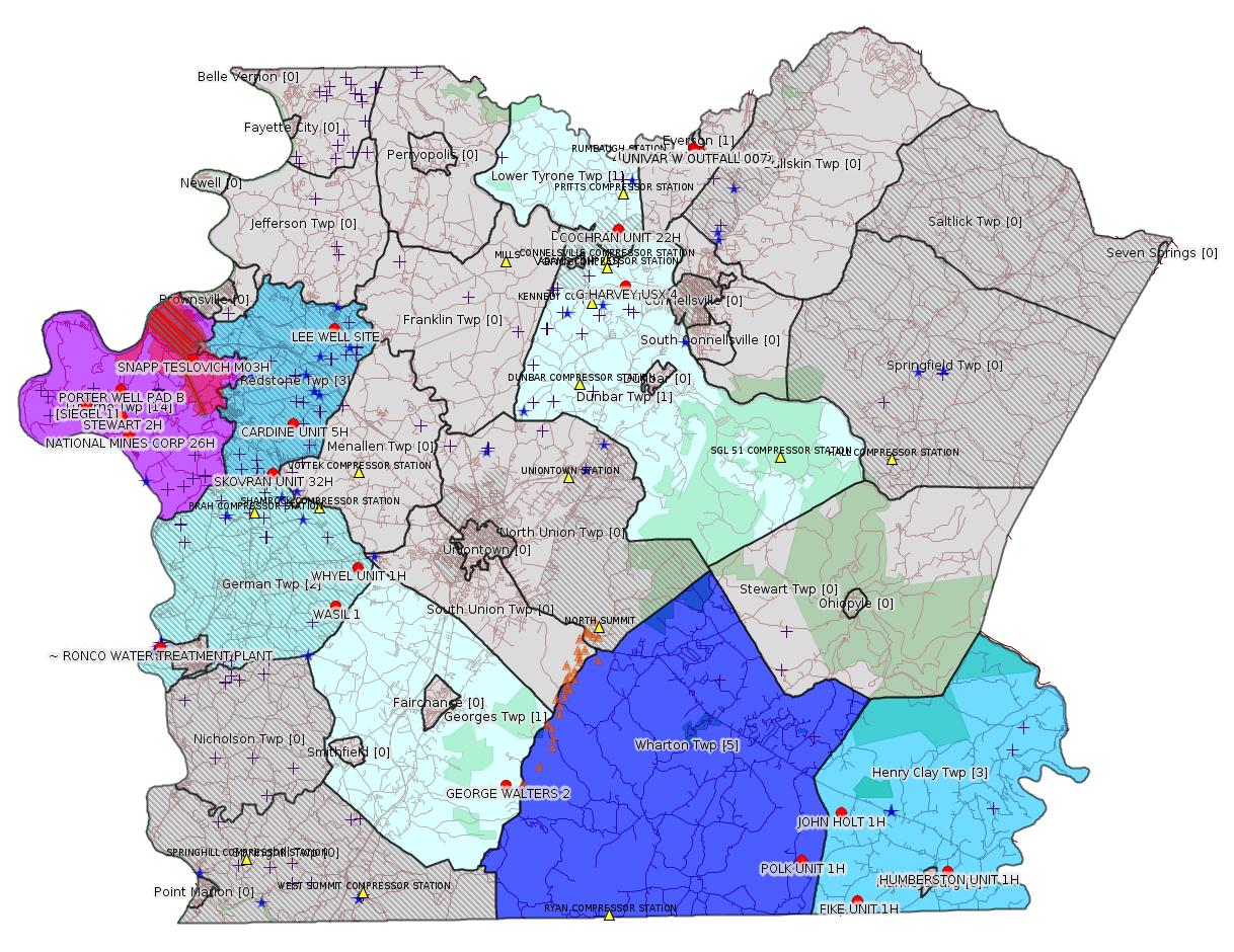
Map
Key
Red dots: items in this permit list with an exact location.
Blue stars: Marcellus Gas Well Water Sources.
Where well laterals are mapped they show in red; a 400-foot buffer surrounding the lateral shows in blue (lavender where it overlaps a mapped mineral tract).
Where mineral tracts are mapped, they show in pink. Mineral tracts can overlap; the overlap will show in red. The precise meaning of "mineral tract" is not clear.
Municipality shading: number of "facilities", with each well counting separately
(includes the red dots):
gray: 0
pale turquoise: 1
turquoise: 2
pale blue: 3
middle blue: 4
dark blue: 5
dark purple: 7
purple: 14
(Color coding may differ from one issue to the next.)
(Note if a project spans multiple municipalities -- e.g. a pipeline -- it will show in the count for each municipality.)
The number of facilities also follows the municipality name in brackets.
Municipality counts are based on the way the permit is listed by DEP; DEP has been known to get a municipality wrong.
Locations in brackets identify a precise location used to locate a surrogate for the actual site being permitted (e.g. locating a well pad or pipeline by the known location of a well.) Locations labeled beginning with "~" and ending in "[?]" are approximate and speculative based on inferences using on-line property and lease records. These are marked in the text as "[Approximate, Speculative]
Cross-hatching: Environmental Justice Areas
Yellow triangles: Compressor Stations
Orange triangles: Storage Field Wells (currently Dominion North Summit Storage Field)
Crosses: SPUD Unconventional well permits
Green: "Natural areas", e.g. state game lands, state forests
Yellow triangles: Compressor Stations
Orange triangles: Storage Field Wells (currently Dominion North Summit Storage Field)
Crosses: SPUD Unconventional well permits
Green: "Natural areas", e.g. state game lands, state forests
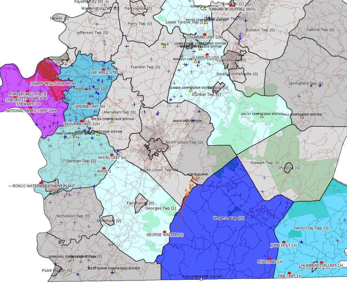
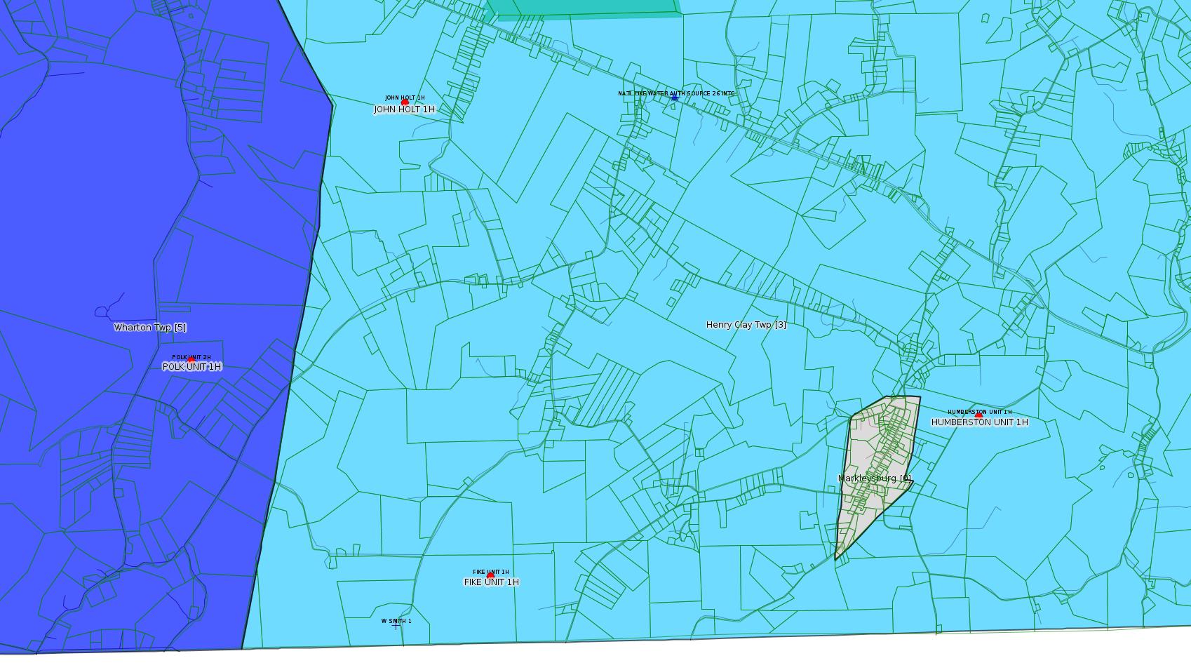
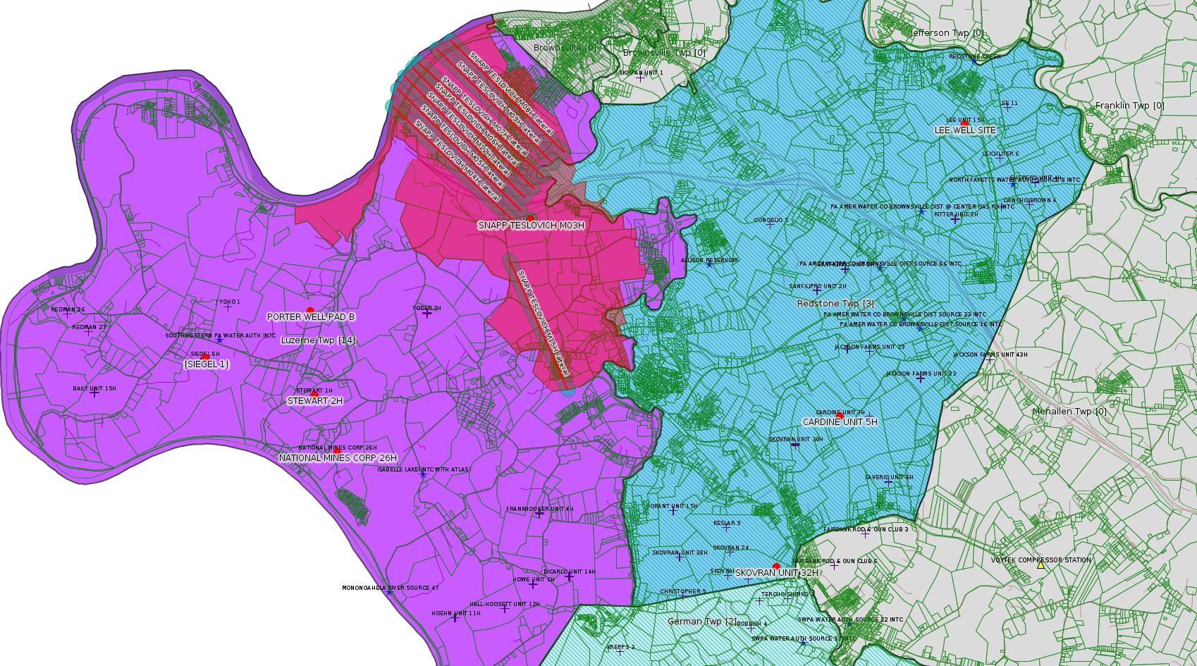
More Maps
 |
 |
 |
Source: Pennsylvania Bulletin
NOTICES
INDEPENDENT REGULATORY REVIEW COMMISSION
Notice of Filing of Final Rulemaking
[49 Pa.B. 5678]
[Saturday, September 28, 2019]
The Independent Regulatory Review Commission (Commission) received the following regulation. It is scheduled to be considered on the date noted. The Commission's public meetings are held at 333 Market Street, 14th Floor, Harrisburg, PA at 10 a.m. To obtain a copy of the regulation, interested parties should first contact the promulgating agency. If a copy cannot be obtained from the promulgating agency, the Commission will provide a copy or it can be viewed on the Commission's web site at www.irrc.state.pa.us.
Final-Form
Reg. No. Agency/Title Received Public Meeting
7-551 Environmental Quality Board
Additional Requirements for Control of
Fine Particulate Matter in the
Nonattainment New Source Review
Program 9/12/19 10/17/19
GEORGE D. BEDWICK,
Chairperson
<https://www.pabulletin.com/secure/data/vol49/49-39/1458.html>
-------------------------
Source: eNOTICE
(+ PA
Oil and Gas Mapping, Well
Pad Report.) Well Details via Data
Portal Services: Oil and Gas Wells All (ID: 3).
Please see the Disclaimer below regarding Parcel Id data.
Authorization ID: 1290728
Permit number: ESG072619003-00
Site: PORTER WELL PAD B ESCGP ESG072619003-00
Client: CHEVRON APPALACHIA LLC
Authorization type: Erosion and Sediment Control General Permit 3
Application type: New
Authorization is for: SITE
Date received: 10/02/2019
Status: Pending
Permit Decision Guarantee Applies?: Yes
Permit Decision Guarantee status: ACTIVE
<https://www.ahs.dep.pa.gov/eFACTSWeb/searchResults_singleAuth.aspx?AuthID=1290728>
Site Programs:
Site Municipalities:
Luzerne Twp, Fayette County
Location: 39.976089,-79.947444
Map URL: <http://www.openstreetmap.org/?mlat=39.976089&mlon=-79.947444#map=15/39.976089/-79.947444>
Presumed Parcel Id: 19160044
Act 14 Notification: <https://www.faymarwatch.org/documents/SKM_554e19100809140.pdf>
---
Authorization ID: 1290536
Permit number: ESX11-051-0031
Site: LEE WELL SITE ESCGP-EXPEDITED
Client: CHEVRON APPALACHIA LLC
Authorization type: Expedited E&S Stormwater General Permit 1
Application type: Notification
Authorization is for: SITE
Date received: 10/02/2019
Status: Pending
Permit Decision Guarantee Applies?: No
Permit Review Notes:
Date Review Note
10/2/2019 The permit application package is complete, has been accepted, and is undergoing technical review.
<https://www.ahs.dep.pa.gov/eFACTSWeb/searchResults_singleAuth.aspx?AuthID=1290536>
Site Programs:
Site Municipalities:
Redstone Twp, Fayette County
Location: 40.003908,-79.814256
Map URL: <http://www.openstreetmap.org/?mlat=40.003908&mlon=-79.814256#map=15/40.003908/-79.814256>
Wells on this pad:
051-24485 LEE UNIT 15H
051-24486 LEE UNIT 14H
---
Authorization ID: 1290096
Permit number: 051-24164
Site: FIKE UNIT 1H OG WELL
Client: LPR ENERGY LLC
Authorization type: Drill & Operate Well Permit Inactive Status
Application type: New
Authorization is for: FACILITY
Date received: 04/22/2019
Status: Issued on 9/30/2019
Permit Decision Guarantee Applies?: No
Sub-Facilities for Authorization:
Sub-Facility ID Sub-Facility Name Description
983871 FIKE UNIT 1H Well
Permit Review Notes:
Date Review Note
9/30/2019 The technical review and decision review are complete and either the permit decision and/or permit issuance are forthcoming.
9/30/2019 The permit application package is complete, has been accepted, and is undergoing technical review.
<https://www.ahs.dep.pa.gov/eFACTSWeb/searchResults_singleAuth.aspx?AuthID=1290096>
Site Programs:
Oil & Gas
Site Municipalities:
Henry Clay Twp, Fayette County
Well Details:
Permit Number: 051-24164
Well Name: FIKE UNIT 1H
Unconventional Well: Y
Well Configuration: Horizontal Well
Well Type: GAS
Well Status: Regulatory Inactive Status
Coal Association: NonCoal
Conservation Well: Y
Primary Facility ID: 715064
Site ID: 716179
Site Name: FIKE UNIT 1H OG WELL
Well Pad ID: 146852
Well Pad Name: FIKE UNIT 1H
Storage Field:
Operator: LPR ENERGY LLC
Operator Number: OGO-68579
Permit Date: 2009-02-09
Permit Date Expires: 2010-02-09
SPUD Date: 2009-02-12
Date Plugged:
UIC ID:
UIC Type:
Surface Elevation: 2222
County: Fayette
Municipality: Henry Clay Twp
Location: 39.727028,-79.495752
Map URL: <http://www.openstreetmap.org/?mlat=39.727028&mlon=-79.495752#map=15/39.727028/-79.495752>
OG WELLS PERMIT DOCS:
2016-06-13: Other Permit Documents, Name: PAG104834_3-1-2016_TENNESSEE GAS PIPELINE (for Authorization: 758213):
<http://www.depgis.state.pa.us/pdfHandler/pdFHandler.ashx?Doc=ODY1OTgw&ext=PDF>
2016-06-13: Other Permit Documents, Name: PAG104834_3-1-2017_TENNESEE GAS PIPELINE (for Authorization: 758213):
<http://www.depgis.state.pa.us/pdfHandler/pdFHandler.ashx?Doc=ODY1OTgx&ext=PDF>
2018-04-23: Other Permit Documents, Name: 1149059 (for Authorization: 1149059):
<http://www.depgis.state.pa.us/pdfHandler/pdFHandler.ashx?Doc=NTk4NzYw&ext=PDF>
2019-09-30: Other Permit Documents, Name: Inactive Well Status (for Authorization: 1290096):
<http://www.depgis.state.pa.us/pdfHandler/pdFHandler.ashx?Doc=OTM1NzQ3&ext=PDF>
Presumed Parcel Id: 16190003
---
Authorization ID: 1289874
Permit number: 051-00116
Site: GEORGE WALTERS 2 WELL
Client: DOMINION ENERGY TRANS INC
Authorization type: Well Plugging Notice Intent to Plug Single Well
Application type: New
Authorization is for: FACILITY
Date received: 09/27/2019
Status: Pending
Permit Decision Guarantee Applies?: No
Sub-Facilities for Authorization:
Sub-Facility ID Sub-Facility Name Description
56076 GEORGE WALTERS 2 Well
Permit Review Notes:
Date Review Note
9/27/2019 The permit application package is complete, has been accepted, and is undergoing technical review.
<https://www.ahs.dep.pa.gov/eFACTSWeb/searchResults_singleAuth.aspx?AuthID=1289874>
Site Programs:
Oil & Gas
Site Municipalities:
Georges Twp, Fayette County
Well Details:
Permit Number: 051-00116
Well Name: GEORGE WALTERS 2
Unconventional Well: N
Well Configuration: Vertical Well
Well Type: GAS
Well Status: Active
Coal Association: Coal
Conservation Well: N
Primary Facility ID: 42546
Site ID: 40794
Site Name: GEORGE WALTERS 2 WELL
Well Pad ID: 0
Well Pad Name:
Storage Field:
Operator: DOMINION ENERGY TRANS INC
Operator Number: OGO-2239
Permit Date: 1986-02-25
Permit Date Expires:
SPUD Date: 1800-01-01
Date Plugged:
UIC ID:
UIC Type:
Surface Elevation: 0
County: Fayette
Municipality: Georges Twp
Location: 39.784831,-79.71165
Map URL: <http://www.openstreetmap.org/?mlat=39.784831&mlon=-79.71165#map=15/39.784831/-79.71165>
Presumed Parcel Id: 14370012
---
Authorization ID: 1289747
Permit number:
Site: SKOVRAN UNIT 29 OG WELL
Client: CHEVRON APPALACHIA LLC
Authorization type: Residual Waste Processing
Application type: New
Authorization is for: FACILITY
Date received: 09/24/2019
Status: Issued on 9/26/2019
Permit Decision Guarantee Applies?: No
Sub-Facilities for Authorization:
Sub-Facility ID Sub-Facility Name Description
1228333 SKOVRAN UNIT ALT RW Residual Waste Processing Locations
Permit Review Notes:
Date Review Note
9/26/2019 The technical review and decision review are complete and either the permit decision and/or permit issuance are forthcoming.
9/26/2019 The permit application package is complete, has been accepted, and is undergoing technical review.
<https://www.ahs.dep.pa.gov/eFACTSWeb/searchResults_singleAuth.aspx?AuthID=1289747>
Site Programs:
Oil & Gas
Site Municipalities:
Redstone Twp, Fayette County
Well Details:
Permit Number: 051-24316
Well Name: SKOVRAN UNIT 32H
Unconventional Well: Y
Well Configuration: Horizontal Well
Well Type: GAS
Well Status: Active
Coal Association: Coal
Conservation Well: Y
Primary Facility ID: 726290
Site ID: 729115
Site Name: SKOVRAN UNIT 29 OG WELL
Well Pad ID: 149315
Well Pad Name: SKOVRAN UNIT 32H
Storage Field:
Operator: CHEVRON APPALACHIA LLC
Operator Number: OGO-39307
Permit Date: 2010-02-02
Permit Date Expires: 2011-02-02
SPUD Date: 2010-05-26
Date Plugged:
UIC ID:
UIC Type:
Surface Elevation: 1105
County: Fayette
Municipality: Redstone Twp
Location: 39.935247,-79.853619
Map URL: <http://www.openstreetmap.org/?mlat=39.935247&mlon=-79.853619#map=15/39.935247/-79.853619>
Application Form Type: Request For Approval Of Previously Approved Alternative Waste Management Practices
Previously Approved Authorization: 1169792
Application: <https://www.ahs.dep.pa.gov/eSubmissionsDocs/DownloadESubmissionDocument.ashx?enc=MOpmV6IzBtmToVjqF07C9Zqwb%2beWeTPT%2fXy1uNVN%2fnk%3d>
Previous Application: <https://www.ahs.dep.pa.gov/eSubmissionsDocs/DownloadESubmissionDocument.ashx?enc=MOpmV6IzBtmToVjqF07C9QH7%2btisPPVNELAOAmmNmAg%3d>
See Notes.
Presumed Parcel Id: 30330064
---
Authorization ID: 1289741
Permit number:
Site: NATIONAL MINES CORP 26H OG WELL
Client: CHEVRON APPALACHIA LLC
Authorization type: Residual Waste Processing
Application type: New
Authorization is for: FACILITY
Date received: 09/24/2019
Status: Issued on 9/26/2019
Permit Decision Guarantee Applies?: No
Sub-Facilities for Authorization:
Sub-Facility ID Sub-Facility Name Description
1242050 NATIONAL MINES CORP ALT RW Residual Waste Processing Locations
Permit Review Notes:
Date Review Note
9/26/2019 The technical review and decision review are complete and either the permit decision and/or permit issuance are forthcoming.
9/26/2019 The permit application package is complete, has been accepted, and is undergoing technical review.
<https://www.ahs.dep.pa.gov/eFACTSWeb/searchResults_singleAuth.aspx?AuthID=1289741>
Site Programs:
Oil & Gas
Site Municipalities:
Luzerne Twp, Fayette County
Well Details:
Permit Number: 051-24365
Well Name: NATIONAL MINES CORP 26H
Unconventional Well: Y
Well Configuration: Horizontal Well
Well Type: GAS
Well Status: Active
Coal Association: Coal
Conservation Well: Y
Primary Facility ID: 731022
Site ID: 734804
Site Name: NATIONAL MINES CORP 26H OG WELL
Well Pad ID: 146298
Well Pad Name: NATIONAL MINES CORP 26H
Storage Field:
Operator: CHEVRON APPALACHIA LLC
Operator Number: OGO-39307
Permit Date: 2010-06-07
Permit Date Expires: 2011-06-07
SPUD Date: 2010-07-27
Date Plugged:
UIC ID:
UIC Type:
Surface Elevation: 1117
County: Fayette
Municipality: Luzerne Twp
Location: 39.954019,-79.942361
Map URL: <http://www.openstreetmap.org/?mlat=39.954019&mlon=-79.942361#map=15/39.954019/-79.942361>
Application Form Type: Request For Approval Of Previously Approved Alternative Waste Management Practices
Previously Approved Authorization: 1169792
Application: <https://www.ahs.dep.pa.gov/eSubmissionsDocs/DownloadESubmissionDocument.ashx?enc=MOpmV6IzBtmToVjqF07C9ejhiiJkKpONmrKoEAupppA%3d>
Previous Application: <https://www.ahs.dep.pa.gov/eSubmissionsDocs/DownloadESubmissionDocument.ashx?enc=MOpmV6IzBtmToVjqF07C9QH7%2btisPPVNELAOAmmNmAg%3d>
See Notes.
Presumed Parcel Id: 1925018602
---
Authorization ID: 1289709
Permit number:
Site: COCHRAN UNIT 22H OG WELL
Client: CHEVRON APPALACHIA LLC
Authorization type: Residual Waste Processing
Application type: New
Authorization is for: FACILITY
Date received: 09/24/2019
Status: Issued on 9/26/2019
Permit Decision Guarantee Applies?: No
Sub-Facilities for Authorization:
Sub-Facility ID Sub-Facility Name Description
1227982 COCHRAN UNIT ALT RW Residual Waste Processing Locations
Permit Review Notes:
Date Review Note
9/26/2019 The technical review and decision review are complete and either the permit decision and/or permit issuance are forthcoming.
9/26/2019 The permit application package is complete, has been accepted, and is undergoing technical review.
<https://www.ahs.dep.pa.gov/eFACTSWeb/searchResults_singleAuth.aspx?AuthID=1289709>
Site Programs:
Oil & Gas
Site Municipalities:
Lower Tyrone Twp, Fayette County
Well Details:
Permit Number: 051-24395
Well Name: COCHRAN UNIT 22H
Unconventional Well: Y
Well Configuration: Horizontal Well
Well Type: GAS
Well Status: Active
Coal Association: NonCoal
Conservation Well: Y
Primary Facility ID: 734613
Site ID: 739528
Site Name: COCHRAN UNIT 22H OG WELL
Well Pad ID: 147974
Well Pad Name: COCHRAN UNIT
Storage Field:
Operator: CHEVRON APPALACHIA LLC
Operator Number: OGO-39307
Permit Date: 2010-10-06
Permit Date Expires: 2011-10-06
SPUD Date: 2010-12-09
Date Plugged:
UIC ID:
UIC Type:
Surface Elevation: 986
County: Fayette
Municipality: Lower Tyrone Twp
Location: 40.049239,-79.636886
Map URL: <http://www.openstreetmap.org/?mlat=40.049239&mlon=-79.636886#map=15/40.049239/-79.636886>
Application Form Type: Request For Approval Of Previously Approved Alternative Waste Management Practices
Previously Approved Authorization: 1169792
Application: <https://www.ahs.dep.pa.gov/eSubmissionsDocs/DownloadESubmissionDocument.ashx?enc=MOpmV6IzBtmToVjqF07C9cdLa1W7kDvG5nYm%2fhpK0Z4%3d>
Previous Application: <https://www.ahs.dep.pa.gov/eSubmissionsDocs/DownloadESubmissionDocument.ashx?enc=MOpmV6IzBtmToVjqF07C9QH7%2btisPPVNELAOAmmNmAg%3d>
See Notes.
Presumed Parcel Id: 18080083
---
Authorization ID: 1289702
Permit number:
Site: CARDINE UNIT 5H OG WELL
Client: CHEVRON APPALACHIA LLC
Authorization type: Residual Waste Processing
Application type: New
Authorization is for: FACILITY
Date received: 09/25/2019
Status: Issued on 9/26/2019
Permit Decision Guarantee Applies?: No
Sub-Facilities for Authorization:
Sub-Facility ID Sub-Facility Name Description
1227965 CARDINE UNIT ALT RW Residual Waste Processing Locations
Permit Review Notes:
Date Review Note
9/26/2019 The technical review and decision review are complete and either the permit decision and/or permit issuance are forthcoming.
9/26/2019 The permit application package is complete, has been accepted, and is undergoing technical review.
<https://www.ahs.dep.pa.gov/eFACTSWeb/searchResults_singleAuth.aspx?AuthID=1289702>
Site Programs:
Oil & Gas
Site Municipalities:
Redstone Twp, Fayette County
Well Details:
Permit Number: 051-24311
Well Name: CARDINE UNIT 5H
Unconventional Well: Y
Well Configuration: Horizontal Well
Well Type: GAS
Well Status: Active
Coal Association: Coal
Conservation Well: Y
Primary Facility ID: 726218
Site ID: 729030
Site Name: CARDINE UNIT 5H OG WELL
Well Pad ID: 147923
Well Pad Name: CARDINE UNIT 5H
Storage Field:
Operator: CHEVRON APPALACHIA LLC
Operator Number: OGO-39307
Permit Date: 2010-01-05
Permit Date Expires: 2011-01-05
SPUD Date: 2010-03-10
Date Plugged:
UIC ID:
UIC Type:
Surface Elevation: 1177
County: Fayette
Municipality: Redstone Twp
Location: 39.958626,-79.84037
Map URL: <http://www.openstreetmap.org/?mlat=39.958626&mlon=-79.84037#map=15/39.958626/-79.84037>
Application Form Type: Request For Approval Of Previously Approved Alternative Waste Management Practices
Previously Approved Authorization: 1169792
Application: <https://www.ahs.dep.pa.gov/eSubmissionsDocs/DownloadESubmissionDocument.ashx?enc=MOpmV6IzBtmToVjqF07C9bhScwsNdnyh6EVblslPwe0%3d>
Previous Application: <https://www.ahs.dep.pa.gov/eSubmissionsDocs/DownloadESubmissionDocument.ashx?enc=MOpmV6IzBtmToVjqF07C9QH7%2btisPPVNELAOAmmNmAg%3d>
See Notes.
Presumed Parcel Id: 30310020
---
Authorization ID: 1289255
Permit number: ESG072619002-00
Site: Siegel Well Connect Pipeline Project
Client: LAUREL MTN MIDSTREAM OPR LLC
Authorization type: Erosion and Sediment Control General Permit 3 Expedited
Application type: New
Authorization is for: SITE
Date received: 09/23/2019
Status: Pending
Permit Decision Guarantee Applies?: Yes
Permit Decision Guarantee status: ACTIVE
<https://www.ahs.dep.pa.gov/eFACTSWeb/searchResults_singleAuth.aspx?AuthID=1289255>
Site Programs:
Site Municipalities:
Luzerne Twp, Fayette County
---
Authorization ID: 1288638
Permit number: PAR236137
Site: UNIVAR SOLUTIONS USA INC EVERSON PLANT
Client: UNIVAR SOLUTIONS USA INC
Authorization type: PAG-03 Discharge of Stormwater Assoc w Industrial Activities
Application type: Transfer
Authorization is for: FACILITY
Date received: 09/03/2019
Status: Pending
Permit Decision Guarantee Applies?: No
Sub-Facilities for Authorization:
Sub-Facility ID Sub-Facility Name Description
1110331 SW OUTFALL 001 Discharge Point
Location: 40.085978,-79.58585
Map URL: <http://www.openstreetmap.org/?mlat=40.085978&mlon=-79.58585#map=15/40.085978/-79.58585>
1110723 SW OUTFALL 002 Discharge Point
Location: 40.085964,-79.586283
Map URL: <http://www.openstreetmap.org/?mlat=40.085964&mlon=-79.586283#map=15/40.085964/-79.586283>
1110724 SW OUTFALL 003 Discharge Point
Location: 40.085864,-79.587031
Map URL: <http://www.openstreetmap.org/?mlat=40.085864&mlon=-79.587031#map=15/40.085864/-79.587031>
1110725 SW OUTFALL 004 Discharge Point
Location: 40.085828,-79.587653
Map URL: <http://www.openstreetmap.org/?mlat=40.085828&mlon=-79.587653#map=15/40.085828/-79.587653>
1110726 SW OUTFALL 005 Discharge Point
Location: 40.087217,-79.589686
Map URL: <http://www.openstreetmap.org/?mlat=40.087217&mlon=-79.589686#map=15/40.087217/-79.589686>
1110727 SW OUTFALL 006 Discharge Point
Location: 40.087258,-79.589569
Map URL: <http://www.openstreetmap.org/?mlat=40.087258&mlon=-79.589569#map=15/40.087258/-79.589569>
1110728 SW OUTFALL 007 Discharge Point
Location: 40.086547,-79.589419
Map URL: <http://www.openstreetmap.org/?mlat=40.086547&mlon=-79.589419#map=15/40.086547/-79.589419>
Permit Review Notes:
Date Review Note
10/3/2019 The technical review and decision review are complete and either the permit decision and/or permit issuance are forthcoming.
9/26/2019 Applicant has been issued a deficiency letter. If applicable, this application no longer qualifies for the Permit Decision Guarantee.
9/18/2019 The permit application package is complete, has been accepted, and is undergoing technical review.
<https://www.ahs.dep.pa.gov/eFACTSWeb/searchResults_singleAuth.aspx?AuthID=1288638>
Site Programs:
Air Quality
Clean Water
Waste Management
Water Planning and Conservation
Site Municipalities:
---
Authorization ID: 1288324
Permit number: 051-24449
Site: WHYEL UNIT PREVIOUSLY SUMEY 1H ESCGP-EXPEDITED
Client: INR OPR LLC
Authorization type: Drill & Operate Well Permit Inactive Status
Application type: New
Authorization is for: FACILITY
Date received: 09/12/2019
Status: Issued on 9/24/2019
Permit Decision Guarantee Applies?: No
Sub-Facilities for Authorization:
Sub-Facility ID Sub-Facility Name Description
1079520 WHYEL UNIT 1H Well
1047049 WHYEL UNIT 1H Well
Permit Review Notes:
Date Review Note
9/24/2019 The technical review and decision review are complete and either the permit decision and/or permit issuance are forthcoming.
9/16/2019 The permit application package is complete, has been accepted, and is undergoing technical review.
<https://www.ahs.dep.pa.gov/eFACTSWeb/searchResults_singleAuth.aspx?AuthID=1288324>
Site Programs:
Oil & Gas
Site Municipalities:
German Twp, Fayette County
Well Details:
Permit Number: 051-24449
Well Name: WHYEL UNIT 1H
Unconventional Well: Y
Well Configuration: Horizontal Well
Well Type: GAS
Well Status: Regulatory Inactive Status
Coal Association: NonCoal
Conservation Well: N
Primary Facility ID: 743725
Site ID: 749115
Site Name: WHYEL UNIT PREVIOUSLY SUMEY 1H ESCGP-EXPEDITED
Well Pad ID: 147078
Well Pad Name: WHYEL WELL PAD
Storage Field:
Operator: INR OPR LLC
Operator Number: OGO-51036
Permit Date: 2011-08-16
Permit Date Expires: 2013-06-29
SPUD Date: 2012-07-12
Date Plugged:
UIC ID:
UIC Type:
Surface Elevation: 1290
County: Fayette
Municipality: German Twp
Location: 39.889344,-79.801681
Map URL: <http://www.openstreetmap.org/?mlat=39.889344&mlon=-79.801681#map=15/39.889344/-79.801681>
OG WELLS PERMIT DOCS:
2019-09-24: Other Permit Documents, Name: Inactive Well Status (for Authorization: 1288324):
<http://www.depgis.state.pa.us/pdfHandler/pdFHandler.ashx?Doc=OTMxODc5&ext=PDF>
---
Authorization ID: 1288323
Permit number: 051-24448
Site: WASIL 1 WELL PAD ESCGP-EXPEDITED
Client: INR OPR LLC
Authorization type: Drill & Operate Well Permit Inactive Status
Application type: New
Authorization is for: FACILITY
Date received: 09/12/2019
Status: Issued on 9/24/2019
Permit Decision Guarantee Applies?: No
Sub-Facilities for Authorization:
Sub-Facility ID Sub-Facility Name Description
1046766 WASIL 1 Well
Permit Review Notes:
Date Review Note
9/24/2019 The technical review and decision review are complete and either the permit decision and/or permit issuance are forthcoming.
9/16/2019 The permit application package is complete, has been accepted, and is undergoing technical review.
<https://www.ahs.dep.pa.gov/eFACTSWeb/searchResults_singleAuth.aspx?AuthID=1288323>
Site Programs:
Oil & Gas
Site Municipalities:
German Twp, Fayette County
Well Details:
Permit Number: 051-24448
Well Name: WASIL 1
Unconventional Well: N
Well Configuration: Vertical Well
Well Type: GAS
Well Status: Regulatory Inactive Status
Coal Association: NonCoal
Conservation Well: Y
Primary Facility ID: 743583
Site ID: 749854
Site Name: WASIL 1 WELL PAD ESCGP-EXPEDITED
Well Pad ID: 0
Well Pad Name:
Storage Field:
Operator: INR OPR LLC
Operator Number: OGO-51036
Permit Date: 2011-08-29
Permit Date Expires: 2012-08-29
SPUD Date: 2012-07-20
Date Plugged:
UIC ID:
UIC Type:
Surface Elevation: 1228
County: Fayette
Municipality: German Twp
Location: 39.871472,-79.815522
Map URL: <http://www.openstreetmap.org/?mlat=39.871472&mlon=-79.815522#map=15/39.871472/-79.815522>
OG WELLS PERMIT DOCS:
2019-09-24: Other Permit Documents, Name: Inactive Well Status (for Authorization: 1288323):
<http://www.depgis.state.pa.us/pdfHandler/pdFHandler.ashx?Doc=OTMxODc2&ext=PDF>
---
Authorization ID: 1284565
Permit number: 051-24718
Site: SNAPP TESLOVICH WELL PAD A ESCGP3 ESG30705118-002
Client: CHEVRON APPALACHIA LLC
Authorization type: Drill & Operate Well Permit (Unconventional)
Application type: New
Authorization is for: FACILITY
Date received: 08/20/2019
Status: Issued on 9/18/2019
Permit Decision Guarantee Applies?: No
Sub-Facilities for Authorization:
Sub-Facility ID Sub-Facility Name Description
1292827 WELLBORE SURFACE HOLE LOCATION Well
Permit Review Notes:
Date Review Note
9/12/2019 The technical review and decision review are complete and either the permit decision and/or permit issuance are forthcoming.
8/20/2019 The permit application package is complete, has been accepted, and is undergoing technical review.
<https://www.ahs.dep.pa.gov/eFACTSWeb/searchResults_singleAuth.aspx?AuthID=1284565>
Site Programs:
Oil & Gas
Site Municipalities:
Luzerne Twp, Fayette County
Well Details:
Permit Number: 051-24718
Well Name: SNAPP TESLOVICH M03H
Unconventional Well: Y
Well Configuration: Vertical Well
Well Type: GAS
Well Status: Active
Coal Association: NonCoal
Conservation Well: N
Primary Facility ID: 836867
Site ID: 833740
Site Name: SNAPP TESLOVICH WELL PAD A ESCGP3 ESG30705118-002
Well Pad ID: 155747
Well Pad Name: SNAPP-TESLOVICH PAD A
Storage Field:
Operator: CHEVRON APPALACHIA LLC
Operator Number: OGO-39307
Permit Date: 2019-09-18
Permit Date Expires: 2020-09-18
SPUD Date:
Date Plugged:
UIC ID:
UIC Type:
Surface Elevation: 1100
County: Fayette
Municipality: Luzerne Twp
Location: 39.989956,-79.902525
Map URL: <http://www.openstreetmap.org/?mlat=39.989956&mlon=-79.902525#map=15/39.989956/-79.902525>
OG WELLS PERMIT DOCS:
2019-09-18: Other Permit Documents, Name: SNAPP TESLOVICH Coal Determination (for Authorization: 1284565):
<http://www.depgis.state.pa.us/pdfHandler/pdFHandler.ashx?Doc=OTIzNDc5&ext=PDF>
Electronically Submitted Records:
2019-09-18: Submission for Authorization 1284565
Pennsylvania Natural Diversity Inventory Form: Snapp Teslovich_PNDI.pdf
<http://www.depgis.state.pa.us/eWellDocHandler/pdFHandler.ashx?Doc=OTE4ODk5&ext=PDF>
Justification for Non-Coal Well: Snapp Teslovich Non-Coal Packet.pdf
<http://www.depgis.state.pa.us/eWellDocHandler/pdFHandler.ashx?Doc=OTE4OTAw&ext=PDF>
Location Plat: Snapp Teslovich - M03H Plat - 2019.08.15.dwg
<http://www.depgis.state.pa.us/eWellDocHandler/pdFHandler.ashx?Doc=OTIyMDgw&ext=PDF>
Pennsylvania Natural Diversity Inventory Support Document: PNDI Clearance.pdf
<http://www.depgis.state.pa.us/eWellDocHandler/pdFHandler.ashx?Doc=OTIyMDgx&ext=PDF>
Coordination of Well Location with Public Resources: COORDINATION_OF_A_WELL_LOCATION_WITH_PUBLIC_RESOURCES_Snapp Teslovich - M03H.pdf
<http://www.depgis.state.pa.us/eWellDocHandler/pdFHandler.ashx?Doc=OTIyMDky&ext=PDF>
Permit Application to Drill and Operate a Well: 1995530.pdf
<http://www.depgis.state.pa.us/eWellDocHandler/pdFHandler.ashx?Doc=OTIzODEx&ext=PDF>
---
Authorization ID: 1284564
Permit number: 051-24717
Site: SNAPP TESLOVICH WELL PAD A ESCGP3 ESG30705118-002
Client: CHEVRON APPALACHIA LLC
Authorization type: Drill & Operate Well Permit (Unconventional)
Application type: New
Authorization is for: FACILITY
Date received: 08/20/2019
Status: Issued on 9/18/2019
Permit Decision Guarantee Applies?: No
Sub-Facilities for Authorization:
Sub-Facility ID Sub-Facility Name Description
1292826 WELLBORE SURFACE HOLE LOCATION Well
Permit Review Notes:
Date Review Note
9/12/2019 The technical review and decision review are complete and either the permit decision and/or permit issuance are forthcoming.
9/9/2019 Applicant has been issued a deficiency letter. If applicable, this application no longer qualifies for the Permit Decision Guarantee.
8/20/2019 The permit application package is complete, has been accepted, and is undergoing technical review.
<https://www.ahs.dep.pa.gov/eFACTSWeb/searchResults_singleAuth.aspx?AuthID=1284564>
Site Programs:
Oil & Gas
Site Municipalities:
Luzerne Twp, Fayette County
Well Details:
Permit Number: 051-24717
Well Name: SNAPP TESLOVICH M02H
Unconventional Well: Y
Well Configuration: Vertical Well
Well Type: GAS
Well Status: Active
Coal Association: NonCoal
Conservation Well: N
Primary Facility ID: 836866
Site ID: 833740
Site Name: SNAPP TESLOVICH WELL PAD A ESCGP3 ESG30705118-002
Well Pad ID: 155747
Well Pad Name: SNAPP-TESLOVICH PAD A
Storage Field:
Operator: CHEVRON APPALACHIA LLC
Operator Number: OGO-39307
Permit Date: 2019-09-18
Permit Date Expires: 2020-09-18
SPUD Date:
Date Plugged:
UIC ID:
UIC Type:
Surface Elevation: 1100
County: Fayette
Municipality: Luzerne Twp
Location: 39.989947,-79.902578
Map URL: <http://www.openstreetmap.org/?mlat=39.989947&mlon=-79.902578#map=15/39.989947/-79.902578>
OG WELLS PERMIT DOCS:
2019-09-18: Final Permit Documents, Name: Authorization ID 1284564 (for Authorization: 1284564):
<http://www.depgis.state.pa.us/pdfHandler/pdFHandler.ashx?Doc=OTI2ODY5&ext=PDF>
2019-09-18: Other Permit Documents, Name: SNAPP TESLOVICH Coal Determination (for Authorization: 1284564):
<http://www.depgis.state.pa.us/pdfHandler/pdFHandler.ashx?Doc=OTIzMzUw&ext=PDF>
Electronically Submitted Records:
2019-09-18: Submission for Authorization 1284564
Pennsylvania Natural Diversity Inventory Form: Snapp Teslovich_PNDI.pdf
<http://www.depgis.state.pa.us/eWellDocHandler/pdFHandler.ashx?Doc=OTE4ODgy&ext=PDF>
Justification for Non-Coal Well: Snapp Teslovich Non-Coal Packet.pdf
<http://www.depgis.state.pa.us/eWellDocHandler/pdFHandler.ashx?Doc=OTE4ODgz&ext=PDF>
Pennsylvania Natural Diversity Inventory Support Document: PNDI Clearance.pdf
<http://www.depgis.state.pa.us/eWellDocHandler/pdFHandler.ashx?Doc=OTE4ODg0&ext=PDF>
Coordination of Well Location with Public Resources: COORDINATION_OF_A_WELL_LOCATION_WITH_PUBLIC_RESOURCES_Snapp Teslovich - M02H.pdf
<http://www.depgis.state.pa.us/eWellDocHandler/pdFHandler.ashx?Doc=OTIyMDYz&ext=PDF>
Location Plat: Snapp Teslovich - M02H Plat - 2019.09.09.dwg
<http://www.depgis.state.pa.us/eWellDocHandler/pdFHandler.ashx?Doc=OTQxNTEz&ext=PDF>
Permit Application to Drill and Operate a Well: 1995152.pdf
<http://www.depgis.state.pa.us/eWellDocHandler/pdFHandler.ashx?Doc=OTQxNTcz&ext=PDF>
---
Authorization ID: 1284022
Permit number: 051-24716
Site: SNAPP TESLOVICH WELL PAD A ESCGP3 ESG30705118-002
Client: CHEVRON APPALACHIA LLC
Authorization type: Drill & Operate Well Permit (Unconventional)
Application type: New
Authorization is for: FACILITY
Date received: 08/14/2019
Status: Issued on 9/18/2019
Permit Decision Guarantee Applies?: No
Sub-Facilities for Authorization:
Sub-Facility ID Sub-Facility Name Description
1292500 WELLBORE SURFACE HOLE LOCATION Well
Permit Review Notes:
Date Review Note
9/12/2019 The technical review and decision review are complete and either the permit decision and/or permit issuance are forthcoming.
9/9/2019 Applicant has been issued a deficiency letter. If applicable, this application no longer qualifies for the Permit Decision Guarantee.
8/16/2019 Applicant has been issued a deficiency letter. If applicable, this application no longer qualifies for the Permit Decision Guarantee.
<https://www.ahs.dep.pa.gov/eFACTSWeb/searchResults_singleAuth.aspx?AuthID=1284022>
Site Programs:
Oil & Gas
Site Municipalities:
Luzerne Twp, Fayette County
Well Details:
Permit Number: 051-24716
Well Name: SNAPP TESLOVICH M15H
Unconventional Well: Y
Well Configuration: Horizontal Well
Well Type: GAS
Well Status: Active
Coal Association: NonCoal
Conservation Well: N
Primary Facility ID: 836750
Site ID: 833740
Site Name: SNAPP TESLOVICH WELL PAD A ESCGP3 ESG30705118-002
Well Pad ID: 155747
Well Pad Name: SNAPP-TESLOVICH PAD A
Storage Field:
Operator: CHEVRON APPALACHIA LLC
Operator Number: OGO-39307
Permit Date: 2019-09-18
Permit Date Expires: 2020-09-18
SPUD Date:
Date Plugged:
UIC ID:
UIC Type:
Surface Elevation: 1100
County: Fayette
Municipality: Luzerne Twp
Location: 39.990031,-79.902594
Map URL: <http://www.openstreetmap.org/?mlat=39.990031&mlon=-79.902594#map=15/39.990031/-79.902594>
OG WELLS PERMIT DOCS:
2019-09-18: Final Permit Documents, Name: Authorization ID 1284022 (for Authorization: 1284022):
<http://www.depgis.state.pa.us/pdfHandler/pdFHandler.ashx?Doc=OTI2ODYx&ext=PDF>
2019-09-18: Other Permit Documents, Name: SNAPP TESLOVICH Coal Determination (for Authorization: 1284022):
<http://www.depgis.state.pa.us/pdfHandler/pdFHandler.ashx?Doc=OTIzMzQ4&ext=PDF>
Electronically Submitted Records:
2019-09-18: Submission for Authorization 1284022
Pennsylvania Natural Diversity Inventory Form: Snapp Teslovich_PNDI.pdf
<http://www.depgis.state.pa.us/eWellDocHandler/pdFHandler.ashx?Doc=OTExMTEw&ext=PDF>
Justification for Non-Coal Well: Snapp Teslovich Non-Coal Packet.pdf
<http://www.depgis.state.pa.us/eWellDocHandler/pdFHandler.ashx?Doc=OTExMTEx&ext=PDF>
Coordination of Well Location with Public Resources: COORDINATION_OF_A_WELL_LOCATION_WITH_PUBLIC_RESOURCES_Snapp Teslovich - M15H.pdf
<http://www.depgis.state.pa.us/eWellDocHandler/pdFHandler.ashx?Doc=OTE4NzAz&ext=PDF>
Pennsylvania Natural Diversity Inventory Support Document: PNDI Clearance.pdf
<http://www.depgis.state.pa.us/eWellDocHandler/pdFHandler.ashx?Doc=OTE5MjAy&ext=PDF>
Well Cross-Section Diagram: Page 4_Snapp Teslovich Pad A_M15H.pdf
<http://www.depgis.state.pa.us/eWellDocHandler/pdFHandler.ashx?Doc=OTE5NjY2&ext=PDF>
Location Plat: Snapp Teslovich - M15H Plat - 2019.09.09.dwg
<http://www.depgis.state.pa.us/eWellDocHandler/pdFHandler.ashx?Doc=OTQxNTQ4&ext=PDF>
Permit Application to Drill and Operate a Well: 1985280.pdf
<http://www.depgis.state.pa.us/eWellDocHandler/pdFHandler.ashx?Doc=OTQxNTgy&ext=PDF>
---
Authorization ID: 1284021
Permit number: 051-24715
Site: SNAPP TESLOVICH WELL PAD A ESCGP3 ESG30705118-002
Client: CHEVRON APPALACHIA LLC
Authorization type: Drill & Operate Well Permit (Unconventional)
Application type: New
Authorization is for: FACILITY
Date received: 08/14/2019
Status: Issued on 9/18/2019
Permit Decision Guarantee Applies?: No
Sub-Facilities for Authorization:
Sub-Facility ID Sub-Facility Name Description
1292499 WELLBORE SURFACE HOLE LOCATION Well
Permit Review Notes:
Date Review Note
9/12/2019 The technical review and decision review are complete and either the permit decision and/or permit issuance are forthcoming.
9/9/2019 Applicant has been issued a deficiency letter. If applicable, this application no longer qualifies for the Permit Decision Guarantee.
8/16/2019 Applicant has been issued a deficiency letter. If applicable, this application no longer qualifies for the Permit Decision Guarantee.
<https://www.ahs.dep.pa.gov/eFACTSWeb/searchResults_singleAuth.aspx?AuthID=1284021>
Site Programs:
Oil & Gas
Site Municipalities:
Luzerne Twp, Fayette County
Well Details:
Permit Number: 051-24715
Well Name: SNAPP TESLOVICH M12H
Unconventional Well: Y
Well Configuration: Horizontal Well
Well Type: GAS
Well Status: Active
Coal Association: NonCoal
Conservation Well: N
Primary Facility ID: 836749
Site ID: 833740
Site Name: SNAPP TESLOVICH WELL PAD A ESCGP3 ESG30705118-002
Well Pad ID: 155747
Well Pad Name: SNAPP-TESLOVICH PAD A
Storage Field:
Operator: CHEVRON APPALACHIA LLC
Operator Number: OGO-39307
Permit Date: 2019-09-18
Permit Date Expires: 2020-09-18
SPUD Date:
Date Plugged:
UIC ID:
UIC Type:
Surface Elevation: 1100
County: Fayette
Municipality: Luzerne Twp
Location: 39.99005,-79.902436
Map URL: <http://www.openstreetmap.org/?mlat=39.99005&mlon=-79.902436#map=15/39.99005/-79.902436>
OG WELLS PERMIT DOCS:
2019-09-18: Final Permit Documents, Name: Authorization ID 1284021 (for Authorization: 1284021):
<http://www.depgis.state.pa.us/pdfHandler/pdFHandler.ashx?Doc=OTI2ODUz&ext=PDF>
2019-09-18: Other Permit Documents, Name: SNAPP TESLOVICH Coal Determination (for Authorization: 1284021):
<http://www.depgis.state.pa.us/pdfHandler/pdFHandler.ashx?Doc=OTIzMzQw&ext=PDF>
Electronically Submitted Records:
2019-09-18: Submission for Authorization 1284021
Pennsylvania Natural Diversity Inventory Form: Snapp Teslovich_PNDI.pdf
<http://www.depgis.state.pa.us/eWellDocHandler/pdFHandler.ashx?Doc=OTExMDk1&ext=PDF>
Justification for Non-Coal Well: Snapp Teslovich Non-Coal Packet.pdf
<http://www.depgis.state.pa.us/eWellDocHandler/pdFHandler.ashx?Doc=OTExMDk2&ext=PDF>
Coordination of Well Location with Public Resources: COORDINATION_OF_A_WELL_LOCATION_WITH_PUBLIC_RESOURCES_Snapp Teslovich - M12H.pdf
<http://www.depgis.state.pa.us/eWellDocHandler/pdFHandler.ashx?Doc=OTE4NzAy&ext=PDF>
Pennsylvania Natural Diversity Inventory Support Document: PNDI Clearance.pdf
<http://www.depgis.state.pa.us/eWellDocHandler/pdFHandler.ashx?Doc=OTE5MTkz&ext=PDF>
Well Cross-Section Diagram: Page 4_Snapp Teslovich Pad A_M12H.pdf
<http://www.depgis.state.pa.us/eWellDocHandler/pdFHandler.ashx?Doc=OTE5NjYw&ext=PDF>
Location Plat: Snapp Teslovich - M12H Plat - 2019.09.09.dwg
<http://www.depgis.state.pa.us/eWellDocHandler/pdFHandler.ashx?Doc=OTQxNTQ0&ext=PDF>
Permit Application to Drill and Operate a Well: 1985276.pdf
<http://www.depgis.state.pa.us/eWellDocHandler/pdFHandler.ashx?Doc=OTQxNTc5&ext=PDF>
---
Authorization ID: 1284015
Permit number: 051-24714
Site: SNAPP TESLOVICH WELL PAD A ESCGP3 ESG30705118-002
Client: CHEVRON APPALACHIA LLC
Authorization type: Drill & Operate Well Permit (Unconventional)
Application type: New
Authorization is for: FACILITY
Date received: 08/14/2019
Status: Issued on 9/18/2019
Permit Decision Guarantee Applies?: No
Sub-Facilities for Authorization:
Sub-Facility ID Sub-Facility Name Description
1292498 WELLBORE SURFACE HOLE LOCATION Well
Permit Review Notes:
Date Review Note
9/12/2019 The technical review and decision review are complete and either the permit decision and/or permit issuance are forthcoming.
9/9/2019 Applicant has been issued a deficiency letter. If applicable, this application no longer qualifies for the Permit Decision Guarantee.
8/16/2019 Applicant has been issued a deficiency letter. If applicable, this application no longer qualifies for the Permit Decision Guarantee.
<https://www.ahs.dep.pa.gov/eFACTSWeb/searchResults_singleAuth.aspx?AuthID=1284015>
Site Programs:
Oil & Gas
Site Municipalities:
Luzerne Twp, Fayette County
Well Details:
Permit Number: 051-24714
Well Name: SNAPP TESLOVICH M04H
Unconventional Well: Y
Well Configuration: Horizontal Well
Well Type: GAS
Well Status: Active
Coal Association: NonCoal
Conservation Well: N
Primary Facility ID: 836748
Site ID: 833740
Site Name: SNAPP TESLOVICH WELL PAD A ESCGP3 ESG30705118-002
Well Pad ID: 155747
Well Pad Name: SNAPP-TESLOVICH PAD A
Storage Field:
Operator: CHEVRON APPALACHIA LLC
Operator Number: OGO-39307
Permit Date: 2019-09-18
Permit Date Expires: 2020-09-18
SPUD Date:
Date Plugged:
UIC ID:
UIC Type:
Surface Elevation: 1100
County: Fayette
Municipality: Luzerne Twp
Location: 39.989964,-79.902472
Map URL: <http://www.openstreetmap.org/?mlat=39.989964&mlon=-79.902472#map=15/39.989964/-79.902472>
OG WELLS PERMIT DOCS:
2019-09-18: Final Permit Documents, Name: Authorization ID 1284015 (for Authorization: 1284015):
<http://www.depgis.state.pa.us/pdfHandler/pdFHandler.ashx?Doc=OTI2ODUw&ext=PDF>
2019-09-18: Other Permit Documents, Name: SNAPP TESLOVICH Coal Determination (for Authorization: 1284015):
<http://www.depgis.state.pa.us/pdfHandler/pdFHandler.ashx?Doc=OTIzMzM2&ext=PDF>
Electronically Submitted Records:
2019-09-18: Submission for Authorization 1284015
Justification for Non-Coal Well: Snapp Teslovich Non-Coal Packet.pdf
<http://www.depgis.state.pa.us/eWellDocHandler/pdFHandler.ashx?Doc=OTEwOTIw&ext=PDF>
Pennsylvania Natural Diversity Inventory Form: Snapp Teslovich_PNDI.pdf
<http://www.depgis.state.pa.us/eWellDocHandler/pdFHandler.ashx?Doc=OTEwOTIx&ext=PDF>
Coordination of Well Location with Public Resources: COORDINATION_OF_A_WELL_LOCATION_WITH_PUBLIC_RESOURCES_Snapp Teslovich - M04H.pdf
<http://www.depgis.state.pa.us/eWellDocHandler/pdFHandler.ashx?Doc=OTE4Njkw&ext=PDF>
Pennsylvania Natural Diversity Inventory Support Document: PNDI Clearance.pdf
<http://www.depgis.state.pa.us/eWellDocHandler/pdFHandler.ashx?Doc=OTE5MDky&ext=PDF>
Well Cross-Section Diagram: Page 4_Snapp Teslovich Pad A_M04H.pdf
<http://www.depgis.state.pa.us/eWellDocHandler/pdFHandler.ashx?Doc=OTE5NTg5&ext=PDF>
Location Plat: Snapp Teslovich - M04H Plat - 2019.09.09.dwg
<http://www.depgis.state.pa.us/eWellDocHandler/pdFHandler.ashx?Doc=OTQxNTIw&ext=PDF>
Permit Application to Drill and Operate a Well: 1984876.pdf
<http://www.depgis.state.pa.us/eWellDocHandler/pdFHandler.ashx?Doc=OTQxNTU1&ext=PDF>
---
Authorization ID: 1284014
Permit number: 051-24713
Site: SNAPP TESLOVICH WELL PAD A ESCGP3 ESG30705118-002
Client: CHEVRON APPALACHIA LLC
Authorization type: Drill & Operate Well Permit (Unconventional)
Application type: New
Authorization is for: FACILITY
Date received: 08/14/2019
Status: Issued on 9/18/2019
Permit Decision Guarantee Applies?: No
Sub-Facilities for Authorization:
Sub-Facility ID Sub-Facility Name Description
1292497 WELLBORE SURFACE HOLE LOCATION Well
Permit Review Notes:
Date Review Note
9/12/2019 The technical review and decision review are complete and either the permit decision and/or permit issuance are forthcoming.
9/9/2019 Applicant has been issued a deficiency letter. If applicable, this application no longer qualifies for the Permit Decision Guarantee.
8/16/2019 Applicant has been issued a deficiency letter. If applicable, this application no longer qualifies for the Permit Decision Guarantee.
<https://www.ahs.dep.pa.gov/eFACTSWeb/searchResults_singleAuth.aspx?AuthID=1284014>
Site Programs:
Oil & Gas
Site Municipalities:
Luzerne Twp, Fayette County
Well Details:
Permit Number: 051-24713
Well Name: SNAPP TESLOVICH M05H
Unconventional Well: Y
Well Configuration: Horizontal Well
Well Type: GAS
Well Status: Active
Coal Association: NonCoal
Conservation Well: N
Primary Facility ID: 836747
Site ID: 833740
Site Name: SNAPP TESLOVICH WELL PAD A ESCGP3 ESG30705118-002
Well Pad ID: 155747
Well Pad Name: SNAPP-TESLOVICH PAD A
Storage Field:
Operator: CHEVRON APPALACHIA LLC
Operator Number: OGO-39307
Permit Date: 2019-09-18
Permit Date Expires: 2020-09-18
SPUD Date:
Date Plugged:
UIC ID:
UIC Type:
Surface Elevation: 1100
County: Fayette
Municipality: Luzerne Twp
Location: 39.989969,-79.902417
Map URL: <http://www.openstreetmap.org/?mlat=39.989969&mlon=-79.902417#map=15/39.989969/-79.902417>
OG WELLS PERMIT DOCS:
2019-09-18: Final Permit Documents, Name: Authorization ID 1284014 (for Authorization: 1284014):
<http://www.depgis.state.pa.us/pdfHandler/pdFHandler.ashx?Doc=OTI2ODQ0&ext=PDF>
2019-09-18: Other Permit Documents, Name: SNAPP TESLOVICH Coal Determination (for Authorization: 1284014):
<http://www.depgis.state.pa.us/pdfHandler/pdFHandler.ashx?Doc=OTIzMjMx&ext=PDF>
Electronically Submitted Records:
2019-09-18: Submission for Authorization 1284014
Justification for Non-Coal Well: Snapp Teslovich Non-Coal Packet.pdf
<http://www.depgis.state.pa.us/eWellDocHandler/pdFHandler.ashx?Doc=OTExMDI5&ext=PDF>
Pennsylvania Natural Diversity Inventory Form: Snapp Teslovich_PNDI.pdf
<http://www.depgis.state.pa.us/eWellDocHandler/pdFHandler.ashx?Doc=OTExMDMw&ext=PDF>
Coordination of Well Location with Public Resources: COORDINATION_OF_A_WELL_LOCATION_WITH_PUBLIC_RESOURCES_Snapp Teslovich - M05H.pdf
<http://www.depgis.state.pa.us/eWellDocHandler/pdFHandler.ashx?Doc=OTE4Njkx&ext=PDF>
Pennsylvania Natural Diversity Inventory Support Document: PNDI Clearance.pdf
<http://www.depgis.state.pa.us/eWellDocHandler/pdFHandler.ashx?Doc=OTE5MTA0&ext=PDF>
Well Cross-Section Diagram: Page 4_Snapp Teslovich Pad A_M05H.pdf
<http://www.depgis.state.pa.us/eWellDocHandler/pdFHandler.ashx?Doc=OTE5NjAz&ext=PDF>
Location Plat: Snapp Teslovich - M05H Plat - 2019.09.09.dwg
<http://www.depgis.state.pa.us/eWellDocHandler/pdFHandler.ashx?Doc=OTQxNTI0&ext=PDF>
Permit Application to Drill and Operate a Well: 1984897.pdf
<http://www.depgis.state.pa.us/eWellDocHandler/pdFHandler.ashx?Doc=OTQxNTU4&ext=PDF>
---
Authorization ID: 1284013
Permit number: 051-24712
Site: SNAPP TESLOVICH WELL PAD A ESCGP3 ESG30705118-002
Client: CHEVRON APPALACHIA LLC
Authorization type: Drill & Operate Well Permit (Unconventional)
Application type: New
Authorization is for: FACILITY
Date received: 08/14/2019
Status: Issued on 9/18/2019
Permit Decision Guarantee Applies?: No
Sub-Facilities for Authorization:
Sub-Facility ID Sub-Facility Name Description
1292496 WELLBORE SURFACE HOLE LOCATION Well
Permit Review Notes:
Date Review Note
9/12/2019 The technical review and decision review are complete and either the permit decision and/or permit issuance are forthcoming.
9/9/2019 Applicant has been issued a deficiency letter. If applicable, this application no longer qualifies for the Permit Decision Guarantee.
8/16/2019 Applicant has been issued a deficiency letter. If applicable, this application no longer qualifies for the Permit Decision Guarantee.
<https://www.ahs.dep.pa.gov/eFACTSWeb/searchResults_singleAuth.aspx?AuthID=1284013>
Site Programs:
Oil & Gas
Site Municipalities:
Luzerne Twp, Fayette County
Well Details:
Permit Number: 051-24712
Well Name: SNAPP TESLOVICH M09H
Unconventional Well: Y
Well Configuration: Horizontal Well
Well Type: GAS
Well Status: Active
Coal Association: NonCoal
Conservation Well: N
Primary Facility ID: 836746
Site ID: 833740
Site Name: SNAPP TESLOVICH WELL PAD A ESCGP3 ESG30705118-002
Well Pad ID: 155747
Well Pad Name: SNAPP-TESLOVICH PAD A
Storage Field:
Operator: CHEVRON APPALACHIA LLC
Operator Number: OGO-39307
Permit Date: 2019-09-18
Permit Date Expires: 2020-09-18
SPUD Date:
Date Plugged:
UIC ID:
UIC Type:
Surface Elevation: 1100
County: Fayette
Municipality: Luzerne Twp
Location: 39.990072,-79.902278
Map URL: <http://www.openstreetmap.org/?mlat=39.990072&mlon=-79.902278#map=15/39.990072/-79.902278>
OG WELLS PERMIT DOCS:
2019-09-18: Final Permit Documents, Name: Authorization ID 1284013 (for Authorization: 1284013):
<http://www.depgis.state.pa.us/pdfHandler/pdFHandler.ashx?Doc=OTI2ODM2&ext=PDF>
2019-09-18: Other Permit Documents, Name: SNAPP TESLOVICH Coal Determination (for Authorization: 1284013):
<http://www.depgis.state.pa.us/pdfHandler/pdFHandler.ashx?Doc=OTIzMzMx&ext=PDF>
Electronically Submitted Records:
2019-09-18: Submission for Authorization 1284013
Justification for Non-Coal Well: Snapp Teslovich Non-Coal Packet.pdf
<http://www.depgis.state.pa.us/eWellDocHandler/pdFHandler.ashx?Doc=OTExMDg5&ext=PDF>
Pennsylvania Natural Diversity Inventory Form: Snapp Teslovich_PNDI.pdf
<http://www.depgis.state.pa.us/eWellDocHandler/pdFHandler.ashx?Doc=OTExMDkw&ext=PDF>
Coordination of Well Location with Public Resources: COORDINATION_OF_A_WELL_LOCATION_WITH_PUBLIC_RESOURCES_Snapp Teslovich - M09H.pdf
<http://www.depgis.state.pa.us/eWellDocHandler/pdFHandler.ashx?Doc=OTE4NzAw&ext=PDF>
Pennsylvania Natural Diversity Inventory Support Document: PNDI Clearance.pdf
<http://www.depgis.state.pa.us/eWellDocHandler/pdFHandler.ashx?Doc=OTE5MTYx&ext=PDF>
Well Cross-Section Diagram: Page 4_Snapp Teslovich Pad A_M09H.pdf
<http://www.depgis.state.pa.us/eWellDocHandler/pdFHandler.ashx?Doc=OTE5NjQ0&ext=PDF>
Location Plat: Snapp Teslovich - M09H Plat - 2019.09.09.dwg
<http://www.depgis.state.pa.us/eWellDocHandler/pdFHandler.ashx?Doc=OTQxNTQw&ext=PDF>
Permit Application to Drill and Operate a Well: 1984953.pdf
<http://www.depgis.state.pa.us/eWellDocHandler/pdFHandler.ashx?Doc=OTQxNTcw&ext=PDF>
---
Authorization ID: 1284011
Permit number: 051-24711
Site: SNAPP TESLOVICH WELL PAD A ESCGP3 ESG30705118-002
Client: CHEVRON APPALACHIA LLC
Authorization type: Drill & Operate Well Permit (Unconventional)
Application type: New
Authorization is for: FACILITY
Date received: 08/14/2019
Status: Issued on 9/18/2019
Permit Decision Guarantee Applies?: No
Sub-Facilities for Authorization:
Sub-Facility ID Sub-Facility Name Description
1292495 WELLBORE SURFACE HOLE LOCATION Well
Permit Review Notes:
Date Review Note
9/12/2019 The technical review and decision review are complete and either the permit decision and/or permit issuance are forthcoming.
9/9/2019 Applicant has been issued a deficiency letter. If applicable, this application no longer qualifies for the Permit Decision Guarantee.
8/16/2019 Applicant has been issued a deficiency letter. If applicable, this application no longer qualifies for the Permit Decision Guarantee.
<https://www.ahs.dep.pa.gov/eFACTSWeb/searchResults_singleAuth.aspx?AuthID=1284011>
Site Programs:
Oil & Gas
Site Municipalities:
Luzerne Twp, Fayette County
Well Details:
Permit Number: 051-24711
Well Name: SNAPP TESLOVICH M06H
Unconventional Well: Y
Well Configuration: Horizontal Well
Well Type: GAS
Well Status: Active
Coal Association: NonCoal
Conservation Well: N
Primary Facility ID: 836745
Site ID: 833740
Site Name: SNAPP TESLOVICH WELL PAD A ESCGP3 ESG30705118-002
Well Pad ID: 155747
Well Pad Name: SNAPP-TESLOVICH PAD A
Storage Field:
Operator: CHEVRON APPALACHIA LLC
Operator Number: OGO-39307
Permit Date: 2019-09-18
Permit Date Expires: 2020-09-18
SPUD Date:
Date Plugged:
UIC ID:
UIC Type:
Surface Elevation: 1100
County: Fayette
Municipality: Luzerne Twp
Location: 39.989978,-79.902367
Map URL: <http://www.openstreetmap.org/?mlat=39.989978&mlon=-79.902367#map=15/39.989978/-79.902367>
OG WELLS PERMIT DOCS:
2019-09-18: Final Permit Documents, Name: Authorization ID 1284011 (for Authorization: 1284011):
<http://www.depgis.state.pa.us/pdfHandler/pdFHandler.ashx?Doc=OTI2ODIw&ext=PDF>
2019-09-18: Other Permit Documents, Name: SNAPP TESLOVICH Coal Determination (for Authorization: 1284011):
<http://www.depgis.state.pa.us/pdfHandler/pdFHandler.ashx?Doc=OTIyODEz&ext=PDF>
Electronically Submitted Records:
2019-09-18: Submission for Authorization 1284011
Pennsylvania Natural Diversity Inventory Form: Snapp Teslovich_PNDI.pdf
<http://www.depgis.state.pa.us/eWellDocHandler/pdFHandler.ashx?Doc=OTExMDYz&ext=PDF>
Justification for Non-Coal Well: Snapp Teslovich Non-Coal Packet.pdf
<http://www.depgis.state.pa.us/eWellDocHandler/pdFHandler.ashx?Doc=OTExMDY0&ext=PDF>
Coordination of Well Location with Public Resources: COORDINATION_OF_A_WELL_LOCATION_WITH_PUBLIC_RESOURCES_Snapp Teslovich - M06H.pdf
<http://www.depgis.state.pa.us/eWellDocHandler/pdFHandler.ashx?Doc=OTE4Njky&ext=PDF>
Pennsylvania Natural Diversity Inventory Support Document: PNDI Clearance.pdf
<http://www.depgis.state.pa.us/eWellDocHandler/pdFHandler.ashx?Doc=OTE5MTE4&ext=PDF>
Well Cross-Section Diagram: Page 4_Snapp Teslovich Pad A_M06H.pdf
<http://www.depgis.state.pa.us/eWellDocHandler/pdFHandler.ashx?Doc=OTE5NjE1&ext=PDF>
Location Plat: Snapp Teslovich - M06H Plat - 2019.09.09.dwg
<http://www.depgis.state.pa.us/eWellDocHandler/pdFHandler.ashx?Doc=OTQxNTI4&ext=PDF>
Permit Application to Drill and Operate a Well: 1984910.pdf
<http://www.depgis.state.pa.us/eWellDocHandler/pdFHandler.ashx?Doc=OTQxNTYx&ext=PDF>
---
Authorization ID: 1284010
Permit number: 051-24710
Site: SNAPP TESLOVICH WELL PAD A ESCGP3 ESG30705118-002
Client: CHEVRON APPALACHIA LLC
Authorization type: Drill & Operate Well Permit (Unconventional)
Application type: New
Authorization is for: FACILITY
Date received: 08/14/2019
Status: Issued on 9/18/2019
Permit Decision Guarantee Applies?: No
Sub-Facilities for Authorization:
Sub-Facility ID Sub-Facility Name Description
1292494 WELLBORE SURFACE HOLE LOCATION Well
Permit Review Notes:
Date Review Note
9/12/2019 The technical review and decision review are complete and either the permit decision and/or permit issuance are forthcoming.
9/9/2019 Applicant has been issued a deficiency letter. If applicable, this application no longer qualifies for the Permit Decision Guarantee.
8/16/2019 Applicant has been issued a deficiency letter. If applicable, this application no longer qualifies for the Permit Decision Guarantee.
<https://www.ahs.dep.pa.gov/eFACTSWeb/searchResults_singleAuth.aspx?AuthID=1284010>
Site Programs:
Oil & Gas
Site Municipalities:
Luzerne Twp, Fayette County
Well Details:
Permit Number: 051-24710
Well Name: SNAPP TESLOVICH M08H
Unconventional Well: Y
Well Configuration: Horizontal Well
Well Type: GAS
Well Status: Active
Coal Association: NonCoal
Conservation Well: N
Primary Facility ID: 836744
Site ID: 833740
Site Name: SNAPP TESLOVICH WELL PAD A ESCGP3 ESG30705118-002
Well Pad ID: 155747
Well Pad Name: SNAPP-TESLOVICH PAD A
Storage Field:
Operator: CHEVRON APPALACHIA LLC
Operator Number: OGO-39307
Permit Date: 2019-09-18
Permit Date Expires: 2020-09-18
SPUD Date:
Date Plugged:
UIC ID:
UIC Type:
Surface Elevation: 1100
County: Fayette
Municipality: Luzerne Twp
Location: 39.989992,-79.902261
Map URL: <http://www.openstreetmap.org/?mlat=39.989992&mlon=-79.902261#map=15/39.989992/-79.902261>
OG WELLS PERMIT DOCS:
2019-09-18: Final Permit Documents, Name: Authorization ID 1284010 (for Authorization: 1284010):
<http://www.depgis.state.pa.us/pdfHandler/pdFHandler.ashx?Doc=OTI2ODE5&ext=PDF>
2019-09-18: Other Permit Documents, Name: SNAPP TESLOVICH Coal Determination (for Authorization: 1284010):
<http://www.depgis.state.pa.us/pdfHandler/pdFHandler.ashx?Doc=OTIyNTcz&ext=PDF>
Electronically Submitted Records:
2019-09-18: Submission for Authorization 1284010
Justification for Non-Coal Well: Snapp Teslovich Non-Coal Packet.pdf
<http://www.depgis.state.pa.us/eWellDocHandler/pdFHandler.ashx?Doc=OTExMDg0&ext=PDF>
Pennsylvania Natural Diversity Inventory Form: Snapp Teslovich_PNDI.pdf
<http://www.depgis.state.pa.us/eWellDocHandler/pdFHandler.ashx?Doc=OTExMDg1&ext=PDF>
Coordination of Well Location with Public Resources: COORDINATION_OF_A_WELL_LOCATION_WITH_PUBLIC_RESOURCES_Snapp Teslovich - M08H.pdf
<http://www.depgis.state.pa.us/eWellDocHandler/pdFHandler.ashx?Doc=OTE4Njk4&ext=PDF>
Pennsylvania Natural Diversity Inventory Support Document: PNDI Clearance.pdf
<http://www.depgis.state.pa.us/eWellDocHandler/pdFHandler.ashx?Doc=OTE5MTQ0&ext=PDF>
Well Cross-Section Diagram: Page 4_Snapp Teslovich Pad A_M08H.pdf
<http://www.depgis.state.pa.us/eWellDocHandler/pdFHandler.ashx?Doc=OTE5NjQw&ext=PDF>
Location Plat: Snapp Teslovich - M08H Plat - 2019.09.09.dwg
<http://www.depgis.state.pa.us/eWellDocHandler/pdFHandler.ashx?Doc=OTQxNTM2&ext=PDF>
Permit Application to Drill and Operate a Well: 1984951.pdf
<http://www.depgis.state.pa.us/eWellDocHandler/pdFHandler.ashx?Doc=OTQxNTY0&ext=PDF>
---
Authorization ID: 1284009
Permit number: 051-24709
Site: SNAPP TESLOVICH WELL PAD A ESCGP3 ESG30705118-002
Client: CHEVRON APPALACHIA LLC
Authorization type: Drill & Operate Well Permit (Unconventional)
Application type: New
Authorization is for: FACILITY
Date received: 08/14/2019
Status: Issued on 9/18/2019
Permit Decision Guarantee Applies?: No
Sub-Facilities for Authorization:
Sub-Facility ID Sub-Facility Name Description
1292493 WELLBORE SURFACE HOLE LOCATION Well
Permit Review Notes:
Date Review Note
9/12/2019 The technical review and decision review are complete and either the permit decision and/or permit issuance are forthcoming.
9/9/2019 Applicant has been issued a deficiency letter. If applicable, this application no longer qualifies for the Permit Decision Guarantee.
8/15/2019 Applicant has been issued a deficiency letter. If applicable, this application no longer qualifies for the Permit Decision Guarantee.
<https://www.ahs.dep.pa.gov/eFACTSWeb/searchResults_singleAuth.aspx?AuthID=1284009>
Site Programs:
Oil & Gas
Site Municipalities:
Luzerne Twp, Fayette County
Well Details:
Permit Number: 051-24709
Well Name: SNAPP TESLOVICH M07H
Unconventional Well: Y
Well Configuration: Horizontal Well
Well Type: GAS
Well Status: Active
Coal Association: NonCoal
Conservation Well: N
Primary Facility ID: 836743
Site ID: 833740
Site Name: SNAPP TESLOVICH WELL PAD A ESCGP3 ESG30705118-002
Well Pad ID: 155747
Well Pad Name: SNAPP-TESLOVICH PAD A
Storage Field:
Operator: CHEVRON APPALACHIA LLC
Operator Number: OGO-39307
Permit Date: 2019-09-18
Permit Date Expires: 2020-09-18
SPUD Date:
Date Plugged:
UIC ID:
UIC Type:
Surface Elevation: 1100
County: Fayette
Municipality: Luzerne Twp
Location: 39.989983,-79.902314
Map URL: <http://www.openstreetmap.org/?mlat=39.989983&mlon=-79.902314#map=15/39.989983/-79.902314>
OG WELLS PERMIT DOCS:
2019-09-18: Final Permit Documents, Name: Authorization ID 1284009 (for Authorization: 1284009):
<http://www.depgis.state.pa.us/pdfHandler/pdFHandler.ashx?Doc=OTI2ODA1&ext=PDF>
2019-09-18: Other Permit Documents, Name: SNAPP TESLOVICH Coal Determination (for Authorization: 1284009):
<http://www.depgis.state.pa.us/pdfHandler/pdFHandler.ashx?Doc=OTIyNTYz&ext=PDF>
Electronically Submitted Records:
2019-09-18: Submission for Authorization 1284009
Pennsylvania Natural Diversity Inventory Form: Snapp Teslovich_PNDI.pdf
<http://www.depgis.state.pa.us/eWellDocHandler/pdFHandler.ashx?Doc=OTExMDgy&ext=PDF>
Justification for Non-Coal Well: Snapp Teslovich Non-Coal Packet.pdf
<http://www.depgis.state.pa.us/eWellDocHandler/pdFHandler.ashx?Doc=OTExMDgz&ext=PDF>
Coordination of Well Location with Public Resources: COORDINATION_OF_A_WELL_LOCATION_WITH_PUBLIC_RESOURCES_Snapp Teslovich - M07H.pdf
<http://www.depgis.state.pa.us/eWellDocHandler/pdFHandler.ashx?Doc=OTE4Njkz&ext=PDF>
Pennsylvania Natural Diversity Inventory Support Document: PNDI Clearance.pdf
<http://www.depgis.state.pa.us/eWellDocHandler/pdFHandler.ashx?Doc=OTE5MTM2&ext=PDF>
Well Cross-Section Diagram: Page 4_Snapp Teslovich Pad A_M07H.pdf
<http://www.depgis.state.pa.us/eWellDocHandler/pdFHandler.ashx?Doc=OTE5NjI1&ext=PDF>
Location Plat: Snapp Teslovich - M07H Plat - 2019.09.09.dwg
<http://www.depgis.state.pa.us/eWellDocHandler/pdFHandler.ashx?Doc=OTQxNTMy&ext=PDF>
Permit Application to Drill and Operate a Well: 1984949.pdf
<http://www.depgis.state.pa.us/eWellDocHandler/pdFHandler.ashx?Doc=OTQxNTc2&ext=PDF>
---
Authorization ID: 1274218
Permit number: E26-07-006
Site: RONCO PLANT JPA 326-07-006
Client: APPALACHIAN WATER SVC LLC
Authorization type: Water Obstruction & Encroachment Pmt
Application type: New
Authorization is for: FACILITY
Date received: 05/13/2019
Status: Pending
Permit Decision Guarantee Applies?: Yes
Permit Decision Guarantee status: VOID
Sub-Facilities for Authorization:
Sub-Facility ID Sub-Facility Name Description
1287361 RONCO PLANT JPA 326-07-006 Pipeline or Conduit
1294699 WATER INTAKE STRUCTURE - MONONGAHELA RIVER Submerged Lands License Agreement
Location: 39.854167,-79.924578
Map URL: <http://www.openstreetmap.org/?mlat=39.854167&mlon=-79.924578#map=15/39.854167/-79.924578>
Permit Review Notes:
Date Review Note
8/21/2019 DEP's interim review is complete. Final decision review/permit issuance is pending receipt of comments/approvals from other state or federal resources agencies.
8/21/2019 DEP's interim review is complete. Final decision review/permit issuance is pending receipt of comments/approvals from other state or federal resources agencies.
7/19/2019 Applicant has been issued a deficiency letter. If applicable, this application no longer qualifies for the Permit Decision Guarantee.
<https://www.ahs.dep.pa.gov/eFACTSWeb/searchResults_singleAuth.aspx?AuthID=1274218>
Site Programs:
Water Planning and Conservation
Site Municipalities:
Masontown Boro, Fayette County
-------------------------
Source: DEP
Oil and Gas Electronic NotificationsPlease see the Disclaimer below regarding Parcel Id data.
Authorization ID: 1290728
Permit number: ESG072619003-00
Site: PORTER WELL PAD B ESCGP ESG072619003-00
Client: CHEVRON APPALACHIA LLC
Authorization type: Erosion and Sediment Control General Permit 3
Application type: New
Authorization is for: SITE
Date received: 10/02/2019
Status: Pending
Permit Decision Guarantee Applies?: Yes
Permit Decision Guarantee status: ACTIVE
<https://www.ahs.dep.pa.gov/eFACTSWeb/searchResults_singleAuth.aspx?AuthID=1290728>
Site Programs:
Site Municipalities:
Luzerne Twp, Fayette County
Location: 39.976089,-79.947444
Map URL: <http://www.openstreetmap.org/?mlat=39.976089&mlon=-79.947444#map=15/39.976089/-79.947444>
Presumed Parcel Id: 19160044
Act 14 Notification: <https://www.faymarwatch.org/documents/SKM_554e19100809140.pdf>
---
Authorization ID: 1290536
Permit number: ESX11-051-0031
Site: LEE WELL SITE ESCGP-EXPEDITED
Client: CHEVRON APPALACHIA LLC
Authorization type: Expedited E&S Stormwater General Permit 1
Application type: Notification
Authorization is for: SITE
Date received: 10/02/2019
Status: Pending
Permit Decision Guarantee Applies?: No
Permit Review Notes:
Date Review Note
10/2/2019 The permit application package is complete, has been accepted, and is undergoing technical review.
<https://www.ahs.dep.pa.gov/eFACTSWeb/searchResults_singleAuth.aspx?AuthID=1290536>
Site Programs:
Site Municipalities:
Redstone Twp, Fayette County
Location: 40.003908,-79.814256
Map URL: <http://www.openstreetmap.org/?mlat=40.003908&mlon=-79.814256#map=15/40.003908/-79.814256>
Wells on this pad:
051-24485 LEE UNIT 15H
051-24486 LEE UNIT 14H
Presumed Parcel Id: 30060201
---
Authorization ID: 1290096
Permit number: 051-24164
Site: FIKE UNIT 1H OG WELL
Client: LPR ENERGY LLC
Authorization type: Drill & Operate Well Permit Inactive Status
Application type: New
Authorization is for: FACILITY
Date received: 04/22/2019
Status: Issued on 9/30/2019
Permit Decision Guarantee Applies?: No
Sub-Facilities for Authorization:
Sub-Facility ID Sub-Facility Name Description
983871 FIKE UNIT 1H Well
Permit Review Notes:
Date Review Note
9/30/2019 The technical review and decision review are complete and either the permit decision and/or permit issuance are forthcoming.
9/30/2019 The permit application package is complete, has been accepted, and is undergoing technical review.
<https://www.ahs.dep.pa.gov/eFACTSWeb/searchResults_singleAuth.aspx?AuthID=1290096>
Site Programs:
Oil & Gas
Site Municipalities:
Henry Clay Twp, Fayette County
Well Details:
Permit Number: 051-24164
Well Name: FIKE UNIT 1H
Unconventional Well: Y
Well Configuration: Horizontal Well
Well Type: GAS
Well Status: Regulatory Inactive Status
Coal Association: NonCoal
Conservation Well: Y
Primary Facility ID: 715064
Site ID: 716179
Site Name: FIKE UNIT 1H OG WELL
Well Pad ID: 146852
Well Pad Name: FIKE UNIT 1H
Storage Field:
Operator: LPR ENERGY LLC
Operator Number: OGO-68579
Permit Date: 2009-02-09
Permit Date Expires: 2010-02-09
SPUD Date: 2009-02-12
Date Plugged:
UIC ID:
UIC Type:
Surface Elevation: 2222
County: Fayette
Municipality: Henry Clay Twp
Location: 39.727028,-79.495752
Map URL: <http://www.openstreetmap.org/?mlat=39.727028&mlon=-79.495752#map=15/39.727028/-79.495752>
OG WELLS PERMIT DOCS:
2016-06-13: Other Permit Documents, Name: PAG104834_3-1-2016_TENNESSEE GAS PIPELINE (for Authorization: 758213):
<http://www.depgis.state.pa.us/pdfHandler/pdFHandler.ashx?Doc=ODY1OTgw&ext=PDF>
2016-06-13: Other Permit Documents, Name: PAG104834_3-1-2017_TENNESEE GAS PIPELINE (for Authorization: 758213):
<http://www.depgis.state.pa.us/pdfHandler/pdFHandler.ashx?Doc=ODY1OTgx&ext=PDF>
2018-04-23: Other Permit Documents, Name: 1149059 (for Authorization: 1149059):
<http://www.depgis.state.pa.us/pdfHandler/pdFHandler.ashx?Doc=NTk4NzYw&ext=PDF>
2019-09-30: Other Permit Documents, Name: Inactive Well Status (for Authorization: 1290096):
<http://www.depgis.state.pa.us/pdfHandler/pdFHandler.ashx?Doc=OTM1NzQ3&ext=PDF>
Presumed Parcel Id: 16190003
---
Authorization ID: 1289874
Permit number: 051-00116
Site: GEORGE WALTERS 2 WELL
Client: DOMINION ENERGY TRANS INC
Authorization type: Well Plugging Notice Intent to Plug Single Well
Application type: New
Authorization is for: FACILITY
Date received: 09/27/2019
Status: Pending
Permit Decision Guarantee Applies?: No
Sub-Facilities for Authorization:
Sub-Facility ID Sub-Facility Name Description
56076 GEORGE WALTERS 2 Well
Permit Review Notes:
Date Review Note
9/27/2019 The permit application package is complete, has been accepted, and is undergoing technical review.
<https://www.ahs.dep.pa.gov/eFACTSWeb/searchResults_singleAuth.aspx?AuthID=1289874>
Site Programs:
Oil & Gas
Site Municipalities:
Georges Twp, Fayette County
Well Details:
Permit Number: 051-00116
Well Name: GEORGE WALTERS 2
Unconventional Well: N
Well Configuration: Vertical Well
Well Type: GAS
Well Status: Active
Coal Association: Coal
Conservation Well: N
Primary Facility ID: 42546
Site ID: 40794
Site Name: GEORGE WALTERS 2 WELL
Well Pad ID: 0
Well Pad Name:
Storage Field:
Operator: DOMINION ENERGY TRANS INC
Operator Number: OGO-2239
Permit Date: 1986-02-25
Permit Date Expires:
SPUD Date: 1800-01-01
Date Plugged:
UIC ID:
UIC Type:
Surface Elevation: 0
County: Fayette
Municipality: Georges Twp
Location: 39.784831,-79.71165
Map URL: <http://www.openstreetmap.org/?mlat=39.784831&mlon=-79.71165#map=15/39.784831/-79.71165>
Presumed Parcel Id: 14370012
---
Authorization ID: 1289747
Permit number:
Site: SKOVRAN UNIT 29 OG WELL
Client: CHEVRON APPALACHIA LLC
Authorization type: Residual Waste Processing
Application type: New
Authorization is for: FACILITY
Date received: 09/24/2019
Status: Issued on 9/26/2019
Permit Decision Guarantee Applies?: No
Sub-Facilities for Authorization:
Sub-Facility ID Sub-Facility Name Description
1228333 SKOVRAN UNIT ALT RW Residual Waste Processing Locations
Permit Review Notes:
Date Review Note
9/26/2019 The technical review and decision review are complete and either the permit decision and/or permit issuance are forthcoming.
9/26/2019 The permit application package is complete, has been accepted, and is undergoing technical review.
<https://www.ahs.dep.pa.gov/eFACTSWeb/searchResults_singleAuth.aspx?AuthID=1289747>
Site Programs:
Oil & Gas
Site Municipalities:
Redstone Twp, Fayette County
Well Details:
Permit Number: 051-24316
Well Name: SKOVRAN UNIT 32H
Unconventional Well: Y
Well Configuration: Horizontal Well
Well Type: GAS
Well Status: Active
Coal Association: Coal
Conservation Well: Y
Primary Facility ID: 726290
Site ID: 729115
Site Name: SKOVRAN UNIT 29 OG WELL
Well Pad ID: 149315
Well Pad Name: SKOVRAN UNIT 32H
Storage Field:
Operator: CHEVRON APPALACHIA LLC
Operator Number: OGO-39307
Permit Date: 2010-02-02
Permit Date Expires: 2011-02-02
SPUD Date: 2010-05-26
Date Plugged:
UIC ID:
UIC Type:
Surface Elevation: 1105
County: Fayette
Municipality: Redstone Twp
Location: 39.935247,-79.853619
Map URL: <http://www.openstreetmap.org/?mlat=39.935247&mlon=-79.853619#map=15/39.935247/-79.853619>
Application Form Type: Request For Approval Of Previously Approved Alternative Waste Management Practices
Previously Approved Authorization: 1169792
Application: <https://www.ahs.dep.pa.gov/eSubmissionsDocs/DownloadESubmissionDocument.ashx?enc=MOpmV6IzBtmToVjqF07C9Zqwb%2beWeTPT%2fXy1uNVN%2fnk%3d>
Previous Application: <https://www.ahs.dep.pa.gov/eSubmissionsDocs/DownloadESubmissionDocument.ashx?enc=MOpmV6IzBtmToVjqF07C9QH7%2btisPPVNELAOAmmNmAg%3d>
See Notes.
Presumed Parcel Id: 30330064
---
Authorization ID: 1289741
Permit number:
Site: NATIONAL MINES CORP 26H OG WELL
Client: CHEVRON APPALACHIA LLC
Authorization type: Residual Waste Processing
Application type: New
Authorization is for: FACILITY
Date received: 09/24/2019
Status: Issued on 9/26/2019
Permit Decision Guarantee Applies?: No
Sub-Facilities for Authorization:
Sub-Facility ID Sub-Facility Name Description
1242050 NATIONAL MINES CORP ALT RW Residual Waste Processing Locations
Permit Review Notes:
Date Review Note
9/26/2019 The technical review and decision review are complete and either the permit decision and/or permit issuance are forthcoming.
9/26/2019 The permit application package is complete, has been accepted, and is undergoing technical review.
<https://www.ahs.dep.pa.gov/eFACTSWeb/searchResults_singleAuth.aspx?AuthID=1289741>
Site Programs:
Oil & Gas
Site Municipalities:
Luzerne Twp, Fayette County
Well Details:
Permit Number: 051-24365
Well Name: NATIONAL MINES CORP 26H
Unconventional Well: Y
Well Configuration: Horizontal Well
Well Type: GAS
Well Status: Active
Coal Association: Coal
Conservation Well: Y
Primary Facility ID: 731022
Site ID: 734804
Site Name: NATIONAL MINES CORP 26H OG WELL
Well Pad ID: 146298
Well Pad Name: NATIONAL MINES CORP 26H
Storage Field:
Operator: CHEVRON APPALACHIA LLC
Operator Number: OGO-39307
Permit Date: 2010-06-07
Permit Date Expires: 2011-06-07
SPUD Date: 2010-07-27
Date Plugged:
UIC ID:
UIC Type:
Surface Elevation: 1117
County: Fayette
Municipality: Luzerne Twp
Location: 39.954019,-79.942361
Map URL: <http://www.openstreetmap.org/?mlat=39.954019&mlon=-79.942361#map=15/39.954019/-79.942361>
Application Form Type: Request For Approval Of Previously Approved Alternative Waste Management Practices
Previously Approved Authorization: 1169792
Application: <https://www.ahs.dep.pa.gov/eSubmissionsDocs/DownloadESubmissionDocument.ashx?enc=MOpmV6IzBtmToVjqF07C9ejhiiJkKpONmrKoEAupppA%3d>
Previous Application: <https://www.ahs.dep.pa.gov/eSubmissionsDocs/DownloadESubmissionDocument.ashx?enc=MOpmV6IzBtmToVjqF07C9QH7%2btisPPVNELAOAmmNmAg%3d>
See Notes.
Presumed Parcel Id: 1925018602
---
Authorization ID: 1289709
Permit number:
Site: COCHRAN UNIT 22H OG WELL
Client: CHEVRON APPALACHIA LLC
Authorization type: Residual Waste Processing
Application type: New
Authorization is for: FACILITY
Date received: 09/24/2019
Status: Issued on 9/26/2019
Permit Decision Guarantee Applies?: No
Sub-Facilities for Authorization:
Sub-Facility ID Sub-Facility Name Description
1227982 COCHRAN UNIT ALT RW Residual Waste Processing Locations
Permit Review Notes:
Date Review Note
9/26/2019 The technical review and decision review are complete and either the permit decision and/or permit issuance are forthcoming.
9/26/2019 The permit application package is complete, has been accepted, and is undergoing technical review.
<https://www.ahs.dep.pa.gov/eFACTSWeb/searchResults_singleAuth.aspx?AuthID=1289709>
Site Programs:
Oil & Gas
Site Municipalities:
Lower Tyrone Twp, Fayette County
Well Details:
Permit Number: 051-24395
Well Name: COCHRAN UNIT 22H
Unconventional Well: Y
Well Configuration: Horizontal Well
Well Type: GAS
Well Status: Active
Coal Association: NonCoal
Conservation Well: Y
Primary Facility ID: 734613
Site ID: 739528
Site Name: COCHRAN UNIT 22H OG WELL
Well Pad ID: 147974
Well Pad Name: COCHRAN UNIT
Storage Field:
Operator: CHEVRON APPALACHIA LLC
Operator Number: OGO-39307
Permit Date: 2010-10-06
Permit Date Expires: 2011-10-06
SPUD Date: 2010-12-09
Date Plugged:
UIC ID:
UIC Type:
Surface Elevation: 986
County: Fayette
Municipality: Lower Tyrone Twp
Location: 40.049239,-79.636886
Map URL: <http://www.openstreetmap.org/?mlat=40.049239&mlon=-79.636886#map=15/40.049239/-79.636886>
Application Form Type: Request For Approval Of Previously Approved Alternative Waste Management Practices
Previously Approved Authorization: 1169792
Application: <https://www.ahs.dep.pa.gov/eSubmissionsDocs/DownloadESubmissionDocument.ashx?enc=MOpmV6IzBtmToVjqF07C9cdLa1W7kDvG5nYm%2fhpK0Z4%3d>
Previous Application: <https://www.ahs.dep.pa.gov/eSubmissionsDocs/DownloadESubmissionDocument.ashx?enc=MOpmV6IzBtmToVjqF07C9QH7%2btisPPVNELAOAmmNmAg%3d>
See Notes.
Presumed Parcel Id: 18080083
---
Authorization ID: 1289702
Permit number:
Site: CARDINE UNIT 5H OG WELL
Client: CHEVRON APPALACHIA LLC
Authorization type: Residual Waste Processing
Application type: New
Authorization is for: FACILITY
Date received: 09/25/2019
Status: Issued on 9/26/2019
Permit Decision Guarantee Applies?: No
Sub-Facilities for Authorization:
Sub-Facility ID Sub-Facility Name Description
1227965 CARDINE UNIT ALT RW Residual Waste Processing Locations
Permit Review Notes:
Date Review Note
9/26/2019 The technical review and decision review are complete and either the permit decision and/or permit issuance are forthcoming.
9/26/2019 The permit application package is complete, has been accepted, and is undergoing technical review.
<https://www.ahs.dep.pa.gov/eFACTSWeb/searchResults_singleAuth.aspx?AuthID=1289702>
Site Programs:
Oil & Gas
Site Municipalities:
Redstone Twp, Fayette County
Well Details:
Permit Number: 051-24311
Well Name: CARDINE UNIT 5H
Unconventional Well: Y
Well Configuration: Horizontal Well
Well Type: GAS
Well Status: Active
Coal Association: Coal
Conservation Well: Y
Primary Facility ID: 726218
Site ID: 729030
Site Name: CARDINE UNIT 5H OG WELL
Well Pad ID: 147923
Well Pad Name: CARDINE UNIT 5H
Storage Field:
Operator: CHEVRON APPALACHIA LLC
Operator Number: OGO-39307
Permit Date: 2010-01-05
Permit Date Expires: 2011-01-05
SPUD Date: 2010-03-10
Date Plugged:
UIC ID:
UIC Type:
Surface Elevation: 1177
County: Fayette
Municipality: Redstone Twp
Location: 39.958626,-79.84037
Map URL: <http://www.openstreetmap.org/?mlat=39.958626&mlon=-79.84037#map=15/39.958626/-79.84037>
Application Form Type: Request For Approval Of Previously Approved Alternative Waste Management Practices
Previously Approved Authorization: 1169792
Application: <https://www.ahs.dep.pa.gov/eSubmissionsDocs/DownloadESubmissionDocument.ashx?enc=MOpmV6IzBtmToVjqF07C9bhScwsNdnyh6EVblslPwe0%3d>
Previous Application: <https://www.ahs.dep.pa.gov/eSubmissionsDocs/DownloadESubmissionDocument.ashx?enc=MOpmV6IzBtmToVjqF07C9QH7%2btisPPVNELAOAmmNmAg%3d>
See Notes.
Presumed Parcel Id: 30310020
---
Authorization ID: 1289255
Permit number: ESG072619002-00
Site: Siegel Well Connect Pipeline Project
Client: LAUREL MTN MIDSTREAM OPR LLC
Authorization type: Erosion and Sediment Control General Permit 3 Expedited
Application type: New
Authorization is for: SITE
Date received: 09/23/2019
Status: Pending
Permit Decision Guarantee Applies?: Yes
Permit Decision Guarantee status: ACTIVE
<https://www.ahs.dep.pa.gov/eFACTSWeb/searchResults_singleAuth.aspx?AuthID=1289255>
Site Programs:
Site Municipalities:
Luzerne Twp, Fayette County
---
Authorization ID: 1288638
Permit number: PAR236137
Site: UNIVAR SOLUTIONS USA INC EVERSON PLANT
Client: UNIVAR SOLUTIONS USA INC
Authorization type: PAG-03 Discharge of Stormwater Assoc w Industrial Activities
Application type: Transfer
Authorization is for: FACILITY
Date received: 09/03/2019
Status: Pending
Permit Decision Guarantee Applies?: No
Sub-Facilities for Authorization:
Sub-Facility ID Sub-Facility Name Description
1110331 SW OUTFALL 001 Discharge Point
Location: 40.085978,-79.58585
Map URL: <http://www.openstreetmap.org/?mlat=40.085978&mlon=-79.58585#map=15/40.085978/-79.58585>
1110723 SW OUTFALL 002 Discharge Point
Location: 40.085964,-79.586283
Map URL: <http://www.openstreetmap.org/?mlat=40.085964&mlon=-79.586283#map=15/40.085964/-79.586283>
1110724 SW OUTFALL 003 Discharge Point
Location: 40.085864,-79.587031
Map URL: <http://www.openstreetmap.org/?mlat=40.085864&mlon=-79.587031#map=15/40.085864/-79.587031>
1110725 SW OUTFALL 004 Discharge Point
Location: 40.085828,-79.587653
Map URL: <http://www.openstreetmap.org/?mlat=40.085828&mlon=-79.587653#map=15/40.085828/-79.587653>
1110726 SW OUTFALL 005 Discharge Point
Location: 40.087217,-79.589686
Map URL: <http://www.openstreetmap.org/?mlat=40.087217&mlon=-79.589686#map=15/40.087217/-79.589686>
1110727 SW OUTFALL 006 Discharge Point
Location: 40.087258,-79.589569
Map URL: <http://www.openstreetmap.org/?mlat=40.087258&mlon=-79.589569#map=15/40.087258/-79.589569>
1110728 SW OUTFALL 007 Discharge Point
Location: 40.086547,-79.589419
Map URL: <http://www.openstreetmap.org/?mlat=40.086547&mlon=-79.589419#map=15/40.086547/-79.589419>
Permit Review Notes:
Date Review Note
10/3/2019 The technical review and decision review are complete and either the permit decision and/or permit issuance are forthcoming.
9/26/2019 Applicant has been issued a deficiency letter. If applicable, this application no longer qualifies for the Permit Decision Guarantee.
9/18/2019 The permit application package is complete, has been accepted, and is undergoing technical review.
<https://www.ahs.dep.pa.gov/eFACTSWeb/searchResults_singleAuth.aspx?AuthID=1288638>
Site Programs:
Air Quality
Clean Water
Waste Management
Water Planning and Conservation
Site Municipalities:
Bullskin Twp [Incorrect, should be Everson
Borough -jr], Fayette County
Presumed Parcel Ids: 10040079 (outfalls 1-4), 39070208 (outfalls 5-7)
[See Notes.]
Presumed Parcel Ids: 10040079 (outfalls 1-4), 39070208 (outfalls 5-7)
[See Notes.]
---
Authorization ID: 1288324
Permit number: 051-24449
Site: WHYEL UNIT PREVIOUSLY SUMEY 1H ESCGP-EXPEDITED
Client: INR OPR LLC
Authorization type: Drill & Operate Well Permit Inactive Status
Application type: New
Authorization is for: FACILITY
Date received: 09/12/2019
Status: Issued on 9/24/2019
Permit Decision Guarantee Applies?: No
Sub-Facilities for Authorization:
Sub-Facility ID Sub-Facility Name Description
1079520 WHYEL UNIT 1H Well
1047049 WHYEL UNIT 1H Well
Permit Review Notes:
Date Review Note
9/24/2019 The technical review and decision review are complete and either the permit decision and/or permit issuance are forthcoming.
9/16/2019 The permit application package is complete, has been accepted, and is undergoing technical review.
<https://www.ahs.dep.pa.gov/eFACTSWeb/searchResults_singleAuth.aspx?AuthID=1288324>
Site Programs:
Oil & Gas
Site Municipalities:
German Twp, Fayette County
Well Details:
Permit Number: 051-24449
Well Name: WHYEL UNIT 1H
Unconventional Well: Y
Well Configuration: Horizontal Well
Well Type: GAS
Well Status: Regulatory Inactive Status
Coal Association: NonCoal
Conservation Well: N
Primary Facility ID: 743725
Site ID: 749115
Site Name: WHYEL UNIT PREVIOUSLY SUMEY 1H ESCGP-EXPEDITED
Well Pad ID: 147078
Well Pad Name: WHYEL WELL PAD
Storage Field:
Operator: INR OPR LLC
Operator Number: OGO-51036
Permit Date: 2011-08-16
Permit Date Expires: 2013-06-29
SPUD Date: 2012-07-12
Date Plugged:
UIC ID:
UIC Type:
Surface Elevation: 1290
County: Fayette
Municipality: German Twp
Location: 39.889344,-79.801681
Map URL: <http://www.openstreetmap.org/?mlat=39.889344&mlon=-79.801681#map=15/39.889344/-79.801681>
OG WELLS PERMIT DOCS:
2019-09-24: Other Permit Documents, Name: Inactive Well Status (for Authorization: 1288324):
<http://www.depgis.state.pa.us/pdfHandler/pdFHandler.ashx?Doc=OTMxODc5&ext=PDF>
---
Authorization ID: 1288323
Permit number: 051-24448
Site: WASIL 1 WELL PAD ESCGP-EXPEDITED
Client: INR OPR LLC
Authorization type: Drill & Operate Well Permit Inactive Status
Application type: New
Authorization is for: FACILITY
Date received: 09/12/2019
Status: Issued on 9/24/2019
Permit Decision Guarantee Applies?: No
Sub-Facilities for Authorization:
Sub-Facility ID Sub-Facility Name Description
1046766 WASIL 1 Well
Permit Review Notes:
Date Review Note
9/24/2019 The technical review and decision review are complete and either the permit decision and/or permit issuance are forthcoming.
9/16/2019 The permit application package is complete, has been accepted, and is undergoing technical review.
<https://www.ahs.dep.pa.gov/eFACTSWeb/searchResults_singleAuth.aspx?AuthID=1288323>
Site Programs:
Oil & Gas
Site Municipalities:
German Twp, Fayette County
Well Details:
Permit Number: 051-24448
Well Name: WASIL 1
Unconventional Well: N
Well Configuration: Vertical Well
Well Type: GAS
Well Status: Regulatory Inactive Status
Coal Association: NonCoal
Conservation Well: Y
Primary Facility ID: 743583
Site ID: 749854
Site Name: WASIL 1 WELL PAD ESCGP-EXPEDITED
Well Pad ID: 0
Well Pad Name:
Storage Field:
Operator: INR OPR LLC
Operator Number: OGO-51036
Permit Date: 2011-08-29
Permit Date Expires: 2012-08-29
SPUD Date: 2012-07-20
Date Plugged:
UIC ID:
UIC Type:
Surface Elevation: 1228
County: Fayette
Municipality: German Twp
Location: 39.871472,-79.815522
Map URL: <http://www.openstreetmap.org/?mlat=39.871472&mlon=-79.815522#map=15/39.871472/-79.815522>
OG WELLS PERMIT DOCS:
2019-09-24: Other Permit Documents, Name: Inactive Well Status (for Authorization: 1288323):
<http://www.depgis.state.pa.us/pdfHandler/pdFHandler.ashx?Doc=OTMxODc2&ext=PDF>
---
Authorization ID: 1284565
Permit number: 051-24718
Site: SNAPP TESLOVICH WELL PAD A ESCGP3 ESG30705118-002
Client: CHEVRON APPALACHIA LLC
Authorization type: Drill & Operate Well Permit (Unconventional)
Application type: New
Authorization is for: FACILITY
Date received: 08/20/2019
Status: Issued on 9/18/2019
Permit Decision Guarantee Applies?: No
Sub-Facilities for Authorization:
Sub-Facility ID Sub-Facility Name Description
1292827 WELLBORE SURFACE HOLE LOCATION Well
Permit Review Notes:
Date Review Note
9/12/2019 The technical review and decision review are complete and either the permit decision and/or permit issuance are forthcoming.
8/20/2019 The permit application package is complete, has been accepted, and is undergoing technical review.
<https://www.ahs.dep.pa.gov/eFACTSWeb/searchResults_singleAuth.aspx?AuthID=1284565>
Site Programs:
Oil & Gas
Site Municipalities:
Luzerne Twp, Fayette County
Well Details:
Permit Number: 051-24718
Well Name: SNAPP TESLOVICH M03H
Unconventional Well: Y
Well Configuration: Vertical Well
Well Type: GAS
Well Status: Active
Coal Association: NonCoal
Conservation Well: N
Primary Facility ID: 836867
Site ID: 833740
Site Name: SNAPP TESLOVICH WELL PAD A ESCGP3 ESG30705118-002
Well Pad ID: 155747
Well Pad Name: SNAPP-TESLOVICH PAD A
Storage Field:
Operator: CHEVRON APPALACHIA LLC
Operator Number: OGO-39307
Permit Date: 2019-09-18
Permit Date Expires: 2020-09-18
SPUD Date:
Date Plugged:
UIC ID:
UIC Type:
Surface Elevation: 1100
County: Fayette
Municipality: Luzerne Twp
Location: 39.989956,-79.902525
Map URL: <http://www.openstreetmap.org/?mlat=39.989956&mlon=-79.902525#map=15/39.989956/-79.902525>
OG WELLS PERMIT DOCS:
2019-09-18: Other Permit Documents, Name: SNAPP TESLOVICH Coal Determination (for Authorization: 1284565):
<http://www.depgis.state.pa.us/pdfHandler/pdFHandler.ashx?Doc=OTIzNDc5&ext=PDF>
Electronically Submitted Records:
2019-09-18: Submission for Authorization 1284565
Pennsylvania Natural Diversity Inventory Form: Snapp Teslovich_PNDI.pdf
<http://www.depgis.state.pa.us/eWellDocHandler/pdFHandler.ashx?Doc=OTE4ODk5&ext=PDF>
Justification for Non-Coal Well: Snapp Teslovich Non-Coal Packet.pdf
<http://www.depgis.state.pa.us/eWellDocHandler/pdFHandler.ashx?Doc=OTE4OTAw&ext=PDF>
Location Plat: Snapp Teslovich - M03H Plat - 2019.08.15.dwg
<http://www.depgis.state.pa.us/eWellDocHandler/pdFHandler.ashx?Doc=OTIyMDgw&ext=PDF>
Pennsylvania Natural Diversity Inventory Support Document: PNDI Clearance.pdf
<http://www.depgis.state.pa.us/eWellDocHandler/pdFHandler.ashx?Doc=OTIyMDgx&ext=PDF>
Coordination of Well Location with Public Resources: COORDINATION_OF_A_WELL_LOCATION_WITH_PUBLIC_RESOURCES_Snapp Teslovich - M03H.pdf
<http://www.depgis.state.pa.us/eWellDocHandler/pdFHandler.ashx?Doc=OTIyMDky&ext=PDF>
Permit Application to Drill and Operate a Well: 1995530.pdf
<http://www.depgis.state.pa.us/eWellDocHandler/pdFHandler.ashx?Doc=OTIzODEx&ext=PDF>
---
Authorization ID: 1284564
Permit number: 051-24717
Site: SNAPP TESLOVICH WELL PAD A ESCGP3 ESG30705118-002
Client: CHEVRON APPALACHIA LLC
Authorization type: Drill & Operate Well Permit (Unconventional)
Application type: New
Authorization is for: FACILITY
Date received: 08/20/2019
Status: Issued on 9/18/2019
Permit Decision Guarantee Applies?: No
Sub-Facilities for Authorization:
Sub-Facility ID Sub-Facility Name Description
1292826 WELLBORE SURFACE HOLE LOCATION Well
Permit Review Notes:
Date Review Note
9/12/2019 The technical review and decision review are complete and either the permit decision and/or permit issuance are forthcoming.
9/9/2019 Applicant has been issued a deficiency letter. If applicable, this application no longer qualifies for the Permit Decision Guarantee.
8/20/2019 The permit application package is complete, has been accepted, and is undergoing technical review.
<https://www.ahs.dep.pa.gov/eFACTSWeb/searchResults_singleAuth.aspx?AuthID=1284564>
Site Programs:
Oil & Gas
Site Municipalities:
Luzerne Twp, Fayette County
Well Details:
Permit Number: 051-24717
Well Name: SNAPP TESLOVICH M02H
Unconventional Well: Y
Well Configuration: Vertical Well
Well Type: GAS
Well Status: Active
Coal Association: NonCoal
Conservation Well: N
Primary Facility ID: 836866
Site ID: 833740
Site Name: SNAPP TESLOVICH WELL PAD A ESCGP3 ESG30705118-002
Well Pad ID: 155747
Well Pad Name: SNAPP-TESLOVICH PAD A
Storage Field:
Operator: CHEVRON APPALACHIA LLC
Operator Number: OGO-39307
Permit Date: 2019-09-18
Permit Date Expires: 2020-09-18
SPUD Date:
Date Plugged:
UIC ID:
UIC Type:
Surface Elevation: 1100
County: Fayette
Municipality: Luzerne Twp
Location: 39.989947,-79.902578
Map URL: <http://www.openstreetmap.org/?mlat=39.989947&mlon=-79.902578#map=15/39.989947/-79.902578>
OG WELLS PERMIT DOCS:
2019-09-18: Final Permit Documents, Name: Authorization ID 1284564 (for Authorization: 1284564):
<http://www.depgis.state.pa.us/pdfHandler/pdFHandler.ashx?Doc=OTI2ODY5&ext=PDF>
2019-09-18: Other Permit Documents, Name: SNAPP TESLOVICH Coal Determination (for Authorization: 1284564):
<http://www.depgis.state.pa.us/pdfHandler/pdFHandler.ashx?Doc=OTIzMzUw&ext=PDF>
Electronically Submitted Records:
2019-09-18: Submission for Authorization 1284564
Pennsylvania Natural Diversity Inventory Form: Snapp Teslovich_PNDI.pdf
<http://www.depgis.state.pa.us/eWellDocHandler/pdFHandler.ashx?Doc=OTE4ODgy&ext=PDF>
Justification for Non-Coal Well: Snapp Teslovich Non-Coal Packet.pdf
<http://www.depgis.state.pa.us/eWellDocHandler/pdFHandler.ashx?Doc=OTE4ODgz&ext=PDF>
Pennsylvania Natural Diversity Inventory Support Document: PNDI Clearance.pdf
<http://www.depgis.state.pa.us/eWellDocHandler/pdFHandler.ashx?Doc=OTE4ODg0&ext=PDF>
Coordination of Well Location with Public Resources: COORDINATION_OF_A_WELL_LOCATION_WITH_PUBLIC_RESOURCES_Snapp Teslovich - M02H.pdf
<http://www.depgis.state.pa.us/eWellDocHandler/pdFHandler.ashx?Doc=OTIyMDYz&ext=PDF>
Location Plat: Snapp Teslovich - M02H Plat - 2019.09.09.dwg
<http://www.depgis.state.pa.us/eWellDocHandler/pdFHandler.ashx?Doc=OTQxNTEz&ext=PDF>
Permit Application to Drill and Operate a Well: 1995152.pdf
<http://www.depgis.state.pa.us/eWellDocHandler/pdFHandler.ashx?Doc=OTQxNTcz&ext=PDF>
---
Authorization ID: 1284022
Permit number: 051-24716
Site: SNAPP TESLOVICH WELL PAD A ESCGP3 ESG30705118-002
Client: CHEVRON APPALACHIA LLC
Authorization type: Drill & Operate Well Permit (Unconventional)
Application type: New
Authorization is for: FACILITY
Date received: 08/14/2019
Status: Issued on 9/18/2019
Permit Decision Guarantee Applies?: No
Sub-Facilities for Authorization:
Sub-Facility ID Sub-Facility Name Description
1292500 WELLBORE SURFACE HOLE LOCATION Well
Permit Review Notes:
Date Review Note
9/12/2019 The technical review and decision review are complete and either the permit decision and/or permit issuance are forthcoming.
9/9/2019 Applicant has been issued a deficiency letter. If applicable, this application no longer qualifies for the Permit Decision Guarantee.
8/16/2019 Applicant has been issued a deficiency letter. If applicable, this application no longer qualifies for the Permit Decision Guarantee.
<https://www.ahs.dep.pa.gov/eFACTSWeb/searchResults_singleAuth.aspx?AuthID=1284022>
Site Programs:
Oil & Gas
Site Municipalities:
Luzerne Twp, Fayette County
Well Details:
Permit Number: 051-24716
Well Name: SNAPP TESLOVICH M15H
Unconventional Well: Y
Well Configuration: Horizontal Well
Well Type: GAS
Well Status: Active
Coal Association: NonCoal
Conservation Well: N
Primary Facility ID: 836750
Site ID: 833740
Site Name: SNAPP TESLOVICH WELL PAD A ESCGP3 ESG30705118-002
Well Pad ID: 155747
Well Pad Name: SNAPP-TESLOVICH PAD A
Storage Field:
Operator: CHEVRON APPALACHIA LLC
Operator Number: OGO-39307
Permit Date: 2019-09-18
Permit Date Expires: 2020-09-18
SPUD Date:
Date Plugged:
UIC ID:
UIC Type:
Surface Elevation: 1100
County: Fayette
Municipality: Luzerne Twp
Location: 39.990031,-79.902594
Map URL: <http://www.openstreetmap.org/?mlat=39.990031&mlon=-79.902594#map=15/39.990031/-79.902594>
OG WELLS PERMIT DOCS:
2019-09-18: Final Permit Documents, Name: Authorization ID 1284022 (for Authorization: 1284022):
<http://www.depgis.state.pa.us/pdfHandler/pdFHandler.ashx?Doc=OTI2ODYx&ext=PDF>
2019-09-18: Other Permit Documents, Name: SNAPP TESLOVICH Coal Determination (for Authorization: 1284022):
<http://www.depgis.state.pa.us/pdfHandler/pdFHandler.ashx?Doc=OTIzMzQ4&ext=PDF>
Electronically Submitted Records:
2019-09-18: Submission for Authorization 1284022
Pennsylvania Natural Diversity Inventory Form: Snapp Teslovich_PNDI.pdf
<http://www.depgis.state.pa.us/eWellDocHandler/pdFHandler.ashx?Doc=OTExMTEw&ext=PDF>
Justification for Non-Coal Well: Snapp Teslovich Non-Coal Packet.pdf
<http://www.depgis.state.pa.us/eWellDocHandler/pdFHandler.ashx?Doc=OTExMTEx&ext=PDF>
Coordination of Well Location with Public Resources: COORDINATION_OF_A_WELL_LOCATION_WITH_PUBLIC_RESOURCES_Snapp Teslovich - M15H.pdf
<http://www.depgis.state.pa.us/eWellDocHandler/pdFHandler.ashx?Doc=OTE4NzAz&ext=PDF>
Pennsylvania Natural Diversity Inventory Support Document: PNDI Clearance.pdf
<http://www.depgis.state.pa.us/eWellDocHandler/pdFHandler.ashx?Doc=OTE5MjAy&ext=PDF>
Well Cross-Section Diagram: Page 4_Snapp Teslovich Pad A_M15H.pdf
<http://www.depgis.state.pa.us/eWellDocHandler/pdFHandler.ashx?Doc=OTE5NjY2&ext=PDF>
Location Plat: Snapp Teslovich - M15H Plat - 2019.09.09.dwg
<http://www.depgis.state.pa.us/eWellDocHandler/pdFHandler.ashx?Doc=OTQxNTQ4&ext=PDF>
Permit Application to Drill and Operate a Well: 1985280.pdf
<http://www.depgis.state.pa.us/eWellDocHandler/pdFHandler.ashx?Doc=OTQxNTgy&ext=PDF>
---
Authorization ID: 1284021
Permit number: 051-24715
Site: SNAPP TESLOVICH WELL PAD A ESCGP3 ESG30705118-002
Client: CHEVRON APPALACHIA LLC
Authorization type: Drill & Operate Well Permit (Unconventional)
Application type: New
Authorization is for: FACILITY
Date received: 08/14/2019
Status: Issued on 9/18/2019
Permit Decision Guarantee Applies?: No
Sub-Facilities for Authorization:
Sub-Facility ID Sub-Facility Name Description
1292499 WELLBORE SURFACE HOLE LOCATION Well
Permit Review Notes:
Date Review Note
9/12/2019 The technical review and decision review are complete and either the permit decision and/or permit issuance are forthcoming.
9/9/2019 Applicant has been issued a deficiency letter. If applicable, this application no longer qualifies for the Permit Decision Guarantee.
8/16/2019 Applicant has been issued a deficiency letter. If applicable, this application no longer qualifies for the Permit Decision Guarantee.
<https://www.ahs.dep.pa.gov/eFACTSWeb/searchResults_singleAuth.aspx?AuthID=1284021>
Site Programs:
Oil & Gas
Site Municipalities:
Luzerne Twp, Fayette County
Well Details:
Permit Number: 051-24715
Well Name: SNAPP TESLOVICH M12H
Unconventional Well: Y
Well Configuration: Horizontal Well
Well Type: GAS
Well Status: Active
Coal Association: NonCoal
Conservation Well: N
Primary Facility ID: 836749
Site ID: 833740
Site Name: SNAPP TESLOVICH WELL PAD A ESCGP3 ESG30705118-002
Well Pad ID: 155747
Well Pad Name: SNAPP-TESLOVICH PAD A
Storage Field:
Operator: CHEVRON APPALACHIA LLC
Operator Number: OGO-39307
Permit Date: 2019-09-18
Permit Date Expires: 2020-09-18
SPUD Date:
Date Plugged:
UIC ID:
UIC Type:
Surface Elevation: 1100
County: Fayette
Municipality: Luzerne Twp
Location: 39.99005,-79.902436
Map URL: <http://www.openstreetmap.org/?mlat=39.99005&mlon=-79.902436#map=15/39.99005/-79.902436>
OG WELLS PERMIT DOCS:
2019-09-18: Final Permit Documents, Name: Authorization ID 1284021 (for Authorization: 1284021):
<http://www.depgis.state.pa.us/pdfHandler/pdFHandler.ashx?Doc=OTI2ODUz&ext=PDF>
2019-09-18: Other Permit Documents, Name: SNAPP TESLOVICH Coal Determination (for Authorization: 1284021):
<http://www.depgis.state.pa.us/pdfHandler/pdFHandler.ashx?Doc=OTIzMzQw&ext=PDF>
Electronically Submitted Records:
2019-09-18: Submission for Authorization 1284021
Pennsylvania Natural Diversity Inventory Form: Snapp Teslovich_PNDI.pdf
<http://www.depgis.state.pa.us/eWellDocHandler/pdFHandler.ashx?Doc=OTExMDk1&ext=PDF>
Justification for Non-Coal Well: Snapp Teslovich Non-Coal Packet.pdf
<http://www.depgis.state.pa.us/eWellDocHandler/pdFHandler.ashx?Doc=OTExMDk2&ext=PDF>
Coordination of Well Location with Public Resources: COORDINATION_OF_A_WELL_LOCATION_WITH_PUBLIC_RESOURCES_Snapp Teslovich - M12H.pdf
<http://www.depgis.state.pa.us/eWellDocHandler/pdFHandler.ashx?Doc=OTE4NzAy&ext=PDF>
Pennsylvania Natural Diversity Inventory Support Document: PNDI Clearance.pdf
<http://www.depgis.state.pa.us/eWellDocHandler/pdFHandler.ashx?Doc=OTE5MTkz&ext=PDF>
Well Cross-Section Diagram: Page 4_Snapp Teslovich Pad A_M12H.pdf
<http://www.depgis.state.pa.us/eWellDocHandler/pdFHandler.ashx?Doc=OTE5NjYw&ext=PDF>
Location Plat: Snapp Teslovich - M12H Plat - 2019.09.09.dwg
<http://www.depgis.state.pa.us/eWellDocHandler/pdFHandler.ashx?Doc=OTQxNTQ0&ext=PDF>
Permit Application to Drill and Operate a Well: 1985276.pdf
<http://www.depgis.state.pa.us/eWellDocHandler/pdFHandler.ashx?Doc=OTQxNTc5&ext=PDF>
---
Authorization ID: 1284015
Permit number: 051-24714
Site: SNAPP TESLOVICH WELL PAD A ESCGP3 ESG30705118-002
Client: CHEVRON APPALACHIA LLC
Authorization type: Drill & Operate Well Permit (Unconventional)
Application type: New
Authorization is for: FACILITY
Date received: 08/14/2019
Status: Issued on 9/18/2019
Permit Decision Guarantee Applies?: No
Sub-Facilities for Authorization:
Sub-Facility ID Sub-Facility Name Description
1292498 WELLBORE SURFACE HOLE LOCATION Well
Permit Review Notes:
Date Review Note
9/12/2019 The technical review and decision review are complete and either the permit decision and/or permit issuance are forthcoming.
9/9/2019 Applicant has been issued a deficiency letter. If applicable, this application no longer qualifies for the Permit Decision Guarantee.
8/16/2019 Applicant has been issued a deficiency letter. If applicable, this application no longer qualifies for the Permit Decision Guarantee.
<https://www.ahs.dep.pa.gov/eFACTSWeb/searchResults_singleAuth.aspx?AuthID=1284015>
Site Programs:
Oil & Gas
Site Municipalities:
Luzerne Twp, Fayette County
Well Details:
Permit Number: 051-24714
Well Name: SNAPP TESLOVICH M04H
Unconventional Well: Y
Well Configuration: Horizontal Well
Well Type: GAS
Well Status: Active
Coal Association: NonCoal
Conservation Well: N
Primary Facility ID: 836748
Site ID: 833740
Site Name: SNAPP TESLOVICH WELL PAD A ESCGP3 ESG30705118-002
Well Pad ID: 155747
Well Pad Name: SNAPP-TESLOVICH PAD A
Storage Field:
Operator: CHEVRON APPALACHIA LLC
Operator Number: OGO-39307
Permit Date: 2019-09-18
Permit Date Expires: 2020-09-18
SPUD Date:
Date Plugged:
UIC ID:
UIC Type:
Surface Elevation: 1100
County: Fayette
Municipality: Luzerne Twp
Location: 39.989964,-79.902472
Map URL: <http://www.openstreetmap.org/?mlat=39.989964&mlon=-79.902472#map=15/39.989964/-79.902472>
OG WELLS PERMIT DOCS:
2019-09-18: Final Permit Documents, Name: Authorization ID 1284015 (for Authorization: 1284015):
<http://www.depgis.state.pa.us/pdfHandler/pdFHandler.ashx?Doc=OTI2ODUw&ext=PDF>
2019-09-18: Other Permit Documents, Name: SNAPP TESLOVICH Coal Determination (for Authorization: 1284015):
<http://www.depgis.state.pa.us/pdfHandler/pdFHandler.ashx?Doc=OTIzMzM2&ext=PDF>
Electronically Submitted Records:
2019-09-18: Submission for Authorization 1284015
Justification for Non-Coal Well: Snapp Teslovich Non-Coal Packet.pdf
<http://www.depgis.state.pa.us/eWellDocHandler/pdFHandler.ashx?Doc=OTEwOTIw&ext=PDF>
Pennsylvania Natural Diversity Inventory Form: Snapp Teslovich_PNDI.pdf
<http://www.depgis.state.pa.us/eWellDocHandler/pdFHandler.ashx?Doc=OTEwOTIx&ext=PDF>
Coordination of Well Location with Public Resources: COORDINATION_OF_A_WELL_LOCATION_WITH_PUBLIC_RESOURCES_Snapp Teslovich - M04H.pdf
<http://www.depgis.state.pa.us/eWellDocHandler/pdFHandler.ashx?Doc=OTE4Njkw&ext=PDF>
Pennsylvania Natural Diversity Inventory Support Document: PNDI Clearance.pdf
<http://www.depgis.state.pa.us/eWellDocHandler/pdFHandler.ashx?Doc=OTE5MDky&ext=PDF>
Well Cross-Section Diagram: Page 4_Snapp Teslovich Pad A_M04H.pdf
<http://www.depgis.state.pa.us/eWellDocHandler/pdFHandler.ashx?Doc=OTE5NTg5&ext=PDF>
Location Plat: Snapp Teslovich - M04H Plat - 2019.09.09.dwg
<http://www.depgis.state.pa.us/eWellDocHandler/pdFHandler.ashx?Doc=OTQxNTIw&ext=PDF>
Permit Application to Drill and Operate a Well: 1984876.pdf
<http://www.depgis.state.pa.us/eWellDocHandler/pdFHandler.ashx?Doc=OTQxNTU1&ext=PDF>
---
Authorization ID: 1284014
Permit number: 051-24713
Site: SNAPP TESLOVICH WELL PAD A ESCGP3 ESG30705118-002
Client: CHEVRON APPALACHIA LLC
Authorization type: Drill & Operate Well Permit (Unconventional)
Application type: New
Authorization is for: FACILITY
Date received: 08/14/2019
Status: Issued on 9/18/2019
Permit Decision Guarantee Applies?: No
Sub-Facilities for Authorization:
Sub-Facility ID Sub-Facility Name Description
1292497 WELLBORE SURFACE HOLE LOCATION Well
Permit Review Notes:
Date Review Note
9/12/2019 The technical review and decision review are complete and either the permit decision and/or permit issuance are forthcoming.
9/9/2019 Applicant has been issued a deficiency letter. If applicable, this application no longer qualifies for the Permit Decision Guarantee.
8/16/2019 Applicant has been issued a deficiency letter. If applicable, this application no longer qualifies for the Permit Decision Guarantee.
<https://www.ahs.dep.pa.gov/eFACTSWeb/searchResults_singleAuth.aspx?AuthID=1284014>
Site Programs:
Oil & Gas
Site Municipalities:
Luzerne Twp, Fayette County
Well Details:
Permit Number: 051-24713
Well Name: SNAPP TESLOVICH M05H
Unconventional Well: Y
Well Configuration: Horizontal Well
Well Type: GAS
Well Status: Active
Coal Association: NonCoal
Conservation Well: N
Primary Facility ID: 836747
Site ID: 833740
Site Name: SNAPP TESLOVICH WELL PAD A ESCGP3 ESG30705118-002
Well Pad ID: 155747
Well Pad Name: SNAPP-TESLOVICH PAD A
Storage Field:
Operator: CHEVRON APPALACHIA LLC
Operator Number: OGO-39307
Permit Date: 2019-09-18
Permit Date Expires: 2020-09-18
SPUD Date:
Date Plugged:
UIC ID:
UIC Type:
Surface Elevation: 1100
County: Fayette
Municipality: Luzerne Twp
Location: 39.989969,-79.902417
Map URL: <http://www.openstreetmap.org/?mlat=39.989969&mlon=-79.902417#map=15/39.989969/-79.902417>
OG WELLS PERMIT DOCS:
2019-09-18: Final Permit Documents, Name: Authorization ID 1284014 (for Authorization: 1284014):
<http://www.depgis.state.pa.us/pdfHandler/pdFHandler.ashx?Doc=OTI2ODQ0&ext=PDF>
2019-09-18: Other Permit Documents, Name: SNAPP TESLOVICH Coal Determination (for Authorization: 1284014):
<http://www.depgis.state.pa.us/pdfHandler/pdFHandler.ashx?Doc=OTIzMjMx&ext=PDF>
Electronically Submitted Records:
2019-09-18: Submission for Authorization 1284014
Justification for Non-Coal Well: Snapp Teslovich Non-Coal Packet.pdf
<http://www.depgis.state.pa.us/eWellDocHandler/pdFHandler.ashx?Doc=OTExMDI5&ext=PDF>
Pennsylvania Natural Diversity Inventory Form: Snapp Teslovich_PNDI.pdf
<http://www.depgis.state.pa.us/eWellDocHandler/pdFHandler.ashx?Doc=OTExMDMw&ext=PDF>
Coordination of Well Location with Public Resources: COORDINATION_OF_A_WELL_LOCATION_WITH_PUBLIC_RESOURCES_Snapp Teslovich - M05H.pdf
<http://www.depgis.state.pa.us/eWellDocHandler/pdFHandler.ashx?Doc=OTE4Njkx&ext=PDF>
Pennsylvania Natural Diversity Inventory Support Document: PNDI Clearance.pdf
<http://www.depgis.state.pa.us/eWellDocHandler/pdFHandler.ashx?Doc=OTE5MTA0&ext=PDF>
Well Cross-Section Diagram: Page 4_Snapp Teslovich Pad A_M05H.pdf
<http://www.depgis.state.pa.us/eWellDocHandler/pdFHandler.ashx?Doc=OTE5NjAz&ext=PDF>
Location Plat: Snapp Teslovich - M05H Plat - 2019.09.09.dwg
<http://www.depgis.state.pa.us/eWellDocHandler/pdFHandler.ashx?Doc=OTQxNTI0&ext=PDF>
Permit Application to Drill and Operate a Well: 1984897.pdf
<http://www.depgis.state.pa.us/eWellDocHandler/pdFHandler.ashx?Doc=OTQxNTU4&ext=PDF>
---
Authorization ID: 1284013
Permit number: 051-24712
Site: SNAPP TESLOVICH WELL PAD A ESCGP3 ESG30705118-002
Client: CHEVRON APPALACHIA LLC
Authorization type: Drill & Operate Well Permit (Unconventional)
Application type: New
Authorization is for: FACILITY
Date received: 08/14/2019
Status: Issued on 9/18/2019
Permit Decision Guarantee Applies?: No
Sub-Facilities for Authorization:
Sub-Facility ID Sub-Facility Name Description
1292496 WELLBORE SURFACE HOLE LOCATION Well
Permit Review Notes:
Date Review Note
9/12/2019 The technical review and decision review are complete and either the permit decision and/or permit issuance are forthcoming.
9/9/2019 Applicant has been issued a deficiency letter. If applicable, this application no longer qualifies for the Permit Decision Guarantee.
8/16/2019 Applicant has been issued a deficiency letter. If applicable, this application no longer qualifies for the Permit Decision Guarantee.
<https://www.ahs.dep.pa.gov/eFACTSWeb/searchResults_singleAuth.aspx?AuthID=1284013>
Site Programs:
Oil & Gas
Site Municipalities:
Luzerne Twp, Fayette County
Well Details:
Permit Number: 051-24712
Well Name: SNAPP TESLOVICH M09H
Unconventional Well: Y
Well Configuration: Horizontal Well
Well Type: GAS
Well Status: Active
Coal Association: NonCoal
Conservation Well: N
Primary Facility ID: 836746
Site ID: 833740
Site Name: SNAPP TESLOVICH WELL PAD A ESCGP3 ESG30705118-002
Well Pad ID: 155747
Well Pad Name: SNAPP-TESLOVICH PAD A
Storage Field:
Operator: CHEVRON APPALACHIA LLC
Operator Number: OGO-39307
Permit Date: 2019-09-18
Permit Date Expires: 2020-09-18
SPUD Date:
Date Plugged:
UIC ID:
UIC Type:
Surface Elevation: 1100
County: Fayette
Municipality: Luzerne Twp
Location: 39.990072,-79.902278
Map URL: <http://www.openstreetmap.org/?mlat=39.990072&mlon=-79.902278#map=15/39.990072/-79.902278>
OG WELLS PERMIT DOCS:
2019-09-18: Final Permit Documents, Name: Authorization ID 1284013 (for Authorization: 1284013):
<http://www.depgis.state.pa.us/pdfHandler/pdFHandler.ashx?Doc=OTI2ODM2&ext=PDF>
2019-09-18: Other Permit Documents, Name: SNAPP TESLOVICH Coal Determination (for Authorization: 1284013):
<http://www.depgis.state.pa.us/pdfHandler/pdFHandler.ashx?Doc=OTIzMzMx&ext=PDF>
Electronically Submitted Records:
2019-09-18: Submission for Authorization 1284013
Justification for Non-Coal Well: Snapp Teslovich Non-Coal Packet.pdf
<http://www.depgis.state.pa.us/eWellDocHandler/pdFHandler.ashx?Doc=OTExMDg5&ext=PDF>
Pennsylvania Natural Diversity Inventory Form: Snapp Teslovich_PNDI.pdf
<http://www.depgis.state.pa.us/eWellDocHandler/pdFHandler.ashx?Doc=OTExMDkw&ext=PDF>
Coordination of Well Location with Public Resources: COORDINATION_OF_A_WELL_LOCATION_WITH_PUBLIC_RESOURCES_Snapp Teslovich - M09H.pdf
<http://www.depgis.state.pa.us/eWellDocHandler/pdFHandler.ashx?Doc=OTE4NzAw&ext=PDF>
Pennsylvania Natural Diversity Inventory Support Document: PNDI Clearance.pdf
<http://www.depgis.state.pa.us/eWellDocHandler/pdFHandler.ashx?Doc=OTE5MTYx&ext=PDF>
Well Cross-Section Diagram: Page 4_Snapp Teslovich Pad A_M09H.pdf
<http://www.depgis.state.pa.us/eWellDocHandler/pdFHandler.ashx?Doc=OTE5NjQ0&ext=PDF>
Location Plat: Snapp Teslovich - M09H Plat - 2019.09.09.dwg
<http://www.depgis.state.pa.us/eWellDocHandler/pdFHandler.ashx?Doc=OTQxNTQw&ext=PDF>
Permit Application to Drill and Operate a Well: 1984953.pdf
<http://www.depgis.state.pa.us/eWellDocHandler/pdFHandler.ashx?Doc=OTQxNTcw&ext=PDF>
---
Authorization ID: 1284011
Permit number: 051-24711
Site: SNAPP TESLOVICH WELL PAD A ESCGP3 ESG30705118-002
Client: CHEVRON APPALACHIA LLC
Authorization type: Drill & Operate Well Permit (Unconventional)
Application type: New
Authorization is for: FACILITY
Date received: 08/14/2019
Status: Issued on 9/18/2019
Permit Decision Guarantee Applies?: No
Sub-Facilities for Authorization:
Sub-Facility ID Sub-Facility Name Description
1292495 WELLBORE SURFACE HOLE LOCATION Well
Permit Review Notes:
Date Review Note
9/12/2019 The technical review and decision review are complete and either the permit decision and/or permit issuance are forthcoming.
9/9/2019 Applicant has been issued a deficiency letter. If applicable, this application no longer qualifies for the Permit Decision Guarantee.
8/16/2019 Applicant has been issued a deficiency letter. If applicable, this application no longer qualifies for the Permit Decision Guarantee.
<https://www.ahs.dep.pa.gov/eFACTSWeb/searchResults_singleAuth.aspx?AuthID=1284011>
Site Programs:
Oil & Gas
Site Municipalities:
Luzerne Twp, Fayette County
Well Details:
Permit Number: 051-24711
Well Name: SNAPP TESLOVICH M06H
Unconventional Well: Y
Well Configuration: Horizontal Well
Well Type: GAS
Well Status: Active
Coal Association: NonCoal
Conservation Well: N
Primary Facility ID: 836745
Site ID: 833740
Site Name: SNAPP TESLOVICH WELL PAD A ESCGP3 ESG30705118-002
Well Pad ID: 155747
Well Pad Name: SNAPP-TESLOVICH PAD A
Storage Field:
Operator: CHEVRON APPALACHIA LLC
Operator Number: OGO-39307
Permit Date: 2019-09-18
Permit Date Expires: 2020-09-18
SPUD Date:
Date Plugged:
UIC ID:
UIC Type:
Surface Elevation: 1100
County: Fayette
Municipality: Luzerne Twp
Location: 39.989978,-79.902367
Map URL: <http://www.openstreetmap.org/?mlat=39.989978&mlon=-79.902367#map=15/39.989978/-79.902367>
OG WELLS PERMIT DOCS:
2019-09-18: Final Permit Documents, Name: Authorization ID 1284011 (for Authorization: 1284011):
<http://www.depgis.state.pa.us/pdfHandler/pdFHandler.ashx?Doc=OTI2ODIw&ext=PDF>
2019-09-18: Other Permit Documents, Name: SNAPP TESLOVICH Coal Determination (for Authorization: 1284011):
<http://www.depgis.state.pa.us/pdfHandler/pdFHandler.ashx?Doc=OTIyODEz&ext=PDF>
Electronically Submitted Records:
2019-09-18: Submission for Authorization 1284011
Pennsylvania Natural Diversity Inventory Form: Snapp Teslovich_PNDI.pdf
<http://www.depgis.state.pa.us/eWellDocHandler/pdFHandler.ashx?Doc=OTExMDYz&ext=PDF>
Justification for Non-Coal Well: Snapp Teslovich Non-Coal Packet.pdf
<http://www.depgis.state.pa.us/eWellDocHandler/pdFHandler.ashx?Doc=OTExMDY0&ext=PDF>
Coordination of Well Location with Public Resources: COORDINATION_OF_A_WELL_LOCATION_WITH_PUBLIC_RESOURCES_Snapp Teslovich - M06H.pdf
<http://www.depgis.state.pa.us/eWellDocHandler/pdFHandler.ashx?Doc=OTE4Njky&ext=PDF>
Pennsylvania Natural Diversity Inventory Support Document: PNDI Clearance.pdf
<http://www.depgis.state.pa.us/eWellDocHandler/pdFHandler.ashx?Doc=OTE5MTE4&ext=PDF>
Well Cross-Section Diagram: Page 4_Snapp Teslovich Pad A_M06H.pdf
<http://www.depgis.state.pa.us/eWellDocHandler/pdFHandler.ashx?Doc=OTE5NjE1&ext=PDF>
Location Plat: Snapp Teslovich - M06H Plat - 2019.09.09.dwg
<http://www.depgis.state.pa.us/eWellDocHandler/pdFHandler.ashx?Doc=OTQxNTI4&ext=PDF>
Permit Application to Drill and Operate a Well: 1984910.pdf
<http://www.depgis.state.pa.us/eWellDocHandler/pdFHandler.ashx?Doc=OTQxNTYx&ext=PDF>
---
Authorization ID: 1284010
Permit number: 051-24710
Site: SNAPP TESLOVICH WELL PAD A ESCGP3 ESG30705118-002
Client: CHEVRON APPALACHIA LLC
Authorization type: Drill & Operate Well Permit (Unconventional)
Application type: New
Authorization is for: FACILITY
Date received: 08/14/2019
Status: Issued on 9/18/2019
Permit Decision Guarantee Applies?: No
Sub-Facilities for Authorization:
Sub-Facility ID Sub-Facility Name Description
1292494 WELLBORE SURFACE HOLE LOCATION Well
Permit Review Notes:
Date Review Note
9/12/2019 The technical review and decision review are complete and either the permit decision and/or permit issuance are forthcoming.
9/9/2019 Applicant has been issued a deficiency letter. If applicable, this application no longer qualifies for the Permit Decision Guarantee.
8/16/2019 Applicant has been issued a deficiency letter. If applicable, this application no longer qualifies for the Permit Decision Guarantee.
<https://www.ahs.dep.pa.gov/eFACTSWeb/searchResults_singleAuth.aspx?AuthID=1284010>
Site Programs:
Oil & Gas
Site Municipalities:
Luzerne Twp, Fayette County
Well Details:
Permit Number: 051-24710
Well Name: SNAPP TESLOVICH M08H
Unconventional Well: Y
Well Configuration: Horizontal Well
Well Type: GAS
Well Status: Active
Coal Association: NonCoal
Conservation Well: N
Primary Facility ID: 836744
Site ID: 833740
Site Name: SNAPP TESLOVICH WELL PAD A ESCGP3 ESG30705118-002
Well Pad ID: 155747
Well Pad Name: SNAPP-TESLOVICH PAD A
Storage Field:
Operator: CHEVRON APPALACHIA LLC
Operator Number: OGO-39307
Permit Date: 2019-09-18
Permit Date Expires: 2020-09-18
SPUD Date:
Date Plugged:
UIC ID:
UIC Type:
Surface Elevation: 1100
County: Fayette
Municipality: Luzerne Twp
Location: 39.989992,-79.902261
Map URL: <http://www.openstreetmap.org/?mlat=39.989992&mlon=-79.902261#map=15/39.989992/-79.902261>
OG WELLS PERMIT DOCS:
2019-09-18: Final Permit Documents, Name: Authorization ID 1284010 (for Authorization: 1284010):
<http://www.depgis.state.pa.us/pdfHandler/pdFHandler.ashx?Doc=OTI2ODE5&ext=PDF>
2019-09-18: Other Permit Documents, Name: SNAPP TESLOVICH Coal Determination (for Authorization: 1284010):
<http://www.depgis.state.pa.us/pdfHandler/pdFHandler.ashx?Doc=OTIyNTcz&ext=PDF>
Electronically Submitted Records:
2019-09-18: Submission for Authorization 1284010
Justification for Non-Coal Well: Snapp Teslovich Non-Coal Packet.pdf
<http://www.depgis.state.pa.us/eWellDocHandler/pdFHandler.ashx?Doc=OTExMDg0&ext=PDF>
Pennsylvania Natural Diversity Inventory Form: Snapp Teslovich_PNDI.pdf
<http://www.depgis.state.pa.us/eWellDocHandler/pdFHandler.ashx?Doc=OTExMDg1&ext=PDF>
Coordination of Well Location with Public Resources: COORDINATION_OF_A_WELL_LOCATION_WITH_PUBLIC_RESOURCES_Snapp Teslovich - M08H.pdf
<http://www.depgis.state.pa.us/eWellDocHandler/pdFHandler.ashx?Doc=OTE4Njk4&ext=PDF>
Pennsylvania Natural Diversity Inventory Support Document: PNDI Clearance.pdf
<http://www.depgis.state.pa.us/eWellDocHandler/pdFHandler.ashx?Doc=OTE5MTQ0&ext=PDF>
Well Cross-Section Diagram: Page 4_Snapp Teslovich Pad A_M08H.pdf
<http://www.depgis.state.pa.us/eWellDocHandler/pdFHandler.ashx?Doc=OTE5NjQw&ext=PDF>
Location Plat: Snapp Teslovich - M08H Plat - 2019.09.09.dwg
<http://www.depgis.state.pa.us/eWellDocHandler/pdFHandler.ashx?Doc=OTQxNTM2&ext=PDF>
Permit Application to Drill and Operate a Well: 1984951.pdf
<http://www.depgis.state.pa.us/eWellDocHandler/pdFHandler.ashx?Doc=OTQxNTY0&ext=PDF>
---
Authorization ID: 1284009
Permit number: 051-24709
Site: SNAPP TESLOVICH WELL PAD A ESCGP3 ESG30705118-002
Client: CHEVRON APPALACHIA LLC
Authorization type: Drill & Operate Well Permit (Unconventional)
Application type: New
Authorization is for: FACILITY
Date received: 08/14/2019
Status: Issued on 9/18/2019
Permit Decision Guarantee Applies?: No
Sub-Facilities for Authorization:
Sub-Facility ID Sub-Facility Name Description
1292493 WELLBORE SURFACE HOLE LOCATION Well
Permit Review Notes:
Date Review Note
9/12/2019 The technical review and decision review are complete and either the permit decision and/or permit issuance are forthcoming.
9/9/2019 Applicant has been issued a deficiency letter. If applicable, this application no longer qualifies for the Permit Decision Guarantee.
8/15/2019 Applicant has been issued a deficiency letter. If applicable, this application no longer qualifies for the Permit Decision Guarantee.
<https://www.ahs.dep.pa.gov/eFACTSWeb/searchResults_singleAuth.aspx?AuthID=1284009>
Site Programs:
Oil & Gas
Site Municipalities:
Luzerne Twp, Fayette County
Well Details:
Permit Number: 051-24709
Well Name: SNAPP TESLOVICH M07H
Unconventional Well: Y
Well Configuration: Horizontal Well
Well Type: GAS
Well Status: Active
Coal Association: NonCoal
Conservation Well: N
Primary Facility ID: 836743
Site ID: 833740
Site Name: SNAPP TESLOVICH WELL PAD A ESCGP3 ESG30705118-002
Well Pad ID: 155747
Well Pad Name: SNAPP-TESLOVICH PAD A
Storage Field:
Operator: CHEVRON APPALACHIA LLC
Operator Number: OGO-39307
Permit Date: 2019-09-18
Permit Date Expires: 2020-09-18
SPUD Date:
Date Plugged:
UIC ID:
UIC Type:
Surface Elevation: 1100
County: Fayette
Municipality: Luzerne Twp
Location: 39.989983,-79.902314
Map URL: <http://www.openstreetmap.org/?mlat=39.989983&mlon=-79.902314#map=15/39.989983/-79.902314>
OG WELLS PERMIT DOCS:
2019-09-18: Final Permit Documents, Name: Authorization ID 1284009 (for Authorization: 1284009):
<http://www.depgis.state.pa.us/pdfHandler/pdFHandler.ashx?Doc=OTI2ODA1&ext=PDF>
2019-09-18: Other Permit Documents, Name: SNAPP TESLOVICH Coal Determination (for Authorization: 1284009):
<http://www.depgis.state.pa.us/pdfHandler/pdFHandler.ashx?Doc=OTIyNTYz&ext=PDF>
Electronically Submitted Records:
2019-09-18: Submission for Authorization 1284009
Pennsylvania Natural Diversity Inventory Form: Snapp Teslovich_PNDI.pdf
<http://www.depgis.state.pa.us/eWellDocHandler/pdFHandler.ashx?Doc=OTExMDgy&ext=PDF>
Justification for Non-Coal Well: Snapp Teslovich Non-Coal Packet.pdf
<http://www.depgis.state.pa.us/eWellDocHandler/pdFHandler.ashx?Doc=OTExMDgz&ext=PDF>
Coordination of Well Location with Public Resources: COORDINATION_OF_A_WELL_LOCATION_WITH_PUBLIC_RESOURCES_Snapp Teslovich - M07H.pdf
<http://www.depgis.state.pa.us/eWellDocHandler/pdFHandler.ashx?Doc=OTE4Njkz&ext=PDF>
Pennsylvania Natural Diversity Inventory Support Document: PNDI Clearance.pdf
<http://www.depgis.state.pa.us/eWellDocHandler/pdFHandler.ashx?Doc=OTE5MTM2&ext=PDF>
Well Cross-Section Diagram: Page 4_Snapp Teslovich Pad A_M07H.pdf
<http://www.depgis.state.pa.us/eWellDocHandler/pdFHandler.ashx?Doc=OTE5NjI1&ext=PDF>
Location Plat: Snapp Teslovich - M07H Plat - 2019.09.09.dwg
<http://www.depgis.state.pa.us/eWellDocHandler/pdFHandler.ashx?Doc=OTQxNTMy&ext=PDF>
Permit Application to Drill and Operate a Well: 1984949.pdf
<http://www.depgis.state.pa.us/eWellDocHandler/pdFHandler.ashx?Doc=OTQxNTc2&ext=PDF>
---
Authorization ID: 1274218
Permit number: E26-07-006
Site: RONCO PLANT JPA 326-07-006
Client: APPALACHIAN WATER SVC LLC
Authorization type: Water Obstruction & Encroachment Pmt
Application type: New
Authorization is for: FACILITY
Date received: 05/13/2019
Status: Pending
Permit Decision Guarantee Applies?: Yes
Permit Decision Guarantee status: VOID
Sub-Facilities for Authorization:
Sub-Facility ID Sub-Facility Name Description
1287361 RONCO PLANT JPA 326-07-006 Pipeline or Conduit
1294699 WATER INTAKE STRUCTURE - MONONGAHELA RIVER Submerged Lands License Agreement
Location: 39.854167,-79.924578
Map URL: <http://www.openstreetmap.org/?mlat=39.854167&mlon=-79.924578#map=15/39.854167/-79.924578>
Permit Review Notes:
Date Review Note
8/21/2019 DEP's interim review is complete. Final decision review/permit issuance is pending receipt of comments/approvals from other state or federal resources agencies.
8/21/2019 DEP's interim review is complete. Final decision review/permit issuance is pending receipt of comments/approvals from other state or federal resources agencies.
7/19/2019 Applicant has been issued a deficiency letter. If applicable, this application no longer qualifies for the Permit Decision Guarantee.
<https://www.ahs.dep.pa.gov/eFACTSWeb/searchResults_singleAuth.aspx?AuthID=1274218>
Site Programs:
Water Planning and Conservation
Site Municipalities:
Masontown Boro, Fayette County
Location [approximate]:
39.852778,-79.924722 <http://osm.org/go/ZWpM2V0y--?m=>
Presumed Parcel Id: 21010001-------------------------
NOTIFICATION_ID: 50006
OGO: 68579
OPERATOR: LPR ENERGY LLC
API_PERMIT: 051-24428
SPUD_DATE: 03/24/2011
COUNTY: Fayette
MUNICIPALITY: Wharton
LATITUDE: 39.746494
LONGITUDE: -79.529567
SUBJECT: [NOTIFICATION]: Pressure test notification 58 Pa. C.S. 3211(f)(2) for well API 37-051-24428-00-00
QUESTION: Date and approximate time action is to occur
ANSWER: Date: 09/25/2019 Time: 10:00 AM
SENT_DATE: 9/24/2019 9:24:37 AM
SENT_SUCCESS: Yes
LAST_RESENT_DATE:
RESENT_SUCCESS:
REGION: EP DOGO SWDO Dstr Off
Well Details:
Permit Number: 051-24428
Well Name: POLK UNIT 1H
Unconventional Well: Y
Well Configuration: Horizontal Well
Well Type: GAS
Well Status: Regulatory Inactive Status
Coal Association: NonCoal
Conservation Well: N
Primary Facility ID: 738671
Site ID: 739411
Site Name: POLK 1H OG WELL
Well Pad ID: 149075
Well Pad Name: POLK UNIT 1H
Storage Field:
Operator: LPR ENERGY LLC
Operator Number: OGO-68579
Permit Date: 2011-02-28
Permit Date Expires: 2012-02-28
SPUD Date: 2011-03-24
Date Plugged:
UIC ID:
UIC Type:
Surface Elevation: 2310
County: Fayette
Municipality: Wharton Twp
Location: 39.746494,-79.529567
Map URL: <http://www.openstreetmap.org/?mlat=39.746494&mlon=-79.529567#map=15/39.746494/-79.529567>
OG WELLS PERMIT DOCS:
2018-10-11: Other Permit Documents, Name: 1245067 (for Authorization: 1245067):
<http://www.depgis.state.pa.us/pdfHandler/pdFHandler.ashx?Doc=NjkxMDUw&ext=PDF>
Presumed Parcel Id: 4233000106
---
NOTIFICATION_ID: 50007
OGO: 68579
OPERATOR: LPR ENERGY LLC
API_PERMIT: 051-24429
SPUD_DATE: 08/26/2011
COUNTY: Fayette
MUNICIPALITY: Wharton
LATITUDE: 39.746419
LONGITUDE: -79.529614
SUBJECT: [NOTIFICATION]: Pressure test notification 58 Pa. C.S. 3211(f)(2) for well API 37-051-24429-00-00
QUESTION: Date and approximate time action is to occur
ANSWER: Date: 09/25/2019 Time: 10:00 AM
SENT_DATE: 9/24/2019 9:24:58 AM
SENT_SUCCESS: Yes
LAST_RESENT_DATE:
RESENT_SUCCESS:
REGION: EP DOGO SWDO Dstr Off
Well Details:
Permit Number: 051-24429
Well Name: POLK UNIT 2H
Unconventional Well: Y
Well Configuration: Horizontal Well
Well Type: GAS
Well Status: Regulatory Inactive Status
Coal Association: NonCoal
Conservation Well: N
Primary Facility ID: 738664
Site ID: 739411
Site Name: POLK 1H OG WELL
Well Pad ID: 149075
Well Pad Name: POLK UNIT 1H
Storage Field:
Operator: LPR ENERGY LLC
Operator Number: OGO-68579
Permit Date: 2011-02-28
Permit Date Expires: 2012-02-28
SPUD Date: 2011-08-26
Date Plugged:
UIC ID:
UIC Type:
Surface Elevation: 2310
County: Fayette
Municipality: Wharton Twp
Location: 39.746419,-79.529614
Map URL: <http://www.openstreetmap.org/?mlat=39.746419&mlon=-79.529614#map=15/39.746419/-79.529614>
OG WELLS PERMIT DOCS:
2017-11-30: Other Permit Documents, Name: Inactive 051-24429 (for Authorization: 1206221):
<http://www.depgis.state.pa.us/pdfHandler/pdFHandler.ashx?Doc=NTI2NDI1&ext=PDF>
2019-04-02: Other Permit Documents, Name: Inactive Well Status (for Authorization: 1267460):
<http://www.depgis.state.pa.us/pdfHandler/pdFHandler.ashx?Doc=Nzc5Nzky&ext=PDF>
---
NOTIFICATION_ID: 50008
OGO: 68579
OPERATOR: LPR ENERGY LLC
API_PERMIT: 051-24514
SPUD_DATE: 09/04/2012
COUNTY: Fayette
MUNICIPALITY: Wharton
LATITUDE: 39.746414
LONGITUDE: -79.529608
SUBJECT: [NOTIFICATION]: Pressure test notification 58 Pa. C.S. 3211(f)(2) for well API 37-051-24514-00-00
QUESTION: Date and approximate time action is to occur
ANSWER: Date: 09/25/2019 Time: 10:00 AM
SENT_DATE: 9/24/2019 9:25:32 AM
SENT_SUCCESS: Yes
LAST_RESENT_DATE:
RESENT_SUCCESS:
REGION: EP DOGO SWDO Dstr Off
Well Details:
Permit Number: 051-24514
Well Name: POLK UNIT 3H
Unconventional Well: Y
Well Configuration: Horizontal Well
Well Type: GAS
Well Status: Active
Coal Association: NonCoal
Conservation Well: Y
Primary Facility ID: 753736
Site ID: 739411
Site Name: POLK 1H OG WELL
Well Pad ID: 149075
Well Pad Name: POLK UNIT 1H
Storage Field:
Operator: LPR ENERGY LLC
Operator Number: OGO-68579
Permit Date: 2012-07-27
Permit Date Expires: 2013-07-27
SPUD Date: 2012-09-04
Date Plugged:
UIC ID:
UIC Type:
Surface Elevation: 2315
County: Fayette
Municipality: Wharton Twp
Location: 39.746414,-79.529608
Map URL: <http://www.openstreetmap.org/?mlat=39.746414&mlon=-79.529608#map=15/39.746414/-79.529608>
---
NOTIFICATION_ID: 50009
OGO: 68579
OPERATOR: LPR ENERGY LLC
API_PERMIT: 051-24431
SPUD_DATE: 12/03/2011
COUNTY: Fayette
MUNICIPALITY: Wharton
LATITUDE: 39.746531
LONGITUDE: -79.529544
SUBJECT: [NOTIFICATION]: Pressure test notification 58 Pa. C.S. 3211(f)(2) for well API 37-051-24431-00-00
QUESTION: Date and approximate time action is to occur
ANSWER: Date: 09/25/2019 Time: 10:00 AM
SENT_DATE: 9/24/2019 9:25:55 AM
SENT_SUCCESS: Yes
LAST_RESENT_DATE:
RESENT_SUCCESS:
REGION: EP DOGO SWDO Dstr Off
Well Details:
Permit Number: 051-24431
Well Name: POLK UNIT 4H
Unconventional Well: Y
Well Configuration: Horizontal Well
Well Type: GAS
Well Status: Active
Coal Association: NonCoal
Conservation Well: N
Primary Facility ID: 738667
Site ID: 739411
Site Name: POLK 1H OG WELL
Well Pad ID: 149075
Well Pad Name: POLK UNIT 1H
Storage Field:
Operator: LPR ENERGY LLC
Operator Number: OGO-68579
Permit Date: 2011-02-28
Permit Date Expires: 2012-02-28
SPUD Date: 2011-12-03
Date Plugged:
UIC ID:
UIC Type:
Surface Elevation: 2310
County: Fayette
Municipality: Wharton Twp
Location: 39.746531,-79.529544
Map URL: <http://www.openstreetmap.org/?mlat=39.746531&mlon=-79.529544#map=15/39.746531/-79.529544>
---
NOTIFICATION_ID: 50010
OGO: 68579
OPERATOR: LPR ENERGY LLC
API_PERMIT: 051-24432
SPUD_DATE: 12/01/2011
COUNTY: Fayette
MUNICIPALITY: Wharton
LATITUDE: 39.746569
LONGITUDE: -79.529519
SUBJECT: [NOTIFICATION]: Pressure test notification 58 Pa. C.S. 3211(f)(2) for well API 37-051-24432-00-00
QUESTION: Date and approximate time action is to occur
ANSWER: Date: 09/25/2019 Time: 10:00 AM
SENT_DATE: 9/24/2019 9:26:32 AM
SENT_SUCCESS: Yes
LAST_RESENT_DATE:
RESENT_SUCCESS:
REGION: EP DOGO SWDO Dstr Off
Well Details:
Permit Number: 051-24432
Well Name: POLK UNIT 5H
Unconventional Well: Y
Well Configuration: Horizontal Well
Well Type: GAS
Well Status: Active
Coal Association: NonCoal
Conservation Well: N
Primary Facility ID: 738669
Site ID: 739411
Site Name: POLK 1H OG WELL
Well Pad ID: 149075
Well Pad Name: POLK UNIT 1H
Storage Field:
Operator: LPR ENERGY LLC
Operator Number: OGO-68579
Permit Date: 2011-02-28
Permit Date Expires: 2012-02-28
SPUD Date: 2011-12-01
Date Plugged:
UIC ID:
UIC Type:
Surface Elevation: 2310
County: Fayette
Municipality: Wharton Twp
Location: 39.746569,-79.529519
Map URL: <http://www.openstreetmap.org/?mlat=39.746569&mlon=-79.529519#map=15/39.746569/-79.529519>
---
NOTIFICATION_ID: 50011
OGO: 68579
OPERATOR: LPR ENERGY LLC
API_PERMIT: 051-24367
SPUD_DATE: 01/28/2011
COUNTY: Fayette
MUNICIPALITY: Henry Clay
LATITUDE: 39.740383
LONGITUDE: -79.439622
SUBJECT: [NOTIFICATION]: Pressure test notification 58 Pa. C.S. 3211(f)(2) for well API 37-051-24367-00-00
QUESTION: Date and approximate time action is to occur
ANSWER: Date: 09/25/2019 Time: 11:00 AM
SENT_DATE: 9/24/2019 9:27:29 AM
SENT_SUCCESS: Yes
LAST_RESENT_DATE:
RESENT_SUCCESS:
REGION: EP DOGO SWDO Dstr Off
Well Details:
Permit Number: 051-24367
Well Name: HUMBERSTON UNIT 1H
Unconventional Well: Y
Well Configuration: Horizontal Well
Well Type: GAS
Well Status: Regulatory Inactive Status
Coal Association: Coal
Conservation Well: N
Primary Facility ID: 731775
Site ID: 735895
Site Name: HUMBERSTON UNIT 1H OG WELL
Well Pad ID: 146309
Well Pad Name: HUMBERSTON UNIT 1H
Storage Field:
Operator: LPR ENERGY LLC
Operator Number: OGO-68579
Permit Date: 2010-07-13
Permit Date Expires: 2011-07-13
SPUD Date: 2011-01-28
Date Plugged:
UIC ID:
UIC Type:
Surface Elevation: 2000
County: Fayette
Municipality: Henry Clay Twp
Location: 39.740383,-79.439622
Map URL: <http://www.openstreetmap.org/?mlat=39.740383&mlon=-79.439622#map=15/39.740383/-79.439622>
OG WELLS PERMIT DOCS:
2018-10-11: Other Permit Documents, Name: 1244257 (for Authorization: 1244257):
<http://www.depgis.state.pa.us/pdfHandler/pdFHandler.ashx?Doc=NjkxMDQ1&ext=PDF>
Presumed Parcel Id: 16160099
---
NOTIFICATION_ID: 50012
OGO: 68579
OPERATOR: LPR ENERGY LLC
API_PERMIT: 051-24140
SPUD_DATE: 04/02/2009
COUNTY: Fayette
MUNICIPALITY: Henry Clay
LATITUDE: 39.768936
LONGITUDE: -79.504661
SUBJECT: [NOTIFICATION]: Pressure test notification 58 Pa. C.S. 3211(f)(2) for well API 37-051-24140-00-00
QUESTION: Date and approximate time action is to occur
ANSWER: Date: 09/25/2019 Time: 10:30 AM
SENT_DATE: 9/24/2019 9:28:25 AM
SENT_SUCCESS: Yes
LAST_RESENT_DATE:
RESENT_SUCCESS:
REGION: EP DOGO SWDO Dstr Off
Well Details:
Permit Number: 051-24140
Well Name: JOHN HOLT 1H
Unconventional Well: Y
Well Configuration: Vertical Well
Well Type: GAS
Well Status: Regulatory Inactive Status
Coal Association: NonCoal
Conservation Well: Y
Primary Facility ID: 713811
Site ID: 714731
Site Name: JOHN HOLT 1H OG WEL
Well Pad ID: 146975
Well Pad Name: JOHN HOLT 1H
Storage Field:
Operator: LPR ENERGY LLC
Operator Number: OGO-68579
Permit Date: 2008-12-24
Permit Date Expires: 2009-12-24
SPUD Date: 2009-04-02
Date Plugged:
UIC ID:
UIC Type:
Surface Elevation: 2325
County: Fayette
Municipality: Henry Clay Twp
Location: 39.768936,-79.504661
Map URL: <http://www.openstreetmap.org/?mlat=39.768936&mlon=-79.504661#map=15/39.768936/-79.504661>
OG WELLS PERMIT DOCS:
2016-06-13: Other Permit Documents, Name: PAG106153_3-1-2016_M3 APPALACHIA (for Authorization: 753980):
<http://www.depgis.state.pa.us/pdfHandler/pdFHandler.ashx?Doc=ODY1OTk4&ext=PDF>
2018-10-11: Other Permit Documents, Name: 1245068 (for Authorization: 1245068):
<http://www.depgis.state.pa.us/pdfHandler/pdFHandler.ashx?Doc=NjkxMDUx&ext=PDF>
Presumed Parcel Id: 16100009
-------------------------
Source:
Oil
and Gas Compliance Report
OPERATOR: CHEVRON APPALACHIA LLC
INSPECTION_ID: 2937188
INSPECTION_DATE: 09/23/2019
INSPECTION_TYPE: Incident- Response to Accident or Event
API_PERMIT: 051-24628
FARM_NAME: STEWART 2H
UNCONVENTIONAL: Yes
SITE_ID: 788124
SITE_NAME: STEWART WELL SITE ESCGP-2 EXPEDITED
FACILITY_TYPE: Oil & Gas Location
INSPECTION_CATEGORY: Primary Facility
REGION: EP DOGO SWDO Dstr Off
COUNTY: Fayette
MUNICIPALITY: Luzerne Twp
INSPECTOR: EICHENLAUB, KRISTOFER
INSPECTION_SOURCE: SAIR
INSPECTION_RESULT_DESCRIPTION: In Compliance with Policy
INSPECTION_COMMENT: "On 9/23/19 an incident inspection of the Stewart Well Site was conducted in response to an operator reported spill of 30 gallons of produced fluids. The following was observed:
>>The operator reported that a vent valve on a line leading two the two large ASTs on site failed resulting in produced water from the line draining over the side of the containment and onto the pad. Judging from the depth of the spill the operator estimates the spill volume to be around 30 gallons.
>>At the time of inspection the site of the spill had been partially excavated with clean up estimated to be completed on 9/24/19. Remediation was delayed pending access by appropriate equipment. The site was protected from rain events predicted for the evening with plastic sheeting. While this spill constitutes a violation of 25 Pa. Code § 78a.54 and 25 Pa. Code § 78a.57(a) in that the operator failed to control regulated materials in a manner that prevents pollution to the ground and Waters of the Commonwealth the violations are regarded as immediately corrected."
Well Details:
Permit Number: 051-24628
Well Name: STEWART 2H
Unconventional Well: Y
Well Configuration: Horizontal Well
Well Type: GAS
Well Status: Active
Coal Association: Coal
Conservation Well: N
Primary Facility ID: 794410
Site ID: 788124
Site Name: STEWART WELL SITE ESCGP-2 EXPEDITED
Well Pad ID: 152396
Well Pad Name: STEWART
Storage Field:
Operator: CHEVRON APPALACHIA LLC
Operator Number: OGO-39307
Permit Date: 2015-07-17
Permit Date Expires: 2019-01-26
SPUD Date: 2015-09-02
Date Plugged:
UIC ID:
UIC Type:
Surface Elevation: 1145
County: Fayette
Municipality: Luzerne Twp
Location: 39.962947,-79.946842
Map URL: <http://www.openstreetmap.org/?mlat=39.962947&mlon=-79.946842#map=15/39.962947/-79.946842>
OG WELLS PERMIT DOCS:
2015-07-17: Final Permit Documents, Name: 051-24628-00-00 1077193 (for Authorization: 1077193):
<http://www.depgis.state.pa.us/pdfHandler/pdFHandler.ashx?Doc=MjExNjA5&ext=PDF>
2018-01-26: Final Permit Documents, Name: 1203098 (for Authorization: 1203098):
<http://www.depgis.state.pa.us/pdfHandler/pdFHandler.ashx?Doc=NTUxMTIx&ext=PDF>
2018-01-26: Other Permit Documents, Name: Approval of Surface Locations by Landowners (for Authorization: 1203098):
<http://www.depgis.state.pa.us/pdfHandler/pdFHandler.ashx?Doc=NTQ5NzA3&ext=PDF>
Electronically Submitted Records:
2018-01-26: Submission for Authorization 1203098
Pennsylvania Natural Diversity Inventory Form: Stewart Pad A PNDI 8-22-17.pdf
<http://www.depgis.state.pa.us/eWellDocHandler/pdFHandler.ashx?Doc=MzkwODUy&ext=PDF>
Permit Application to Drill and Operate a Well: Stewart 2H Mod Application 2017.pdf
<http://www.depgis.state.pa.us/eWellDocHandler/pdFHandler.ashx?Doc=MzkwODUz&ext=PDF>
Location Plat: Stewart Well Plats 2H.dwg
<http://www.depgis.state.pa.us/eWellDocHandler/pdFHandler.ashx?Doc=MzkwODU0&ext=PDF>
Coal and Gas Resource Coord Act - Section 7 Exception: Stewart 1H-7H Waiver Request Section 7.pdf
<http://www.depgis.state.pa.us/eWellDocHandler/pdFHandler.ashx?Doc=MzkwODU1&ext=PDF>
Well Cross-Section Diagram: Stewart 2H Page 4.pdf
<http://www.depgis.state.pa.us/eWellDocHandler/pdFHandler.ashx?Doc=MzkwODU2&ext=PDF>
Record of Notification to Interested Parties: Stewart 2H Notification of Interested Parties.pdf
<http://www.depgis.state.pa.us/eWellDocHandler/pdFHandler.ashx?Doc=MzkwODU3&ext=PDF>
Well Permit Application - Coal Module: Stewart 1H-7H 2017 Coal Module.pdf
<http://www.depgis.state.pa.us/eWellDocHandler/pdFHandler.ashx?Doc=MzkwODU4&ext=PDF>
Electronic Submission Docket: 1628602.pdf
<http://www.depgis.state.pa.us/eWellDocHandler/pdFHandler.ashx?Doc=MzkyNzY1&ext=PDF>
---
OPERATOR: KEYROCK ENERGY LLC
INSPECTION_ID: 2937550
INSPECTION_DATE: 09/25/2019
INSPECTION_TYPE: Complaint Inspection
API_PERMIT: 051-21013
FARM_NAME: G HARVEY USX 4
UNCONVENTIONAL: No
SITE_ID: 489985
SITE_NAME: G HARVEY USX 4 OG WELL
FACILITY_TYPE: Oil & Gas Location
INSPECTION_CATEGORY: Primary Facility
REGION: EP DOGO SWDO Dstr Off
COUNTY: Fayette
MUNICIPALITY: Dunbar Twp
INSPECTOR: WITHAM, CYNTHIA
INSPECTION_SOURCE: SAIR
INSPECTION_RESULT_DESCRIPTION: In Compliance with Policy
INSPECTION_COMMENT: "Well appears equipped for production. Pump jack on site. Well head surrounded by security fence (photo #1).
Department observes 2 areas of stressed/dead vegetation near access road gate nearest Rt 201 (photo #2). Department collected soil samples, 2 of potentially impacted areas, and 1 background.
Operator appears to be in compliance at this time. Violation(s) may be issued based on soil sample analytical results."
Well Details:
Permit Number: 051-21013
Well Name: G HARVEY USX 4
Unconventional Well: N
Well Configuration: Vertical Well
Well Type: COALBED METHANE
Well Status: Active
Coal Association: Coal
Conservation Well: N
Primary Facility ID: 518408
Site ID: 489985
Site Name: G HARVEY USX 4 OG WELL
Well Pad ID: 0
Well Pad Name:
Storage Field:
Operator: KEYROCK ENERGY LLC
Operator Number: OGO-39111
Permit Date: 1998-07-24
Permit Date Expires: 1999-07-24
SPUD Date: 1998-09-28
Date Plugged:
UIC ID:
UIC Type:
Surface Elevation: 1118
County: Fayette
Municipality: Dunbar Twp
Location: 40.022269,-79.633041
Map URL: <http://www.openstreetmap.org/?mlat=40.022269&mlon=-79.633041#map=15/40.022269/-79.633041>
Presumed Parcel Id: 09110262
All 4 of the "Alt RW" applications listed above are for referencing the same original Request For Approval of Alternative Waste Management Practices application for a well in Indiana County called BUTERBAUGH 8H (details below). The application includes the following description of what is being applied for:
"De-foamer V106 chemical is manually dumped at the top hatch located in the produced water tank (PVSV-0011A) based on Nalco-Champion's recommended dosage (see chart). The intention is to reduce foam volume at the water tank and during water hauling. In this pad, foamer (Foamatron V574FB) is introduced from 2 3/8" by 5" casing annulus, foamer gets in contact with the water downhole and with enough downhole agitation from the gas rate, density of the produced water gets reduced, allowing low rate gas wells to flow without liquid loadind [sic -- meant "loading"?? -jr] See additional schematics, P&ID showing treatment train."
Well Details:
Permit Number: 063-36859
Well Name: BUTERBAUGH 8H
Unconventional Well: Y
Well Configuration: Horizontal Well
Well Type: GAS
Well Status: Active
Coal Association: Coal
Conservation Well: Y
Primary Facility ID: 730003
Site ID: 733567
Site Name: BUTERBAUGH 8H OG WELL
Well Pad ID: 147890
Well Pad Name: BUTERBAUGH 8H
Storage Field:
Operator: CHEVRON APPALACHIA LLC
Operator Number: OGO-39307
Permit Date: 2010-05-24
Permit Date Expires: 2012-01-05
SPUD Date: 2010-06-03
Date Plugged:
UIC ID:
UIC Type:
Surface Elevation: 1612
County: Indiana
Municipality: Green Twp
Location: 40.694567,-78.915103
Map URL: <http://www.openstreetmap.org/?mlat=40.694567&mlon=-78.915103#map=15/40.694567/-78.915103>
---
The Univar facility is evidently a chemical mixing plant, and was formerly known as Magnablend. This was first listed in the 7/7/13 issue of this bulletin. (The Magnablend links in the notes for that issue no longer work.) Magnablend advertised that they make drilling fluid.
How DEP came up with a municipality of Bullskin Twp for this facility is a serious puzzle. The facility itself is evidently in Everson Borough, as are outfalls 1-4; outfalls 5-7 are evidently in Upper Tyrone Twp.
------------------------
DEP defines an environmental justice area as "any census tract where 20 percent or more individuals live in poverty, and/or 30 percent or more of the population is minority". (See:
<http://www.dep.pa.gov/PublicParticipation/OfficeofEnvironmentalJustice/Pages/default.aspx>). There are supposed to be enhanced public participation requirements for permits in environmental justice areas, but news of this actually ever happening is scarce. In Fayette County, the entirety of Redstone, Springhill, Nicholson, and German Townships are environmental justice areas, as well as a large part of Dunbar Township. DEP's policy document on public participation guidelines for environmental justice areas is located here:
<http://www.elibrary.dep.state.pa.us/dsweb/Get/Version-48671/012-0501-002.pdf>
eNOTICE records are likely to list the same permit multiple times, as that permit moves through the DEP process.
Oil & Gas Wells designated with a site a number and the letter H typically designate horizontal wells.
-------------------------
Resources:
Pennsylvania Bulletin: <http://www.pabulletin.com/>
eNOTICE: <http://www.ahs2.dep.state.pa.
DEP Oil and Gas Reports: <http://www.dep.pa.gov/DataandTools/Reports/Oil%20and%20Gas%20Reports/Pages/default.aspx>
DEP Permits Issued Detail Report:
<http://www.depreportingservic
DEP SPUD (drilling started) Report:
<http://www.depreportingservices.state.pa.us/ReportServer/Pages/ReportViewer.aspx?/Oil_Gas/Spud_External_Data>
DEP Oil and Gas Compliance Report:
<http://www.depreportingservices.state.pa.us/ReportServer/Pages/ReportViewer.aspx?/Oil_Gas/OG_Compliance>
DEP PA Oil & Gas Mapping:
<http://www.depgis.state.pa.us/PaOilAndGasMapping>
Data Portal Services Directory [Technical]
<http://www.depgis.state.pa.us/arcgis/rest/services>
Query: Oil and Gas Wells All (ID: 3) [Technical]:
<http://www.depgis.state.pa.us/arcgis/rest/services/OilGas/OilGasAllStrayGasEGSP/MapServer/3/query?where=&text=&objectIds=&time=&geometry=&geometryType=esriGeometryEnvelope&inSR=&spatialRel=esriSpatialRelIntersects&relationParam=&outFields=*&returnGeometry=true&returnTrueCurves=false&maxAllowableOffset=&geometryPrecision=&outSR=&returnIdsOnly=false&returnCountOnly=false&orderByFields=&groupByFieldsForStatistics=&outStatistics=&returnZ=false&returnM=false&gdbVersion=&returnDistinctValues=false&resultOffset=&resultRecordCount=&f=html>
(Be sure to enter a Where clause in SQL format. Dates are in milliseconds since midnight 1/1/1970).
DEP Oil and Gas Electronic Submissions
<http://www.ahs.dep.pa.gov/eSubmissionPublicSearch>
DEP Oil and Gas Electronic Notifications
<http://www.depreportingservices.state.pa.us/ReportServer?/Oil_Gas/OG_Notifications>
DEP Oil and Gas Well Pad Report
<http://www.depreportingservices.state.pa.us/ReportServer?/Oil_Gas/Well_Pads>
Fayette County Assessment Office Search For Tax Records:
<http://property.co.fayette.pa.us/search.aspx>
Pennsylvania Spatial Data Access:
<http://www.pasda.psu.edu/default.asp>
DEP Spatial Data Repository:
<ftp://www.pasda.psu.edu/pub/pasda/dep/>
National Response Center:
<http://www.nrc.uscg.mil/>
EPA-Echo: <http://www.epa-echo.gov/echo/
FERC citizen involvement: <http://www.ferc.gov/for-citiz
To receive E-mail notification of
all documents filed in a FERC docket, see:
<http://www.ferc.gov/docs-filing/esubscription.asp >
<http://www.ferc.gov/docs-fili
Follow the directions and enter the docket number to subscribe to.
Township Supervisors receive information regarding Erosion & Sedimentation permits, and these records may be reviewable at township municipal offices.
DEP permits are reviewable through the File Review process, for application to do file review see: <http://www.portal.state.pa.us/portal/server.pt/community/southwest_regional_office/13775/file_review/593164>
Environmental Hearing Board: <http://ehb.courtapps.com/publ
PA DEP Environmental Policy Comment System:
<http://www.ahs.dep.pa.gov/eComment/>
Federal Register Environment: <https://www.federalregister.g
Browsing of recent comment
opportunities for federal agencies, e.g. EPA. Click "sign up" to
subscribe to daily E-mails of new document listings.
SkyTruth Fayette County Drilling Alerts: <http://frack.skytruth.org/pen
U.S. Army Corps of Engineers, Pittsburgh District, Public Notices:
<http://www.lrp.usace.army.mil/Missions/Regulatory/Public-Notices/>
EPA Pennsylvania Public Notices: <http://www2.epa.gov/aboutepa/epa-pennsylvania#notice>
Marcellus Shale waste disposal
injection wells in Pennsylvania are regulated directly by EPA, not
DEP. Notice of any new permit applications will appear at the
above web address. I'm not aware of any subscription service
to be notified of such applications. I'm not aware of any
Marcellus Shale waste disposal injection wells in Fayette County
(yet ...) but we need to monitor this page for future
applications.
Energy Assurance Daily: <http://www.oe.netl.doe.gov/ead.aspx>
Daily newsletter from the US
Department of Energy about events relating to energy. The Natural
Gas section has information about pipelines.
-------------------------
Disclaimers:
This compilation from the above sources was done in part by hand using copy and paste and in part using automated methods; it may omit relevant permits.
Parcel data is provided via the tax records search web page offered by the Fayette County Assessment Office (http://property.co.fayette.pa.us/). Presumed Parcel Id links are subject to availability provided by that agency and associated web sites. Presumed Parcel Ids are determined as the mapped parcel containing a given latitude and longitude, are a best effort determination which is subject to error, and are not official. In cases where a facility is leased and there is a separate parcel id for the lease, if this parcel id is not separately mapped, the parcel id shown will be the id for the enclosing parcel. Parcel owners may be surface owners only and may or may not have any relationship to oil & gas facilities.
Does not currently include water supply permits. Does not include landfill permits even though many such are for Marcellus Shale waste. (It is not possible at this time to distinguish which landfill permits are for Marcellus Shale waste and which are not without doing File Review for each permit.)
Erosion & Sedimentation permit records do not currently include latitude and longitude. Where I am publishing latitude and longitude with E&S permits it is by inferring an associated well permit and using published latitude and longitude for the well. It is possible I may be inferring the wrong well site.
Municipalities are shown from eFACTS records on the DEP web site. The DEP has been known to list a municipality incorrectly.