The Harmed Success Stories Concepts How To What Is Commentary
Pennsylvania Recent Oil & Gas Electronic Drilling Notifications
Data Source: DEP Oil and Gas Electronic Notifications
<http://cedatareporting.pa.gov/Reportserver/Pages/ReportViewer.aspx?/Public/DEP/OG/SSRS/OG_Notifications>
Notes: Stimulation is the industry term for fracking in the strict sense, i.e. the actual injection of material under hydraulic pressure.
Entries may contain notification of readiness for horizontal drilling of natural gas distribution line pipelines.
As-of date reflects the most recently sent notification as of when data for the report was pulled from the DEP.
Data as of 2026-06-15 Notes: Stimulation is the industry term for fracking in the strict sense, i.e. the actual injection of material under hydraulic pressure.
Entries may contain notification of readiness for horizontal drilling of natural gas distribution line pipelines.
As-of date reflects the most recently sent notification as of when data for the report was pulled from the DEP.
Allegheny
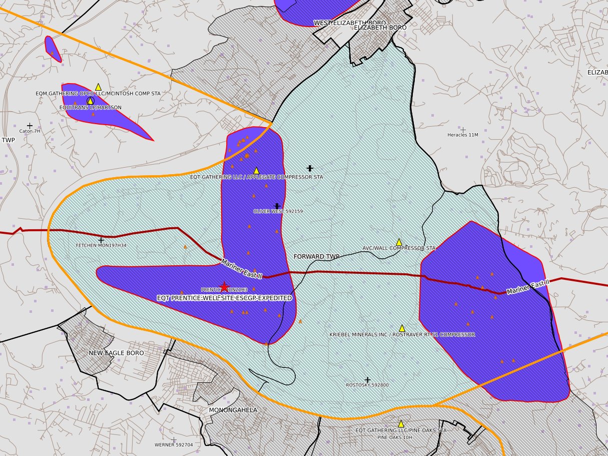
[NOTIFICATION]: Pressure test notification 58 Pa. C.S. 3211(f)(2) for well API 37-003-22477-00-00 for PRENTICE MON21H16
[NOTIFICATION]: Stimulation notification 58 Pa. C.S. 3211(f)(2) for well API 37-003-22477-00-00 for PRENTICE MON21H16
[NOTIFICATION]: Notice prior to installation of a modular storage structure 78a.56(a)(4) (unconventional wells) for EQT PRENTICE WELL SITE ESCGP-EXPEDITED
Armstrong
[NOTIFICATION]: Drilling resumption After Break of 30 days or more notification 58 Pa. C.S. 3211(f)(1) for well API 37-005-31540-00-00 for Dynamite 5H
[NOTIFICATION]: Stimulation notification 58 Pa. C.S. 3211(f)(2) for well API 37-005-31524-00-00 for Frosty Mug 5H
[NOTIFICATION]: Stimulation notification 58 Pa. C.S. 3211(f)(2) for well API 37-005-31523-00-00 for Frosty Mug 4H
[NOTIFICATION]: Stimulation notification 58 Pa. C.S. 3211(f)(2) for well API 37-005-31518-00-00 for Frosty Mug 3H
[NOTIFICATION]: Stimulation notification 58 Pa. C.S. 3211(f)(2) for well API 37-005-31522-00-00 for Frosty Mug 2H
[NOTIFICATION]: Stimulation notification 58 Pa. C.S. 3211(f)(2) for well API 37-005-31521-00-00 for Frosty Mug 1H
[NOTIFICATION]: Casing cementing notification 58 Pa. C.S. 3211(f)(2) for well API 37-005-31525-00-00 for Miller Farm 1H
[NOTIFICATION]: Pressure test notification 58 Pa. C.S. 3211(f)(2) for well API 37-005-31524-00-00 for Frosty Mug 5H
[NOTIFICATION]: Pressure test notification 58 Pa. C.S. 3211(f)(2) for well API 37-005-31523-00-00 for Frosty Mug 4H
[NOTIFICATION]: Pressure test notification 58 Pa. C.S. 3211(f)(2) for well API 37-005-31518-00-00 for Frosty Mug 3H
[NOTIFICATION]: Pressure test notification 58 Pa. C.S. 3211(f)(2) for well API 37-005-31522-00-00 for Frosty Mug 2H
[NOTIFICATION]: Pressure test notification 58 Pa. C.S. 3211(f)(2) for well API 37-005-31521-00-00 for Frosty Mug 1H
[NOTIFICATION]: Drilling resumption After Break of 30 days or more notification 58 Pa. C.S. 3211(f)(1) for well API 37-005-31525-00-00 for Miller Farm 1H
[NOTIFICATION]: Abandonment or plugging notification 58 Pa. C.S. 3211(f)(2) for well API 37-005-30081-00-00 for TREGASKES UNIT 1
[NOTIFICATION]: Drilling resumption After Break of 30 days or more notification 58 Pa. C.S. 3211(f)(1) for well API 37-005-31525-00-00 for Miller Farm 1H
[NOTIFICATION]: Casing cementing notification 58 Pa. C.S. 3211(f)(2) for well API 37-005-31530-00-00 for Frosty Mug 10H
Beaver
[NOTIFICATION]: Casing cementing notification 58 Pa. C.S. 3211(f)(2) for well API 37-007-20657-00-00 for MINTON WILLIAM 12298 15H
[NOTIFICATION]: Drilling resumption After Break of 30 days or more notification 58 Pa. C.S. 3211(f)(1) for well API 37-007-20657-00-00 for MINTON WILLIAM 12298 15H
[NOTIFICATION]: Casing cementing notification 58 Pa. C.S. 3211(f)(2) for well API 37-007-20656-00-00 for MINTON WILLIAM 12298 12H
Bradford
[NOTIFICATION]: Casing cementing notification 58 Pa. C.S. 3211(f)(2) for well API 37-015-24023-00-00 for BENSE (01-025-13) B 13H
[NOTIFICATION]: Casing cementing notification 58 Pa. C.S. 3211(f)(2) for well API 37-015-24022-00-00 for BENSE (01-025-61) B 61H
[NOTIFICATION]: Casing cementing notification 58 Pa. C.S. 3211(f)(2) for well API 37-015-24021-00-00 for BENSE (01-025-09) B 9H
[NOTIFICATION]: Casing cementing notification 58 Pa. C.S. 3211(f)(2) for well API 37-015-24020-00-00 for BENSE (01-025-07) B 7H
[NOTIFICATION]: Casing cementing notification 58 Pa. C.S. 3211(f)(2) for well API 37-015-24019-00-00 for BENSE (01-025-06) B 6H
[NOTIFICATION]: Casing cementing notification 58 Pa. C.S. 3211(f)(2) for well API 37-015-24018-00-00 for BENSE (01-025-05) B 5H
[NOTIFICATION]: Drilling resumption After Break of 30 days or more notification 58 Pa. C.S. 3211(f)(1) for well API 37-015-22332-00-00 for HARLAN N BRA 2H
[NOTIFICATION]: Pressure test notification 58 Pa. C.S. 3211(f)(2) for well API 37-015-24035-00-00 for HERR 103HC
[NOTIFICATION]: Drilling resumption After Break of 30 days or more notification 58 Pa. C.S. 3211(f)(1) for well API 37-015-24022-00-00 for BENSE (01-025-61) B 61H
[NOTIFICATION]: Drilling resumption After Break of 30 days or more notification 58 Pa. C.S. 3211(f)(1) for well API 37-015-24023-00-00 for BENSE (01-025-13) B 13H
[NOTIFICATION]: Drilling resumption After Break of 30 days or more notification 58 Pa. C.S. 3211(f)(1) for well API 37-015-24021-00-00 for BENSE (01-025-09) B 9H
[NOTIFICATION]: Drilling resumption After Break of 30 days or more notification 58 Pa. C.S. 3211(f)(1) for well API 37-015-24020-00-00 for BENSE (01-025-07) B 7H
[NOTIFICATION]: Drilling resumption After Break of 30 days or more notification 58 Pa. C.S. 3211(f)(1) for well API 37-015-24019-00-00 for BENSE (01-025-06) B 6H
[NOTIFICATION]: Drilling resumption After Break of 30 days or more notification 58 Pa. C.S. 3211(f)(1) for well API 37-015-24018-00-00 for BENSE (01-025-05) B 5H
[NOTIFICATION]: Casing cementing notification 58 Pa. C.S. 3211(f)(2) for well API 37-015-24048-00-00 for COVINGTON 102HC
[NOTIFICATION]: Casing cementing notification 58 Pa. C.S. 3211(f)(2) for well API 37-015-24048-00-00 for COVINGTON 102HC
[NOTIFICATION]: Casing cementing notification 58 Pa. C.S. 3211(f)(2) for well API 37-015-24047-00-00 for COVINGTON 101HC
[NOTIFICATION]: Casing cementing notification 58 Pa. C.S. 3211(f)(2) for well API 37-015-24047-00-00 for COVINGTON 101HC
[NOTIFICATION]: Casing cementing notification 58 Pa. C.S. 3211(f)(2) for well API 37-015-24049-00-00 for COVINGTON 103HC
[NOTIFICATION]: Casing cementing notification 58 Pa. C.S. 3211(f)(2) for well API 37-015-24049-00-00 for COVINGTON 103HC
[NOTIFICATION]: Pressure test notification 58 Pa. C.S. 3211(f)(2) for well API 37-015-24009-00-00 for TANNER & HANA 122HC
[NOTIFICATION]: Pressure test notification 58 Pa. C.S. 3211(f)(2) for well API 37-015-24008-00-00 for TANNER & HANA 21HC
[NOTIFICATION]: Casing cementing notification 58 Pa. C.S. 3211(f)(2) for well API 37-015-24022-00-00 for BENSE (01-025-61) B 61H
[NOTIFICATION]: Casing cementing notification 58 Pa. C.S. 3211(f)(2) for well API 37-015-24023-00-00 for BENSE (01-025-13) B 13H
[NOTIFICATION]: Casing cementing notification 58 Pa. C.S. 3211(f)(2) for well API 37-015-24021-00-00 for BENSE (01-025-09) B 9H
[NOTIFICATION]: Casing cementing notification 58 Pa. C.S. 3211(f)(2) for well API 37-015-24020-00-00 for BENSE (01-025-07) B 7H
[NOTIFICATION]: Casing cementing notification 58 Pa. C.S. 3211(f)(2) for well API 37-015-24019-00-00 for BENSE (01-025-06) B 6H
[NOTIFICATION]: Casing cementing notification 58 Pa. C.S. 3211(f)(2) for well API 37-015-24018-00-00 for BENSE (01-025-05) B 5H
[NOTIFICATION]: Casing cementing notification 58 Pa. C.S. 3211(f)(2) for well API 37-015-24039-00-00 for ALDERFER 101HC
[NOTIFICATION]: Casing cementing notification 58 Pa. C.S. 3211(f)(2) for well API 37-015-24040-00-00 for ALDERFER 104HC
[NOTIFICATION]: Casing cementing notification 58 Pa. C.S. 3211(f)(2) for well API 37-015-24038-00-00 for ALDERFER 5HC
[NOTIFICATION]: Casing cementing notification 58 Pa. C.S. 3211(f)(2) for well API 37-015-24041-00-00 for ALDERFER 106HC
[NOTIFICATION]: Drilling resumption After Break of 30 days or more notification 58 Pa. C.S. 3211(f)(1) for well API 37-015-24039-00-00 for ALDERFER 101HC
[NOTIFICATION]: Drilling resumption After Break of 30 days or more notification 58 Pa. C.S. 3211(f)(1) for well API 37-015-24040-00-00 for ALDERFER 104HC
[NOTIFICATION]: Drilling resumption After Break of 30 days or more notification 58 Pa. C.S. 3211(f)(1) for well API 37-015-24038-00-00 for ALDERFER 5HC
[NOTIFICATION]: Drilling resumption After Break of 30 days or more notification 58 Pa. C.S. 3211(f)(1) for well API 37-015-24041-00-00 for ALDERFER 106HC
[NOTIFICATION]: Pressure test notification 58 Pa. C.S. 3211(f)(2) for well API 37-015-24009-00-00 for TANNER & HANA 122HC
[NOTIFICATION]: Pressure test notification 58 Pa. C.S. 3211(f)(2) for well API 37-015-24008-00-00 for TANNER & HANA 21HC
[NOTIFICATION]: Casing cementing notification 58 Pa. C.S. 3211(f)(2) for well API 37-015-24026-00-00 for Kline B 4H
[NOTIFICATION]: Casing cementing notification 58 Pa. C.S. 3211(f)(2) for well API 37-015-24027-00-00 for Kline B 5H
[NOTIFICATION]: Casing cementing notification 58 Pa. C.S. 3211(f)(2) for well API 37-015-24025-00-00 for Kline B 3H
[NOTIFICATION]: Casing cementing notification 58 Pa. C.S. 3211(f)(2) for well API 37-015-24025-00-00 for Kline B 3H
[NOTIFICATION]: Casing cementing notification 58 Pa. C.S. 3211(f)(2) for well API 37-015-24024-00-00 for Kline B 2H
[NOTIFICATION]: Notification of return of regulatory inactive well to active status 3214(d) for well API 37-015-21554-00-00 for NORCONK 2H
[NOTIFICATION]: Casing cementing notification 58 Pa. C.S. 3211(f)(2) for well API 37-015-24037-00-00 for DJ 6HC
[NOTIFICATION]: Casing cementing notification 58 Pa. C.S. 3211(f)(2) for well API 37-015-24035-00-00 for HERR 103HC
[NOTIFICATION]: Casing cementing notification 58 Pa. C.S. 3211(f)(2) for well API 37-015-24036-00-00 for DJ 4HC
[NOTIFICATION]: Casing cementing notification 58 Pa. C.S. 3211(f)(2) for well API 37-015-24011-00-00 for LUNDY 101HC
[NOTIFICATION]: Drilling resumption After Break of 30 days or more notification 58 Pa. C.S. 3211(f)(1) for well API 37-015-24027-00-00 for Kline B 5H
[NOTIFICATION]: Drilling resumption After Break of 30 days or more notification 58 Pa. C.S. 3211(f)(1) for well API 37-015-24025-00-00 for Kline B 3H
[NOTIFICATION]: Drilling resumption After Break of 30 days or more notification 58 Pa. C.S. 3211(f)(1) for well API 37-015-24024-00-00 for Kline B 2H
[NOTIFICATION]: Casing cementing notification 58 Pa. C.S. 3211(f)(2) for well API 37-015-24027-00-00 for Kline B 5H
[NOTIFICATION]: Casing cementing notification 58 Pa. C.S. 3211(f)(2) for well API 37-015-24025-00-00 for Kline B 3H
[NOTIFICATION]: Casing cementing notification 58 Pa. C.S. 3211(f)(2) for well API 37-015-24024-00-00 for Kline B 2H
[NOTIFICATION]: Casing cementing notification 58 Pa. C.S. 3211(f)(2) for well API 37-015-24026-00-00 for Kline B 4H
[NOTIFICATION]: Drilling resumption After Break of 30 days or more notification 58 Pa. C.S. 3211(f)(1) for well API 37-015-24026-00-00 for Kline B 4H
[NOTIFICATION]: Casing cementing notification 58 Pa. C.S. 3211(f)(2) for well API 37-015-24033-00-00 for HERR 2HC
[NOTIFICATION]: Casing cementing notification 58 Pa. C.S. 3211(f)(2) for well API 37-015-24010-00-00 for LUNDY 3HC
[NOTIFICATION]: Casing cementing notification 58 Pa. C.S. 3211(f)(2) for well API 37-015-24037-00-00 for DJ 6HC
[NOTIFICATION]: Casing cementing notification 58 Pa. C.S. 3211(f)(2) for well API 37-015-24037-00-00 for DJ 6HC
[NOTIFICATION]: Drilling resumption After Break of 30 days or more notification 58 Pa. C.S. 3211(f)(1) for well API 37-015-24037-00-00 for DJ 6HC
[NOTIFICATION]: Casing cementing notification 58 Pa. C.S. 3211(f)(2) for well API 37-015-24036-00-00 for DJ 4HC
[NOTIFICATION]: Casing cementing notification 58 Pa. C.S. 3211(f)(2) for well API 37-015-24036-00-00 for DJ 4HC
[NOTIFICATION]: Drilling resumption After Break of 30 days or more notification 58 Pa. C.S. 3211(f)(1) for well API 37-015-24036-00-00 for DJ 4HC
[NOTIFICATION]: Casing cementing notification 58 Pa. C.S. 3211(f)(2) for well API 37-015-24015-00-00 for Lee North 8H
[NOTIFICATION]: Stimulation notification 58 Pa. C.S. 3211(f)(2) for well API 37-015-24007-00-00 for HART 25HC
[NOTIFICATION]: Stimulation notification 58 Pa. C.S. 3211(f)(2) for well API 37-015-24006-00-00 for HART 24HC
[NOTIFICATION]: Stimulation notification 58 Pa. C.S. 3211(f)(2) for well API 37-015-24005-00-00 for HART 22HC
[NOTIFICATION]: Stimulation notification 58 Pa. C.S. 3211(f)(2) for well API 37-015-24004-00-00 for HART 21HC
[NOTIFICATION]: Casing cementing notification 58 Pa. C.S. 3211(f)(2) for well API 37-015-24015-00-00 for Lee North 8H
[NOTIFICATION]: Casing cementing notification 58 Pa. C.S. 3211(f)(2) for well API 37-015-24034-00-00 for HERR 101HC
Butler
[NOTIFICATION]: Casing cementing notification 58 Pa. C.S. 3211(f)(2) for well API 37-019-23032-00-00 for Hilderbrand 2H
[NOTIFICATION]: Casing cementing notification 58 Pa. C.S. 3211(f)(2) for well API 37-019-23025-00-00 for Lamperski 04H
[NOTIFICATION]: Drilling resumption After Break of 30 days or more notification 58 Pa. C.S. 3211(f)(1) for well API 37-019-23025-00-00 for Lamperski 04H
[NOTIFICATION]: Casing cementing notification 58 Pa. C.S. 3211(f)(2) for well API 37-019-23021-00-00 for Lamperski 09H UD
[NOTIFICATION]: Drilling resumption After Break of 30 days or more notification 58 Pa. C.S. 3211(f)(1) for well API 37-019-23021-00-00 for Lamperski 09H UD
[NOTIFICATION]: Casing cementing notification 58 Pa. C.S. 3211(f)(2) for well API 37-019-23034-00-00 for Hilderbrand 4H
[NOTIFICATION]: Casing cementing notification 58 Pa. C.S. 3211(f)(2) for well API 37-019-23039-00-00 for Hilderbrand 6H
[NOTIFICATION]: Casing cementing notification 58 Pa. C.S. 3211(f)(2) for well API 37-019-23039-00-00 for Hilderbrand 6H
[NOTIFICATION]: Casing cementing notification 58 Pa. C.S. 3211(f)(2) for well API 37-019-23036-00-00 for Hilderbrand 8H
[NOTIFICATION]: Casing cementing notification 58 Pa. C.S. 3211(f)(2) for well API 37-019-23036-00-00 for Hilderbrand 8H
[NOTIFICATION]: Casing cementing notification 58 Pa. C.S. 3211(f)(2) for well API 37-019-23037-00-00 for Hilderbrand 9H
[NOTIFICATION]: Casing cementing notification 58 Pa. C.S. 3211(f)(2) for well API 37-019-23024-00-00 for Lamperski 05H UD
[NOTIFICATION]: Drilling resumption After Break of 30 days or more notification 58 Pa. C.S. 3211(f)(1) for well API 37-019-23024-00-00 for Lamperski 05H UD
[NOTIFICATION]: Casing cementing notification 58 Pa. C.S. 3211(f)(2) for well API 37-019-23015-00-00 for Lamperski 17H
[NOTIFICATION]: Drilling resumption After Break of 30 days or more notification 58 Pa. C.S. 3211(f)(1) for well API 37-019-23015-00-00 for Lamperski 17H
[NOTIFICATION]: Casing cementing notification 58 Pa. C.S. 3211(f)(2) for well API 37-019-23037-00-00 for Hilderbrand 9H
[NOTIFICATION]: Casing cementing notification 58 Pa. C.S. 3211(f)(2) for well API 37-019-23035-00-00 for Hilderbrand 7H
[NOTIFICATION]: Casing cementing notification 58 Pa. C.S. 3211(f)(2) for well API 37-019-23035-00-00 for Hilderbrand 7H
[NOTIFICATION]: Casing cementing notification 58 Pa. C.S. 3211(f)(2) for well API 37-019-23017-00-00 for Lamperski 13H UD
[NOTIFICATION]: Drilling resumption After Break of 30 days or more notification 58 Pa. C.S. 3211(f)(1) for well API 37-019-23017-00-00 for Lamperski 13H UD
[NOTIFICATION]: Casing cementing notification 58 Pa. C.S. 3211(f)(2) for well API 37-019-23022-00-00 for Lamperski 07H
[NOTIFICATION]: Drilling resumption After Break of 30 days or more notification 58 Pa. C.S. 3211(f)(1) for well API 37-019-23022-00-00 for Lamperski 07H
[NOTIFICATION]: Casing cementing notification 58 Pa. C.S. 3211(f)(2) for well API 37-019-23031-00-00 for Hilderbrand 5H
[NOTIFICATION]: Casing cementing notification 58 Pa. C.S. 3211(f)(2) for well API 37-019-23031-00-00 for Hilderbrand 5H
[NOTIFICATION]: Casing cementing notification 58 Pa. C.S. 3211(f)(2) for well API 37-019-23033-00-00 for Hilderbrand 3H
[NOTIFICATION]: Casing cementing notification 58 Pa. C.S. 3211(f)(2) for well API 37-019-23033-00-00 for Hilderbrand 3H
[NOTIFICATION]: Casing cementing notification 58 Pa. C.S. 3211(f)(2) for well API 37-019-23026-00-00 for Hilderbrand Well Pad 1H
[NOTIFICATION]: Casing cementing notification 58 Pa. C.S. 3211(f)(2) for well API 37-019-23018-00-00 for Lamperski 12H UD
[NOTIFICATION]: Drilling resumption After Break of 30 days or more notification 58 Pa. C.S. 3211(f)(1) for well API 37-019-23018-00-00 for Lamperski 12H UD
[NOTIFICATION]: Casing cementing notification 58 Pa. C.S. 3211(f)(2) for well API 37-019-23023-00-00 for Lamperski 06H UD
Clarion
[NOTIFICATION]: Abandonment or plugging notification 58 Pa. C.S. 3211(f)(2) for well API 37-031-25140-00-00 for KLINE 2
Fayette
[NOTIFICATION]: Casing cementing notification 58 Pa. C.S. 3211(f)(2) for well API 37-051-24674-00-00 for KOVACH B M03H
[NOTIFICATION]: Notice prior to installation of a modular storage structure 78a.56(a)(4) (unconventional wells) for EDENBORN/RGGS B ESCGP ESX18-051-0003
Forest
[NOTIFICATION]: Abandonment or plugging notification 58 Pa. C.S. 3211(f)(2) for well API 37-053-27186-00-00 for WARRANT 5110 1297
[NOTIFICATION]: Abandonment or plugging notification 58 Pa. C.S. 3211(f)(2) for well API 37-053-27187-00-00 for WARRANT 5110 1298
[NOTIFICATION]: Stimulation notification 58 Pa. C.S. 3211(f)(2) for well API 37-053-31155-00-00 for WT 2850 LOT 1 3
Greene
[NOTIFICATION]: Drilling resumption After Break of 30 days or more notification 58 Pa. C.S. 3211(f)(1) for well API 37-059-28626-00-00 for Pale Ale 9H
[NOTIFICATION]: Casing cementing notification 58 Pa. C.S. 3211(f)(2) for well API 37-059-28625-00-00 for Pale Ale 7H
[NOTIFICATION]: Casing cementing notification 58 Pa. C.S. 3211(f)(2) for well API 37-059-28634-00-00 for Barley Wine 3H
[NOTIFICATION]: Drilling resumption After Break of 30 days or more notification 58 Pa. C.S. 3211(f)(1) for well API 37-059-28634-00-00 for Barley Wine 3H
[NOTIFICATION]: Drilling resumption After Break of 30 days or more notification 58 Pa. C.S. 3211(f)(1) for well API 37-059-28625-00-00 for Pale Ale 7H
[NOTIFICATION]: Casing cementing notification 58 Pa. C.S. 3211(f)(2) for well API 37-059-28624-00-00 for Pale Ale 5H
[NOTIFICATION]: Drilling resumption After Break of 30 days or more notification 58 Pa. C.S. 3211(f)(1) for well API 37-059-28467-00-00 for Polecat 4H
[NOTIFICATION]: Casing cementing notification 58 Pa. C.S. 3211(f)(2) for well API 37-059-28466-00-00 for Polecat 2H
[NOTIFICATION]: Casing cementing notification 58 Pa. C.S. 3211(f)(2) for well API 37-059-28636-00-00 for Barley Wine 5H
[NOTIFICATION]: Drilling resumption After Break of 30 days or more notification 58 Pa. C.S. 3211(f)(1) for well API 37-059-28636-00-00 for Barley Wine 5H
[NOTIFICATION]: Drilling resumption After Break of 30 days or more notification 58 Pa. C.S. 3211(f)(1) for well API 37-059-28624-00-00 for Pale Ale 5H
[NOTIFICATION]: Casing cementing notification 58 Pa. C.S. 3211(f)(2) for well API 37-059-28623-00-00 for Pale Ale 3H
[NOTIFICATION]: Abandonment or plugging notification 58 Pa. C.S. 3211(f)(2) for well API 37-059-27158-00-00 for HENDERSON 593464
[NOTIFICATION]: Notice prior to HDD activities. (24 hrs. prior) 78a.68a(c) for PATMNG133 Trust Valve Yard to Mammoth Compressor Sta.
[NOTIFICATION]: Pressure test notification 58 Pa. C.S. 3211(f)(2) for well API 37-059-28503-00-00 for Irish Pug 14H
[NOTIFICATION]: Pressure test notification 58 Pa. C.S. 3211(f)(2) for well API 37-059-28502-00-00 for Irish Pug 12H
[NOTIFICATION]: Pressure test notification 58 Pa. C.S. 3211(f)(2) for well API 37-059-28501-00-00 for Irish Pug 10H
[NOTIFICATION]: Pressure test notification 58 Pa. C.S. 3211(f)(2) for well API 37-059-28164-00-00 for Irish Pug 8H
[NOTIFICATION]: Pressure test notification 58 Pa. C.S. 3211(f)(2) for well API 37-059-28500-00-00 for Irish Pug 6H
[NOTIFICATION]: Pressure test notification 58 Pa. C.S. 3211(f)(2) for well API 37-059-28499-00-00 for Irish Pug 4H
[NOTIFICATION]: Pressure test notification 58 Pa. C.S. 3211(f)(2) for well API 37-059-28498-00-00 for Irish Pug 2H
[NOTIFICATION]: Stimulation notification 58 Pa. C.S. 3211(f)(2) for well API 37-059-28503-00-00 for Irish Pug 14H
[NOTIFICATION]: Stimulation notification 58 Pa. C.S. 3211(f)(2) for well API 37-059-28502-00-00 for Irish Pug 12H
[NOTIFICATION]: Stimulation notification 58 Pa. C.S. 3211(f)(2) for well API 37-059-28501-00-00 for Irish Pug 10H
[NOTIFICATION]: Stimulation notification 58 Pa. C.S. 3211(f)(2) for well API 37-059-28164-00-00 for Irish Pug 8H
[NOTIFICATION]: Stimulation notification 58 Pa. C.S. 3211(f)(2) for well API 37-059-28500-00-00 for Irish Pug 6H
[NOTIFICATION]: Stimulation notification 58 Pa. C.S. 3211(f)(2) for well API 37-059-28499-00-00 for Irish Pug 4H
[NOTIFICATION]: Stimulation notification 58 Pa. C.S. 3211(f)(2) for well API 37-059-28498-00-00 for Irish Pug 2H
[NOTIFICATION]: Drilling resumption After Break of 30 days or more notification 58 Pa. C.S. 3211(f)(1) for well API 37-059-28623-00-00 for Pale Ale 3H
[NOTIFICATION]: Casing cementing notification 58 Pa. C.S. 3211(f)(2) for well API 37-059-28622-00-00 for Pale Ale 1H
[NOTIFICATION]: Casing cementing notification 58 Pa. C.S. 3211(f)(2) for well API 37-059-28635-00-00 for Barley Wine 7H
[NOTIFICATION]: Drilling resumption After Break of 30 days or more notification 58 Pa. C.S. 3211(f)(1) for well API 37-059-28635-00-00 for Barley Wine 7H
[NOTIFICATION]: Drilling resumption After Break of 30 days or more notification 58 Pa. C.S. 3211(f)(1) for well API 37-059-28466-00-00 for Polecat 2H
[NOTIFICATION]: Casing cementing notification 58 Pa. C.S. 3211(f)(2) for well API 37-059-28503-00-00 for Irish Pug 14H
[NOTIFICATION]: Notice prior to HDD activities. (24 hrs. prior) 78a.68a(c) for PATMNG133 Trust Valve Yard to Mammoth Compressor Sta.
[NOTIFICATION]: Drilling resumption After Break of 30 days or more notification 58 Pa. C.S. 3211(f)(1) for well API 37-059-28622-00-00 for Pale Ale 1H
[NOTIFICATION]: Abandonment or plugging notification 58 Pa. C.S. 3211(f)(2) for well API 37-059-27126-00-00 for HENDERSON 593463
[NOTIFICATION]: Casing cementing notification 58 Pa. C.S. 3211(f)(2) for well API 37-059-28637-00-00 for Barley Wine 9H
[NOTIFICATION]: Drilling resumption After Break of 30 days or more notification 58 Pa. C.S. 3211(f)(1) for well API 37-059-28637-00-00 for Barley Wine 9H
[NOTIFICATION]: Drilling resumption After Break of 30 days or more notification 58 Pa. C.S. 3211(f)(1) for well API 37-059-28503-00-00 for Irish Pug 14H
[NOTIFICATION]: Casing cementing notification 58 Pa. C.S. 3211(f)(2) for well API 37-059-28502-00-00 for Irish Pug 12H
[NOTIFICATION]: Notice prior to HDD activities. (24 hrs. prior) 78a.68a(c) for PATMNG133 Trust Valve Yard to Mammoth Compressor Sta.
[NOTIFICATION]: Notice prior to HDD activities. (24 hrs. prior) 78a.68a(c) for PATMNG133 Trust Valve Yard to Mammoth Compressor Sta.
Indiana
[NOTIFICATION]: Abandonment or plugging notification 58 Pa. C.S. 3211(f)(2) for well API 37-063-28362-00-00 for KENNETH L NEAL 4
[NOTIFICATION]: Casing cementing notification 58 Pa. C.S. 3211(f)(2) for well API 37-063-37584-00-00 for Cooper 3HU
Lycoming
[NOTIFICATION]: Drilling resumption After Break of 30 days or more notification 58 Pa. C.S. 3211(f)(1) for well API 37-081-22085-00-00 for Echo 6H
[NOTIFICATION]: Casing cementing notification 58 Pa. C.S. 3211(f)(2) for well API 37-081-22089-00-00 for Echo 8H
[NOTIFICATION]: Stimulation notification 58 Pa. C.S. 3211(f)(2) for well API 37-081-22044-00-00 for Gamble Y 167H 53936
[NOTIFICATION]: Stimulation notification 58 Pa. C.S. 3211(f)(2) for well API 37-081-22043-00-00 for Gamble Y 166H 53935
[NOTIFICATION]: Stimulation notification 58 Pa. C.S. 3211(f)(2) for well API 37-081-22042-00-00 for Gamble Y 165H 53934
[NOTIFICATION]: Stimulation notification 58 Pa. C.S. 3211(f)(2) for well API 37-081-22041-00-00 for Gamble Y 164H 53933
[NOTIFICATION]: Stimulation notification 58 Pa. C.S. 3211(f)(2) for well API 37-081-22040-00-00 for Gamble Y 159H 53928
[NOTIFICATION]: Stimulation notification 58 Pa. C.S. 3211(f)(2) for well API 37-081-22015-00-00 for Gamble Y 158H 53927
[NOTIFICATION]: Notification of return of regulatory inactive well to active status 3214(d) for well API 37-081-20130-00-00 for DELCIOTTO 2
[NOTIFICATION]: Notification of return of regulatory inactive well to active status 3214(d) for well API 37-081-20099-00-00 for GRAHAM 2
[NOTIFICATION]: Notification of return of regulatory inactive well to active status 3214(d) for well API 37-081-20100-00-00 for DELCIOTTO 1
[NOTIFICATION]: Drilling resumption After Break of 30 days or more notification 58 Pa. C.S. 3211(f)(1) for well API 37-081-22057-00-00 for BEAR HOLLOW 17481 4H
[NOTIFICATION]: Casing cementing notification 58 Pa. C.S. 3211(f)(2) for well API 37-081-22056-00-00 for BEAR HOLLOW 17481 3H
[NOTIFICATION]: Notice prior to installation of a modular storage structure 78a.56(a)(4) (unconventional wells) for LYCOMING HUNTING & FISHING CLUB WELL SITES A, B & E
[NOTIFICATION]: Drilling resumption After Break of 30 days or more notification 58 Pa. C.S. 3211(f)(1) for well API 37-081-22089-00-00 for Echo 8H
[NOTIFICATION]: Casing cementing notification 58 Pa. C.S. 3211(f)(2) for well API 37-081-22089-00-00 for Echo 8H
[NOTIFICATION]: Casing cementing notification 58 Pa. C.S. 3211(f)(2) for well API 37-081-22088-00-00 for Echo 5H
[NOTIFICATION]: Casing cementing notification 58 Pa. C.S. 3211(f)(2) for well API 37-081-22078-00-00 for RBP 2H
[NOTIFICATION]: Casing cementing notification 58 Pa. C.S. 3211(f)(2) for well API 37-081-22078-00-00 for RBP 2H
[NOTIFICATION]: Drilling resumption After Break of 30 days or more notification 58 Pa. C.S. 3211(f)(1) for well API 37-081-22078-00-00 for RBP 2H
[NOTIFICATION]: Casing cementing notification 58 Pa. C.S. 3211(f)(2) for well API 37-081-22088-00-00 for Echo 5H
[NOTIFICATION]: Stimulation notification 58 Pa. C.S. 3211(f)(2) for well API 37-081-22045-00-00 for COP Tract 726 Pad C 2859
[NOTIFICATION]: Stimulation notification 58 Pa. C.S. 3211(f)(2) for well API 37-081-22046-00-00 for COP Tract 726 Pad C 2858
[NOTIFICATION]: Drilling resumption After Break of 30 days or more notification 58 Pa. C.S. 3211(f)(1) for well API 37-081-22056-00-00 for BEAR HOLLOW 17481 3H
[NOTIFICATION]: Casing cementing notification 58 Pa. C.S. 3211(f)(2) for well API 37-081-22055-00-00 for BEAR HOLLOW 17481 2H
[NOTIFICATION]: Notice prior to installation of a modular storage structure 78a.56(a)(4) (unconventional wells) for WALLIS RUN HUNTING CLUB A 2H OG WELL
McKean
[NOTIFICATION]: Stimulation notification 58 Pa. C.S. 3211(f)(2) for well API 37-083-57911-00-00 for PHR WT 3131 69
[NOTIFICATION]: Abandonment or plugging notification 58 Pa. C.S. 3211(f)(2) for well API 37-083-56688-00-00 for SGL 30 WT 2721 150H 51502
[NOTIFICATION]: Stimulation notification 58 Pa. C.S. 3211(f)(2) for well API 37-083-57911-00-00 for PHR WT 3131 69
[NOTIFICATION]: Stimulation notification 58 Pa. C.S. 3211(f)(2) for well API 37-083-57685-00-00 for LOT 221 53
Sullivan
[NOTIFICATION]: Stimulation notification 58 Pa. C.S. 3211(f)(2) for well API 37-113-20499-00-00 for Wistar-Shaffer Tracts Unit #2HU 2HU
[NOTIFICATION]: Stimulation notification 58 Pa. C.S. 3211(f)(2) for well API 37-113-20497-00-00 for EDKIN HILL 4HU
[NOTIFICATION]: Pressure test notification 58 Pa. C.S. 3211(f)(2) for well API 37-113-20497-00-00 for EDKIN HILL 4HU
[NOTIFICATION]: Pressure test notification 58 Pa. C.S. 3211(f)(2) for well API 37-113-20499-00-00 for Wistar-Shaffer Tracts Unit #2HU 2HU
Susquehanna
[NOTIFICATION]: Casing cementing notification 58 Pa. C.S. 3211(f)(2) for well API 37-115-23178-00-00 for DEFARGES J 012
[NOTIFICATION]: Casing cementing notification 58 Pa. C.S. 3211(f)(2) for well API 37-115-23181-00-00 for DEFARGES J 004
[NOTIFICATION]: Casing cementing notification 58 Pa. C.S. 3211(f)(2) for well API 37-115-23180-00-00 for DEFARGES J 002
[NOTIFICATION]: Pressure test notification 58 Pa. C.S. 3211(f)(2) for well API 37-115-23241-00-00 for BUSIK J 015
[NOTIFICATION]: Pressure test notification 58 Pa. C.S. 3211(f)(2) for well API 37-115-23240-00-00 for BUSIK J 013
[NOTIFICATION]: Pressure test notification 58 Pa. C.S. 3211(f)(2) for well API 37-115-23239-00-00 for BUSIK J 011
[NOTIFICATION]: Pressure test notification 58 Pa. C.S. 3211(f)(2) for well API 37-115-23239-00-00 for BUSIK J 011
[NOTIFICATION]: Pressure test notification 58 Pa. C.S. 3211(f)(2) for well API 37-115-23238-00-00 for BUSIK J 009
[NOTIFICATION]: Pressure test notification 58 Pa. C.S. 3211(f)(2) for well API 37-115-23237-00-00 for BUSIK J 007
[NOTIFICATION]: Casing cementing notification 58 Pa. C.S. 3211(f)(2) for well API 37-115-23213-00-00 for JEAN BLAISURE 020
[NOTIFICATION]: Casing cementing notification 58 Pa. C.S. 3211(f)(2) for well API 37-115-23178-00-00 for DEFARGES J 012
[NOTIFICATION]: Drilling resumption After Break of 30 days or more notification 58 Pa. C.S. 3211(f)(1) for well API 37-115-23178-00-00 for DEFARGES J 012
[NOTIFICATION]: Casing cementing notification 58 Pa. C.S. 3211(f)(2) for well API 37-115-23181-00-00 for DEFARGES J 004
[NOTIFICATION]: Drilling resumption After Break of 30 days or more notification 58 Pa. C.S. 3211(f)(1) for well API 37-115-23181-00-00 for DEFARGES J 004
[NOTIFICATION]: Casing cementing notification 58 Pa. C.S. 3211(f)(2) for well API 37-115-23180-00-00 for DEFARGES J 002
[NOTIFICATION]: Drilling resumption After Break of 30 days or more notification 58 Pa. C.S. 3211(f)(1) for well API 37-115-23180-00-00 for DEFARGES J 002
[NOTIFICATION]: Stimulation notification 58 Pa. C.S. 3211(f)(2) for well API 37-115-23204-00-00 for FLOHS 10H
[NOTIFICATION]: Stimulation notification 58 Pa. C.S. 3211(f)(2) for well API 37-115-23203-00-00 for FLOHS 9H
[NOTIFICATION]: Pressure test notification 58 Pa. C.S. 3211(f)(2) for well API 37-115-23204-00-00 for FLOHS 10H
[NOTIFICATION]: Pressure test notification 58 Pa. C.S. 3211(f)(2) for well API 37-115-23203-00-00 for FLOHS 9H
[NOTIFICATION]: Casing cementing notification 58 Pa. C.S. 3211(f)(2) for well API 37-115-23241-00-00 for BUSIK J 015
[NOTIFICATION]: Drilling resumption After Break of 30 days or more notification 58 Pa. C.S. 3211(f)(1) for well API 37-115-23213-00-00 for JEAN BLAISURE 020
[NOTIFICATION]: Abandonment or plugging notification 58 Pa. C.S. 3211(f)(2) for well API 37-115-20955-00-00 for H PETERSEN 2
[NOTIFICATION]: Casing cementing notification 58 Pa. C.S. 3211(f)(2) for well API 37-115-23214-00-00 for JEAN BLAISURE 022
[NOTIFICATION]: Drilling resumption After Break of 30 days or more notification 58 Pa. C.S. 3211(f)(1) for well API 37-115-23241-00-00 for BUSIK J 015
[NOTIFICATION]: Casing cementing notification 58 Pa. C.S. 3211(f)(2) for well API 37-115-23240-00-00 for BUSIK J 013
[NOTIFICATION]: Abandonment or plugging notification 58 Pa. C.S. 3211(f)(2) for well API 37-115-20057-00-00 for ROZANSKI 1
[NOTIFICATION]: Drilling resumption After Break of 30 days or more notification 58 Pa. C.S. 3211(f)(1) for well API 37-115-23240-00-00 for BUSIK J 013
[NOTIFICATION]: Disposal of drill cuttings (unconventional wells) 78a.61(e) for well API 37-115-23178-00-00 for DEFARGES J 012
[NOTIFICATION]: Disposal of drill cuttings (unconventional wells) 78a.61(e) for well API 37-115-23181-00-00 for DEFARGES J 004
[NOTIFICATION]: Disposal of drill cuttings (unconventional wells) 78a.61(e) for well API 37-115-23180-00-00 for DEFARGES J 002
[NOTIFICATION]: Casing cementing notification 58 Pa. C.S. 3211(f)(2) for well API 37-115-23203-00-00 for FLOHS 9H
[NOTIFICATION]: Casing cementing notification 58 Pa. C.S. 3211(f)(2) for well API 37-115-23239-00-00 for BUSIK J 011
[NOTIFICATION]: Casing cementing notification 58 Pa. C.S. 3211(f)(2) for well API 37-115-23239-00-00 for BUSIK J 011
Tioga
[NOTIFICATION]: Casing cementing notification 58 Pa. C.S. 3211(f)(2) for well API 37-117-22332-00-00 for Brown 5H
[NOTIFICATION]: Drilling resumption After Break of 30 days or more notification 58 Pa. C.S. 3211(f)(1) for well API 37-117-22306-00-00 for Belz 2001 8HM
[NOTIFICATION]: Casing cementing notification 58 Pa. C.S. 3211(f)(2) for well API 37-117-22317-00-00 for DCNR 594 (02-207-02) 2H
[NOTIFICATION]: Drilling resumption After Break of 30 days or more notification 58 Pa. C.S. 3211(f)(1) for well API 37-117-22283-00-00 for Goodwin 6139 74HU 54086
[NOTIFICATION]: Casing cementing notification 58 Pa. C.S. 3211(f)(2) for well API 37-117-22313-00-00 for Chappell 855 169HU 54011
[NOTIFICATION]: Abandonment or plugging notification 58 Pa. C.S. 3211(f)(2) for well API 37-117-20596-00-00 for HAZELTON 424 1V
[NOTIFICATION]: Abandonment or plugging notification 58 Pa. C.S. 3211(f)(2) for well API 37-117-20904-00-00 for YOURGALITE 1119 1V
[NOTIFICATION]: Casing cementing notification 58 Pa. C.S. 3211(f)(2) for well API 37-117-22309-00-00 for Belz 2001 6HM
[NOTIFICATION]: Casing cementing notification 58 Pa. C.S. 3211(f)(2) for well API 37-117-22318-00-00 for DCNR 594 (02-207-04) 4H
Warren
[NOTIFICATION]: Stimulation notification 58 Pa. C.S. 3211(f)(2) for well API 37-123-48773-00-00 for RUHLMAN 6
[NOTIFICATION]: Drilling resumption After Break of 30 days or more notification 58 Pa. C.S. 3211(f)(1) for well API 37-123-48543-00-00 for ANF 171 33 OG WELL
[NOTIFICATION]: Stimulation notification 58 Pa. C.S. 3211(f)(2) for well API 37-123-48774-00-00 for RUHLMAN 7
[NOTIFICATION]: Stimulation notification 58 Pa. C.S. 3211(f)(2) for well API 37-123-49222-00-00 for LOT 437 29
Washington
[NOTIFICATION]: Casing cementing notification 58 Pa. C.S. 3211(f)(2) for well API 37-125-29246-00-00 for SCHWOTZER ARTHUR 12705 7H
[NOTIFICATION]: Drilling resumption After Break of 30 days or more notification 58 Pa. C.S. 3211(f)(1) for well API 37-125-29246-00-00 for SCHWOTZER ARTHUR 12705 7H
[NOTIFICATION]: Stimulation notification 58 Pa. C.S. 3211(f)(2) for well API 37-125-29190-00-00 for BIRD RUN 10938 14H
[NOTIFICATION]: Stimulation notification 58 Pa. C.S. 3211(f)(2) for well API 37-125-29195-00-00 for BIRD RUN 10938 3H
[NOTIFICATION]: Stimulation notification 58 Pa. C.S. 3211(f)(2) for well API 37-125-29196-00-00 for BIRD RUN 10938 2H
[NOTIFICATION]: Stimulation notification 58 Pa. C.S. 3211(f)(2) for well API 37-125-29187-00-00 for BIRD RUN 10938 1H
[NOTIFICATION]: Pressure test notification 58 Pa. C.S. 3211(f)(2) for well API 37-125-29190-00-00 for BIRD RUN 10938 14H
[NOTIFICATION]: Pressure test notification 58 Pa. C.S. 3211(f)(2) for well API 37-125-29195-00-00 for BIRD RUN 10938 3H
[NOTIFICATION]: Pressure test notification 58 Pa. C.S. 3211(f)(2) for well API 37-125-29196-00-00 for BIRD RUN 10938 2H
[NOTIFICATION]: Pressure test notification 58 Pa. C.S. 3211(f)(2) for well API 37-125-29187-00-00 for BIRD RUN 10938 1H
[NOTIFICATION]: Casing cementing notification 58 Pa. C.S. 3211(f)(2) for well API 37-125-29247-00-00 for SCHWOTZER ARTHUR 12705 8H
[NOTIFICATION]: Disposal of drill cuttings (unconventional wells) 78a.61(e) for well API 37-125-29294-00-00 for CONNER SAMUEL 17458 10H
[NOTIFICATION]: Disposal of drill cuttings (unconventional wells) 78a.61(e) for well API 37-125-29293-00-00 for CONNER SAMUEL 17458 9H
[NOTIFICATION]: Disposal of drill cuttings (unconventional wells) 78a.61(e) for well API 37-125-29292-00-00 for CONNER SAMUEL 17458 8H
[NOTIFICATION]: Disposal of drill cuttings (unconventional wells) 78a.61(e) for well API 37-125-29291-00-00 for CONNER SAMUEL 17458 7H
[NOTIFICATION]: Disposal of drill cuttings (unconventional wells) 78a.61(e) for well API 37-125-29290-00-00 for CONNER SAMUEL 17458 6H
[NOTIFICATION]: Drilling resumption After Break of 30 days or more notification 58 Pa. C.S. 3211(f)(1) for well API 37-125-29239-00-00 for JEFFRIES ELISABETH 11512 16H
[NOTIFICATION]: Casing cementing notification 58 Pa. C.S. 3211(f)(2) for well API 37-125-29237-00-00 for JEFFRIES ELISABETH 11512 14H
[NOTIFICATION]: Disposal of drill cuttings (unconventional wells) 78a.61(e) for well API 37-125-29238-00-00 for JEFFRIES ELISABETH 11512 15H
[NOTIFICATION]: Disposal of drill cuttings (unconventional wells) 78a.61(e) for well API 37-125-29236-00-00 for JEFFRIES ELISABETH 11512 13H
[NOTIFICATION]: Disposal of drill cuttings (unconventional wells) 78a.61(e) for well API 37-125-29239-00-00 for JEFFRIES ELISABETH 11512 16H
[NOTIFICATION]: Disposal of drill cuttings (unconventional wells) 78a.61(e) for well API 37-125-29246-00-00 for SCHWOTZER ARTHUR 12705 7H
[NOTIFICATION]: Disposal of drill cuttings (unconventional wells) 78a.61(e) for well API 37-125-29247-00-00 for SCHWOTZER ARTHUR 12705 8H
[NOTIFICATION]: Casing cementing notification 58 Pa. C.S. 3211(f)(2) for well API 37-125-29248-00-00 for SCHWOTZER ARTHUR 12705 9H
[NOTIFICATION]: Drilling resumption After Break of 30 days or more notification 58 Pa. C.S. 3211(f)(1) for well API 37-125-29237-00-00 for JEFFRIES ELISABETH 11512 14H
[NOTIFICATION]: Disposal of drill cuttings (unconventional wells) 78a.61(e) for well API 37-125-29248-00-00 for SCHWOTZER ARTHUR 12705 9H
[NOTIFICATION]: Casing cementing notification 58 Pa. C.S. 3211(f)(2) for well API 37-125-29284-00-00 for WYLIE DENNIS 17563 8H
[NOTIFICATION]: Well Communication Incident 78a.73(c) (unconventional wells) for well API 37-125-29216-00-00 for COSSELL RUTH 12697 5H
[NOTIFICATION]: Casing cementing notification 58 Pa. C.S. 3211(f)(2) for well API 37-125-29282-00-00 for WYLIE DENNIS 17563 6H
Westmoreland
[NOTIFICATION]: Casing cementing notification 58 Pa. C.S. 3211(f)(2) for well API 37-129-29294-00-00 for CNX MAM15CHSU
[NOTIFICATION]: Drilling resumption After Break of 30 days or more notification 58 Pa. C.S. 3211(f)(1) for well API 37-129-29294-00-00 for CNX MAM15CHSU
[NOTIFICATION]: Drilling resumption After Break of 30 days or more notification 58 Pa. C.S. 3211(f)(1) for well API 37-129-29293-00-00 for CNX MAM15BHSU
[NOTIFICATION]: Casing cementing notification 58 Pa. C.S. 3211(f)(2) for well API 37-129-29292-00-00 for CNX MAM15AHSU
[NOTIFICATION]: Abandonment or plugging notification 58 Pa. C.S. 3211(f)(2) for well API 37-129-28990-00-00 for JP SMITH 11H
Wyoming
[NOTIFICATION]: Casing cementing notification 58 Pa. C.S. 3211(f)(2) for well API 37-131-20699-00-00 for BREWER 22HC
[NOTIFICATION]: Casing cementing notification 58 Pa. C.S. 3211(f)(2) for well API 37-131-20698-00-00 for BREWER 21HC
[NOTIFICATION]: Casing cementing notification 58 Pa. C.S. 3211(f)(2) for well API 37-131-20699-00-00 for BREWER 22HC
[NOTIFICATION]: Casing cementing notification 58 Pa. C.S. 3211(f)(2) for well API 37-131-20698-00-00 for BREWER 21HC
Allegheny